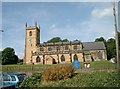
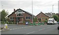
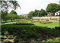
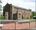
Area Overview for Rothwell (Leeds)
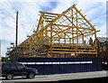
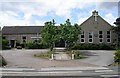
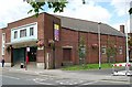
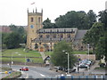
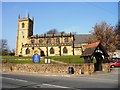
Photos of Rothwell (Leeds)
Area Information
Living in Rothwell (Leeds) offers a settled, established way of life within a built-up area covering 4.5 square kilometres. This community functions as a genuine town rather than a mere suburb, providing a defined locality for those seeking stability in West Yorkshire. The character of the neighbourhood is anchored by a strong tradition of independent living, making it a practical choice for buyers who prioritise a clear separation between private life and public space. You will find a residential environment where daily routines are supported by reliable infrastructure and proximity to essential services. The area caters specifically to those who value a consistent, non-transient community feel over rapid urban development. When you consider homes in Rothwell (Leeds), you are entering an environment designed for long-term residency rather than short-term stays. The physical footprint of the settlement supports a mix of housing that has evolved over years, creating a dense yet distinct living space. This built-up nature means you have familiar local landmarks and established routes for your morning commute or weekend stroll. The area does not offer the anonymity of a large metropolis, yet it avoids the instability of shifting demographics. It is a place where you can build a routine around local patterns and neighbourly connections that are already in place for you.
- Area Type
- Built Up Area 250
- Area Size
- 4.5 km²
- Population
- Not available
- Population Density
- Not available
Your daily life in Rothwell (Leeds) is supported by practical amenities located within easy reach. Five retail outlets are situated nearby, including the Tesco Rothwell Leeds, Morrisons John O'Gaunts, and Aldi Carlton. These supermarkets provide you with access to groceries and household essentials without needing to travel far. The area also offers significant rail connectivity with five stations available, specifically Woodlesford Railway Station, Outwood Railway Station, and Cross Gates Railway Station. You can rely on these five transport nodes to get you to work or expand your leisure options beyond the immediate town. The presence of these specific shops and stations creates a self-contained lifestyle where you do not need to venture deep into the city for routine tasks. While the data focuses on retail and rail, this concentration of five major retailers ensures your shopping needs are met conveniently. You will find that the layout of Rothwell (Leeds) facilitates quick errands and reduces the time spent commuting to centres elsewhere. This mix of local commerce and transport infrastructure defines the practical rhythm of living here.
Amenities
Schools
Families considering Rothwell (Leeds) have access to a specific selection of educational institutions listed in the data. The area includes Rothwell Haigh Road Infant School, which serves as a local primary option. You will also find Woodlesford Primary School and Oulton Primary School both holding a good Ofsted rating, providing verified quality education for younger children. Victoria Junior School is another primary institution in the vicinity with a good Ofsted rating, offering a continuous learning pathway. Langdale Primary School and Nursery rounds out the list of available options for young families. The presence of these specific schools means you can plan your education choices based on actual records rather than reputation alone. While the data lists these five establishments, the concentration of good-rated primary schools indicates a focus on early education. You do not have information regarding secondary schools in the current provided data, so your search may need to look beyond the immediate township boundaries for high school options. The mix of infant and junior schools suggests the area supports children through the early years of the national curriculum.
| Rank | School | Type | Entry gender | Ages |
|---|
Explore more schools in this area
Go to Schools tabDemographics
The community in Rothwell (Leeds) is defined by a mature population, with a median age of 70. This figure indicates that you are likely to encounter an older demographic forming the backbone of the local social fabric. While the data does not break down age by specific ranges beyond the total, the high median suggests a neighbourhood where many residents have lived for decades. Home ownership stands at 97%, a figure that reflects an area deeply rooted in settled homeownership rather than rental living. This statistic means the majority of properties you view in Rothwell (Leeds) will have been owned by the same families for extended periods. Accommodation type data is recorded generally, reinforcing the idea that the stock is consistent and not dominated by temporary housing solutions. The 97% ownership rate creates an environment where neighbours often know one another across generations. There is little pressure from short-term lettings, allowing the community to maintain its rhythm without significant disruption from new tenants. This high level of ownership stability typically correlates with lower property turnover and more predictable neighbourhood demographics. You can expect a quiet, established atmosphere where changes happen slowly and by choice rather than by market volatility.
Household Size
Accommodation Type
Tenure
Ethnic Group
Religion
Household Composition
Age
Household Deprivation
NS-SEC
Explore more demographic insights in this area
Go to Demographics tabPlanning
Planning Constraints
- Crime RiskPremium