Area Overview for Rawcliffe & Clifton Without Ward
Photos of Rawcliffe & Clifton Without Ward
Area Information
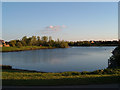
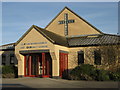
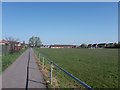
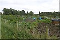
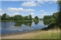
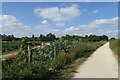
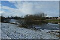
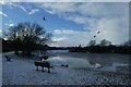
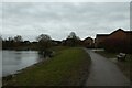
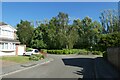
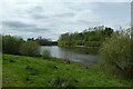
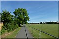
Living in Rawcliffe & Clifton Without Ward offers a distinct mix of residential calm and commercial vitality within the City of York unitary authority. This district borough unitary ward spans 6.0 square kilometres and currently houses a population of 2,816 people. Located approximately 3 miles north-west of central York, the area sits at the intersection of the A19 and A1237 roads, providing defined access to wider road networks. The landscape is a combination of established housing, retail hubs, and natural spaces. Clifton Moor Retail Park, built upon the site of the former RAF Clifton airfield, anchors the commercial side of the neighbourhood. The territory also benefits from proximity to natural features such as Clifton Ings, Clifton Backies, and Rawcliffe Lake, which border the River Ouse. For those seeking accommodation in this part of North Yorkshire, the area provides a blend of history and modern infrastructure. Land in Clifton Without was originally farmland cultivated under St Mary's Abbey, with medieval ridge and furrow earthworks still visible today. The local environment hosts wildlife including foxes and rabbits within its nature reserves. Despite the nearby industrial and retail zones, the ward maintains a defined residential character. It lies near key community assets including the Vale of York Academy and York Cricket Club, which has operated in the area for over two centuries. Homebuyers here gain access to a location that balances quiet living with proximity to major retail stores and entertainment venues like the Vue Cinema without moving to the city centre.
- Area Type
- District Borough Unitary Ward
- Area Size
- 6.0 km²
- Population
- 2816
- Population Density
- 466 people/km²
Demographics
The community in Rawcliffe & Clifton Without Ward is defined by a very mature demographic profile. The median age across the ward stands at 70 years, indicating that the population is significantly older than the national average. This age distribution suggests the area is established by long-term residents rather than young families or recent migrants. The data identifies the total age group as the most common category within the demographic breakdown, reflecting the prevalence of older adults in the neighbourhood. Such a profile often implies stable communities with deep local knowledge and established social networks. Home ownership provides financial security for a large majority of residents, with 81% of households owning their properties outright or with a mortgage. This high rate of ownership points to an area where people have settled permanently rather than renting transiently. While specific details on household composition and predominant ethnic groups are recorded in the general demographic totals, the overwhelming trend points toward stability. The accommodation types reflect this tenure, with the majority of housing stock occupied by owners. This environment suits retirees or those seeking a quiet retirement location. With a population density of 466 people per square kilometre, the ward maintains a moderate spread across its 6.0 km² area, avoiding the overcrowding found in denser city zones while remaining accessible to amenities.
Household Size
Accommodation Type
Tenure
Ethnic Group
Religion
Household Composition
Age
Household Deprivation
NS-SEC
Explore more demographic insights in this area
Go to Demographics tabPlanning
Planning Constraints
- Flood RiskPremium
- Ramsar Wetland SitesPremium
- Area of Outstanding Natural BeautyPremium
- Protected Nature ReservePremium
- Protected WoodlandPremium
- Crime RiskPremium