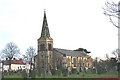
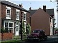
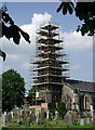
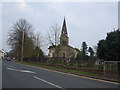
Area Overview for Rawcliffe
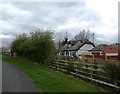
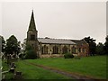
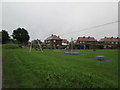
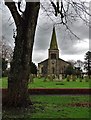
Photos of Rawcliffe
Area Information
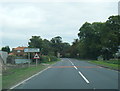
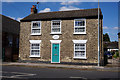
Rawcliffe is a compact built-up area in England, spanning 46.5 hectares. Its population, while not specified in exact numbers, is characterised by a median age of 70, indicating a community skewed towards older residents. This demographic profile shapes the area’s rhythm, with a focus on stability and long-term residency. Home ownership is strong here, with 75% of properties owner-occupied, suggesting a settled population. Daily life in Rawcliffe is anchored by its proximity to essential services, including schools and retail hubs, while its rail connections to nearby stations like Rawcliffe and Snaith offer links to broader regional networks. The area’s charm lies in its simplicity: a quiet, well-connected locale where practicality meets the needs of its residents. For those considering living in Rawcliffe, the blend of accessible amenities and a mature community offers a distinct alternative to busier urban environments.
- Area Type
- Built Up Area 250
- Area Size
- 46.5 hectares
- Population
- Not available
- Population Density
- Not available
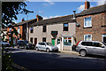
Living in Rawcliffe offers a straightforward lifestyle with essential amenities within reach. Nearby retail options, such as Spar and Co-op Snaith, cater to everyday needs, while rail stations like Rawcliffe and Snaith provide access to broader regional networks. The area’s compact size means residents can access services without lengthy commutes, fostering a sense of self-sufficiency. While there is no mention of parks or leisure facilities in the data, the presence of multiple rail stations and retail spots suggests a focus on practicality over expansive recreational spaces. For those valuing convenience over sprawling amenities, Rawcliffe’s accessible layout and well-connected transport options make it a pragmatic choice. The blend of retail, transport, and proximity to schools creates a functional environment suited to those seeking a balanced, low-maintenance lifestyle.
Amenities
Schools
Rawcliffe’s educational landscape includes Rawcliffe Primary School, which serves the local community and holds an Ofsted rating of ‘good’. This school is a key resource for families, offering a standard primary education. The area also hosts Hazel Lodge Pupil Referral Unit, a specialist institution catering to students with specific educational needs. The presence of both a mainstream primary school and a pupil referral unit indicates a diverse range of educational support for residents. For families, this mix ensures access to both general schooling and targeted assistance, though the absence of secondary schools means students may need to travel to nearby towns for higher education. The quality of Rawcliffe Primary School, combined with the availability of specialist provision, makes the area appealing to parents seeking a range of educational options.
| Rank | School | Type | Entry gender | Ages |
|---|
Explore more schools in this area
Go to Schools tabDemographics
The population of Rawcliffe has a median age of 70, with the most common age range encompassing all age groups. This suggests a community where older residents form a significant portion of the population. Home ownership is high, with 75% of households owning their homes, reflecting a preference for long-term stability. The data does not specify household composition or accommodation types, but the overall profile indicates a settled, low-turnover population. The absence of detailed information on ethnic diversity or religious composition means these aspects remain unexplored in the current dataset. For those considering Rawcliffe, the high home ownership rate and older demographic suggest a quiet, established neighbourhood where property values and community dynamics are shaped by long-term residency.
Household Size
Accommodation Type
Tenure
Ethnic Group
Religion
Household Composition
Age
Household Deprivation
NS-SEC
Explore more demographic insights in this area
Go to Demographics tabPlanning
Planning Constraints
- Crime RiskPremium