Area Overview for Pannal and Burn Bridge
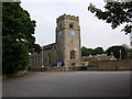
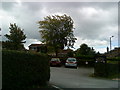
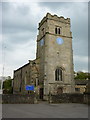
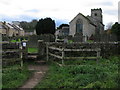
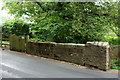
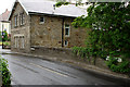
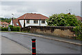
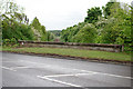
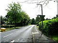
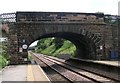
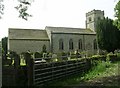
Photos of Pannal and Burn Bridge
Area Information
Pannal and Burn Bridge is a civil parish in North Yorkshire covering 4.7 km². You are looking at a compact rural community where daily life revolves around a close-knit environment. The area functions as a quiet settlement rather than a bustling town, offering residents a slower pace of living. High home ownership rates indicate that long-term residents have established deep roots within the parish boundaries. You will find that the landscape here is defined by a balance of open space and modest development constraints. Living in Pannal and Burn Bridge means accepting a lifestyle centred on proximity to nature and local amenities rather than urban convenience. The small size of the parish ensures that you remain within a familiar setting for most of your daily activities. This locality remains one of the more stable settlements in the wider region, free from large-scale commercial pressures. The distinct character of Pannal and Burn Bridge stems from its status as a traditional parish rather than a modern expansion zone.
- Area Type
- Parish
- Area Size
- 4.7 km²
- Population
- Not available
- Population Density
- Not available
Demographics
The community in Pannal and Burn Bridge is defined by a significant older age profile. The median age here stands at 70 years, placing it among the oldest localities in the region. This demographic shift explains why the most common age grouping falls into the total category without a youth peak. You will find that household structures reflect a settled population rather than families with dependent children. Approximately 87% of residents own their homes, a figure that underscores the prevalence of long-term tenancy in the area. This high level of home ownership typically correlates with the absence of private rental sectors and transient populations. The population composition suggests a demographic made up largely of retirees or older couples who have purchased properties permanently. There is little evidence of recent migration cycles driving population turnover. The social fabric of Pannal and Burn Bridge forms around this static, age-consistent demographic rather than the diverse, younger groups found in urban centres.
Household Size
Accommodation Type
Tenure
Ethnic Group
Religion
Household Composition
Age
Household Deprivation
NS-SEC
Explore more demographic insights in this area
Go to Demographics tabPlanning
Planning Constraints
- Flood RiskLocked
- Ramsar Wetland SitesLocked
- Area of Outstanding Natural BeautyLocked
- Protected Nature ReserveLocked
- Protected WoodlandLocked
- Crime RiskLocked