Area Overview for OL14 8LE
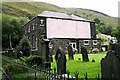
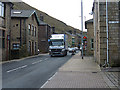
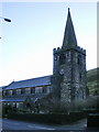
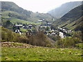
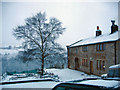
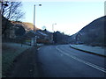
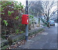
Photos of OL14 8LE

Area Information
Ol14 8LE represents a compact residential cluster covering just 1.9 hectares, with a total population of 1,726 people. The area is dense, with 1,512 people per square kilometre, creating a tight-knit neighbourhood rather than a sprawling suburban expanse. You will find that daily life here revolves around close proximity to immediate services, as the small footprint means neighbours are rarely far away. This setting functions as a specific postal address within the wider Calden and Hebden Bridge corridor, offering a clear boundary for residents who know exactly where their community begins and ends. Living in Ol14 8LE means embracing a defined space where the character of the locality is shaped by its limited size and concentrated population. The area acts as a stable residential node, distinct from the broader town centre yet connected to it through established transport routes.
- Area Type
- Postcode
- Area Size
- 1.9 hectares
- Population
- 1726
- Population Density
- 1512 people/km²
The housing stock in Ol14 8LE is almost exclusively composed of houses, catering primarily to buyers seeking traditional residential properties rather than apartments or flats. With 59% of homes occupied by their owners, this small postcode area functions largely as an owner-occupied market rather than a high-volume rental zone. Prospective buyers here are likely looking for established dwellings within a low-rise environment, given the absence of flat blocks in the provided data. The market reflects a desire for family-sized homes or single-person residences suited to the local 47-year-old median age. Because the area covers only 1.9 hectares, the supply of homes is naturally limited, which can create competition for suitable properties. Those seeking homes in Ol14 8LE should expect to find a homogeneous market focused on owned residential properties aligned with the local demographic needs.
House Prices in OL14 8LE
Showing 4 properties
| Address | Type | Beds | Baths | Last Sale Price | Last Sale Date | |
|---|---|---|---|---|---|---|
| 8 South View Street, Todmorden, OL14 8LE | Terraced | 2 | 1 | £99,500 | Jul 2007 | |
| 9 South View Street, Todmorden, OL14 8LE | house | - | - | £17,000 | May 1998 | |
| 7 South View Street, Todmorden, OL14 8LE | Terraced | 6 | 3 | - | - | |
| 5 South View Street, Todmorden, OL14 8LE | Terraced | - | - | - | - |
Energy Efficiency in OL14 8LE
Residents of Ol14 8LE benefit from nearby amenities located within practical reach. Five retail options are available nearby, including Aldi, Morrisons Todmorden, and Lidl Halifax, ensuring access to essential groceries and household needs. Five railway stations provide transport links, specifically Todmorden Railway Station, Walsden Railway Station, and Hebden Bridge Railway Station. These stations offer regular connections to larger towns for commuting or leisure travel. Living in Ol14 8LE means being a short distance from these specific supermarkets and transport nodes, reducing the need for long journeys for daily shopping or travel. The combination of named retail chains and named railway stations creates a functional lifestyle where essential services and regional connections are easily accessible from your home.
Amenities
Schools
Families moving to Ol14 8LE have access to specific educational facilities within the immediate vicinity. The nearest specific institution is Cornholme Junior, Infant and Nursery School, which serves young learners. This school holds an Ofsted rating of satisfactory, indicating it meets the required national standards for education and safety. The presence of a junior, infant, and nursery option means primary education is readily available on your doorstep. While secondary school data is not included in the current profile, the existence of this primary site confirms the area is zoned for local schooling. School near Ol14 8LE is located at Cornholme, providing a concrete option for parents requiring a primary education setting for their children.
| Rank | School | Type | Entry gender | Ages |
|---|
Explore more schools in this area
Go to Schools tabDemographics
The community in Ol14 8LE is defined by mature residents, with a median age of 47 years. The most common age range comprises adults between 30 and 64 years, indicating a household structure likely dominated by families or empty-nesters rather than young singles. Home ownership stands at 59%, suggesting that more than half of the residents have a property title, while the remaining proportion relies on rental accommodation. The predominant ethnic group is White, reflecting the traditional demographic makeup of the wider region. Houses form the primary accommodation type, meaning you will encounter detached or semi-detached homes rather than flats or terraced blocks. This age profile and ownership structure create a stable environment where long-term residents understand the local history and social norms.
Household Size
Accommodation Type
Tenure
Ethnic Group
Religion
Household Composition
Age
Household Deprivation
NS-SEC
Explore more demographic insights in this area
Go to Demographics tabPlanning
Planning Constraints
- Flood RiskPremium
- Ramsar Wetland SitesPremium
- Area of Outstanding Natural BeautyPremium
- Protected Nature ReservePremium
- Protected WoodlandPremium