Area Overview for OL14 8JN
Photos of OL14 8JN
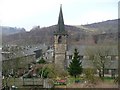
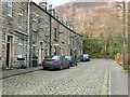
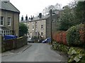
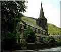
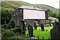
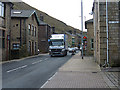
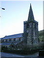
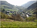
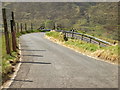
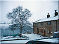
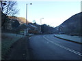
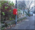
67 photos from this area
Area Information
Key information about the OL14 8JN including its size, population, and administrative classification.
- Area Type
- Postcode
- Area Size
- 1945 m²
- Population
- 1726
- Population Density
- 1512 people/km²
House Prices in OL14 8JN
19
Properties
£84,625
Average Sold Price
£29,000
Lowest Price
£135,000
Highest Price
Showing 19 properties
| Address | Type | Beds | Baths | Last Sale Price | Last Sale Date | |
|---|---|---|---|---|---|---|
| 671 Burnley Road, Todmorden, OL14 8JN | Terraced | 2 | 1 | £124,000 | Jun 2025 | |
| 640 Burnley Road, Todmorden, OL14 8JN | house | - | - | £90,000 | Mar 2023 | |
| 644 Burnley Road, Todmorden, OL14 8JN | Terraced | 4 | 1 | £135,000 | Mar 2023 | |
| 669 Burnley Road, Todmorden, OL14 8JN | Terraced | 3 | 1 | £130,000 | Nov 2022 | |
| 675 Burnley Road, Todmorden, OL14 8JN | Terraced | 3 | 1 | £80,000 | Apr 2017 | |
| 663 Burnley Road, Todmorden, OL14 8JN | house | - | - | £90,000 | Apr 2015 | |
| 677 Burnley Road, Todmorden, OL14 8JN | house | - | - | £88,500 | Feb 2006 | |
| 659 Burnley Road, Todmorden, OL14 8JN | house | 3 | - | £75,000 | Aug 2005 | |
| 638 Burnley Road, Todmorden, OL14 8JN | Terraced | 2 | 1 | £91,000 | May 2005 | |
| 657 Burnley Road, Todmorden, OL14 8JN | house | - | - | £38,000 | May 2002 |
Page 1 of 2
Energy Efficiency in OL14 8JN
Amenities
Schools
| Rank | School | Type | Entry gender | Ages |
|---|
Explore more schools in this area
Go to Schools tabDemographics
Household Size
One person
most common
Accommodation Type
Houses
most common
Tenure
59
majority
Ethnic Group
White
most common
Religion
N/A
most common
Household Composition
N/A
most common
Age
47
median
Adults (30-64 years)
most common
Household Deprivation
N/A
with no deprivation
NS-SEC
27
in Lower managerial occupations
Explore more demographic insights in this area
Go to Demographics tabPlanning
Planning Constraints
- Flood RiskPremium
- Ramsar Wetland SitesPremium
- Area of Outstanding Natural BeautyPremium
- Protected Nature ReservePremium
- Protected WoodlandPremium