Area Overview for OL14 6SX
Photos of OL14 6SX
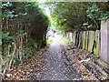
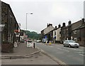
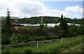
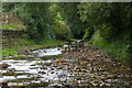
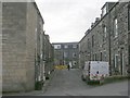
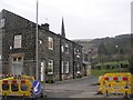
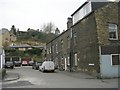
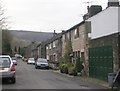
100 photos from this area
Area Information
Key information about the OL14 6SX including its size, population, and administrative classification.
- Area Type
- Postcode
- Area Size
- 1.6 hectares
- Population
- 1513
- Population Density
- 1158 people/km²
House Prices in OL14 6SX
29
Properties
£112,275
Average Sold Price
£26,500
Lowest Price
£225,000
Highest Price
Showing 29 properties
| Address | Type | Beds | Baths | Last Sale Price | Last Sale Date | |
|---|---|---|---|---|---|---|
| 673 Rochdale Road, Todmorden, OL14 6SX | Semi-detached | 4 | 2 | £212,000 | Nov 2024 | |
| 687 Rochdale Road, Todmorden, OL14 6SX | Terraced | 2 | 1 | £140,000 | Jul 2022 | |
| 699 Rochdale Road, Todmorden, OL14 6SX | Semi-detached | 3 | 1 | £225,000 | Aug 2020 | |
| 669 Rochdale Road, Todmorden, OL14 6SX | Terraced | 3 | 1 | £125,000 | Feb 2020 | |
| 659 Rochdale Road, Todmorden, OL14 6SX | Terraced | 3 | 1 | £160,000 | Apr 2017 | |
| 705 Rochdale Road, Todmorden, OL14 6SX | Semi-detached | 3 | 1 | £175,000 | Mar 2016 | |
| 695 Rochdale Road, Todmorden, OL14 6SX | Semi-detached | 2 | 1 | £125,000 | Jan 2016 | |
| 683 Rochdale Road, Todmorden, OL14 6SX | house | - | - | £75,000 | Oct 2015 | |
| 665 Rochdale Road, Todmorden, OL14 6SX | Terraced | 4 | - | £185,000 | Nov 2014 | |
| 661 Rochdale Road, Todmorden, OL14 6SX | house | - | - | £125,000 | Mar 2011 |
Page 1 of 3
Energy Efficiency in OL14 6SX
Amenities
Schools
| Rank | School | Type | Entry gender | Ages |
|---|
Explore more schools in this area
Go to Schools tabDemographics
Household Size
Two person
most common
Accommodation Type
Houses
most common
Tenure
72
majority
Ethnic Group
White
most common
Religion
N/A
most common
Household Composition
N/A
most common
Age
47
median
Adults (30-64 years)
most common
Household Deprivation
N/A
with no deprivation
NS-SEC
37
in Lower managerial occupations
Explore more demographic insights in this area
Go to Demographics tabPlanning
Planning Constraints
- Flood RiskPremium
- Ramsar Wetland SitesPremium
- Area of Outstanding Natural BeautyPremium
- Protected Nature ReservePremium
- Protected WoodlandPremium