Area Overview for Normanby
Photos of Normanby


Area Information
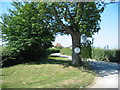
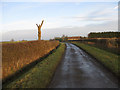
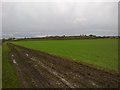
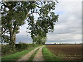
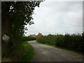
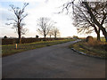
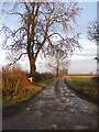
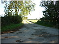
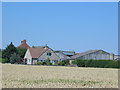
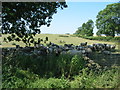
Normanby is a small civil parish covering an area of 9.7 square kilometres. The location offers a distinct rural setting, yet it sits close to major towns that provide access to shops, services, and employment hubs. You can expect a quiet lifestyle where the land surrounding your home remains a central feature of daily life. Many residents value the proximity to nature without needing to travel far to reach key amenities. The parish provides a stable environment for those seeking a slower pace of life away from the city centre. Living in Normanby means embracing a community defined by strong property ownership rather than rapid development. The area caters to individuals who appreciate green spaces and lower population density. Unlike bustling urban districts, Normanby offers a calm backdrop where the weather and surrounding landscape dictate the daily rhythm. Prospective buyers looking for homes in Normanby will find a setting that prioritises tranquillity and established surroundings. The scale of the parish ensures that you are likely to know your neighbours and participate in local events that support the rural character of the village.
- Area Type
- Parish
- Area Size
- 9.7 km²
- Population
- Not available
- Population Density
- Not available
Demographics
The community in Normanby reflects an older population profile, with a median age of 70 years old. This statistic indicates that the area attracts older couples and individuals who have settled down after working lives. The most common age range aligns with this high median, suggesting a significant proportion of residents fall into their seventies, eighties, and nineties. Such a demographic typically results in a peaceful neighbourhood where local shops cater to mature tastes and community centres host arthritis groups or bridge clubs. Home ownership stands at 82%, which is markedly higher than the national average. This high rate suggests that the vast majority of people have owned their homes for a considerable period. Consequently, the housing stock consists principally of long-term owner-occupied properties rather than modern investment builds or rentals. Household composition and accommodation type data support the view that families and empty nesters dominate the local scene. While specific details on ethnicity and religion are not quantified in the provided figures, the high ownership rate points to a stable, rooted community.
Household Size
Accommodation Type
Tenure
Ethnic Group
Religion
Household Composition
Age
Household Deprivation
NS-SEC
Explore more demographic insights in this area
Go to Demographics tabPlanning
Planning Constraints
- Flood RiskLocked
- Ramsar Wetland SitesLocked
- Area of Outstanding Natural BeautyLocked
- Protected Nature ReserveLocked
- Protected WoodlandLocked
- Crime RiskLocked