Area Overview for LS9 7EL
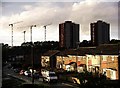
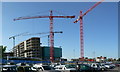
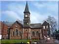
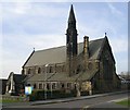
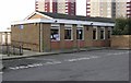
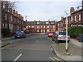
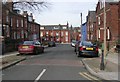
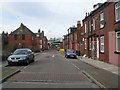
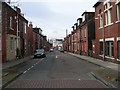
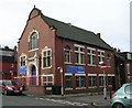
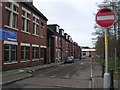
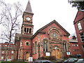
Photos of LS9 7EL
Area Information
Living in LS9 7EL means being part of a small, tightly knit residential cluster in England. With a population of 1608, the area is compact, offering a quiet alternative to larger urban centres. The community is young, with a median age of 22 and the majority of residents aged 15–29. This demographic shapes the area’s character, with a focus on affordability and accessibility. The low home ownership rate of 13% suggests a rental-dominated market, which aligns with the prevalence of flats as the primary accommodation type. Despite its small size, LS9 7EL is well-connected to nearby amenities, including schools, rail networks, and retail hubs. Its proximity to Leeds Railway Station and surrounding stations makes commuting to the city straightforward. For those seeking a balance between urban convenience and residential tranquillity, LS9 7EL offers a distinct blend of practicality and proximity to essential services.
- Area Type
- Postcode
- Area Size
- Not available
- Population
- 1608
- Population Density
- 2943 people/km²
The property market in LS9 7EL is characterised by a low home ownership rate of 13%, indicating that the majority of residents rent their homes. The accommodation type is predominantly flats, reflecting a focus on compact, affordable housing. This suggests the area is more suited to renters, particularly young adults, rather than owner-occupiers. The small size of LS9 7EL means the housing stock is limited, and buyers seeking properties in this area may need to consider nearby neighbourhoods for more options. For those interested in investment, the rental market here could offer opportunities, though competition for available properties is likely high. The prevalence of flats also means buyers should consider whether this type of housing aligns with their long-term needs, particularly if family growth or lifestyle changes are anticipated.
House Prices in LS9 7EL
No properties found in this postcode.
Energy Efficiency in LS9 7EL
The lifestyle in LS9 7EL is shaped by its proximity to practical amenities. Retail options include Aldi Harehills, Spar Roseville, and Heron Burnmantofts, offering everyday shopping convenience. The rail network, with stations like Leeds Railway Station and Burley Park, ensures easy access to urban centres and beyond. While the area lacks large parks or leisure facilities, its compact size means residents can reach nearby attractions without long commutes. The presence of multiple schools and shops suggests a focus on essential services, catering to daily needs without excess. This practicality defines the area’s character, making it suitable for those prioritising accessibility over expansive recreational spaces.
Amenities
Schools
Residents of LS9 7EL have access to several primary schools, including Shakespeare Primary School, which holds an Ofsted rating of ‘good’. Other nearby institutions include St Peter’s Church of England Primary School, Agnes Stewart Church of England High School, St Charle’s RC First School, and Primrose High School. While most are primary schools, the mix of denominational and state-run institutions offers families a range of educational choices. The presence of multiple schools within reach is a significant advantage for parents, ensuring proximity to early education. However, the data does not specify secondary school options or Ofsted ratings for all institutions, so further research may be needed for comprehensive planning. For families prioritising primary education, LS9 7EL’s school network provides a solid foundation.
| Rank | School | Type | Entry gender | Ages |
|---|
Explore more schools in this area
Go to Schools tabDemographics
The community in LS9 7EL is overwhelmingly young, with a median age of 22 and 13% of residents owning their homes. This low home ownership rate indicates a rental-based population, which is typical for areas with a high proportion of flats. The predominant ethnic group is White, and the area’s small size means it lacks significant demographic diversity. The presence of young adults aged 15–29 suggests a transient population, possibly drawn by affordable housing and proximity to educational institutions. While the data does not specify deprivation levels, the high proportion of renters and young residents may imply a focus on short-term housing needs rather than long-term stability. This profile shapes the area’s dynamics, with a strong emphasis on affordability and accessibility over traditional family-oriented amenities.
Household Size
Accommodation Type
Tenure
Ethnic Group
Religion
Household Composition
Age
Household Deprivation
NS-SEC
Explore more demographic insights in this area
Go to Demographics tabPlanning
Planning Constraints
- Flood RiskPremium
- Ramsar Wetland SitesPremium
- Area of Outstanding Natural BeautyPremium
- Protected Nature ReservePremium
- Protected WoodlandPremium