Area Overview for LS9 0WY
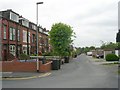
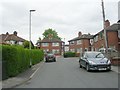
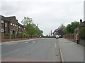
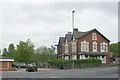
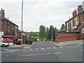
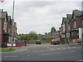
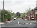
Photos of LS9 0WY


Area Information
Living in LS9 0WY means being part of a small, tightly knit residential cluster in England. With a population of just 1,742 people, the area offers a quiet, community-oriented lifestyle. The postcode covers a compact cluster of homes, making it easy to navigate and fostering a sense of familiarity among residents. Daily life is shaped by proximity to essential services, including five retail outlets like Morrisons Daily and Lidl Halton, and five rail stations, including Cross Gates and Leeds Railway Station, which connect the area to broader networks. The presence of multiple primary schools, such as Corpus Christi Catholic Primary School and Osmondthorpe Primary School, underscores the area’s focus on family living. While the population is small, the mix of housing types and nearby amenities provides practical convenience. However, the area’s limited size means it is best suited for those prioritising accessibility over expansive space.
- Area Type
- Postcode
- Area Size
- Not available
- Population
- 1742
- Population Density
- 3917 people/km²
The property market in LS9 0WY is characterised by a low home ownership rate of 28%, which is significantly below the national average. This suggests that the area is more rental-oriented than owner-occupied. The accommodation type is primarily houses, which are likely to be larger properties compared to flats or terraced homes. For buyers, this means the available housing stock is limited to individual homes rather than apartments or shared spaces. The small population and compact nature of the area mean that the property market is unlikely to see high turnover or speculative investment. Those considering purchasing here should focus on long-term value and the practicality of owning a house in a low-ownership environment. The area’s proximity to rail stations and retail hubs may also influence property desirability.
House Prices in LS9 0WY
No properties found in this postcode.
Energy Efficiency in LS9 0WY
The lifestyle in LS9 0WY is shaped by its proximity to retail and transport hubs. Residents have access to five retail outlets, including Morrisons Daily, Lidl Halton, and Tesco Halton, providing everyday shopping convenience. These stores cater to practical needs, from groceries to household goods. The rail network, with stations like Cross Gates and Leeds, ensures easy access to nearby towns and cities, supporting both commuting and leisure travel. While the area lacks detailed information on parks or leisure facilities, the retail and transport options contribute to a functional daily life. The compact nature of LS9 0WY means amenities are within walking or short driving distance, enhancing convenience for residents.
Amenities
Schools
Residents of LS9 0WY have access to several primary schools, including Osmondthorpe Primary School, Corpus Christi Catholic Primary School, and Corpus Christi Catholic College. Corpus Christi Catholic Primary School holds a ‘good’ Ofsted rating, indicating a solid standard of education. Other schools, such as Osmondthorpe First School and Corpus Christi RC First School, also serve the area. The presence of multiple primary schools within close proximity is a significant advantage for families, reducing the need for long commutes. The variety of school types, including Catholic institutions, allows parents to choose options aligned with their values or preferences. While no secondary schools are listed, the primary education options suggest a focus on early years development and community-based learning.
| Rank | School | Type | Entry gender | Ages |
|---|
Explore more schools in this area
Go to Schools tabDemographics
The community in LS9 0WY is predominantly composed of adults aged 30–64, with a median age of 22. This suggests a mix of long-term residents and younger families. Home ownership is low at 28%, indicating that a significant portion of the population rents their homes. The accommodation types are primarily houses, which is unusual for areas with higher rental demand. The predominant ethnic group is White, though no specific data on diversity or deprivation is provided. The low home ownership rate may influence the local property market, making it more rental-focused. For buyers, this could mean fewer owner-occupied properties and a greater emphasis on investment opportunities. The age profile suggests a stable demographic, with families likely to prioritise schools and local amenities.
Household Size
Accommodation Type
Tenure
Ethnic Group
Religion
Household Composition
Age
Household Deprivation
NS-SEC
Explore more demographic insights in this area
Go to Demographics tabPlanning
Planning Constraints
- Flood RiskPremium
- Ramsar Wetland SitesPremium
- Area of Outstanding Natural BeautyPremium
- Protected Nature ReservePremium
- Protected WoodlandPremium