Area Overview for LS9 0SB
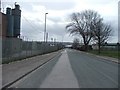
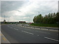
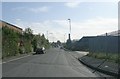
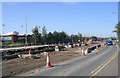
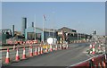
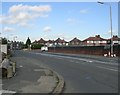
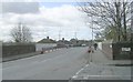
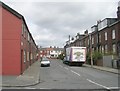
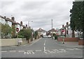
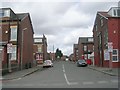
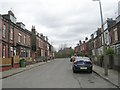
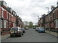
Photos of LS9 0SB
Area Information
Living in LS9 0SB means being part of a small, tightly knit residential cluster in England, where 1,567 people reside across a compact area. The population density of 492 people per square kilometre suggests a mix of established homes and community spaces. Situated near Leeds, this area benefits from proximity to urban amenities while retaining a quieter, more residential character. Daily life here is shaped by its location—within reach of major retail hubs like Tesco Leeds and rail networks connecting to Leeds Railway Station. The community is predominantly composed of adults aged 30–64, with a median age of 47, indicating a mature population profile. While the area lacks large-scale developments, its small size fosters a sense of familiarity, with residents likely to know their neighbours. The absence of significant planning constraints, such as protected woodlands or Areas of Outstanding Natural Beauty, means development pressure is minimal. However, the high crime risk score of 4/100 is a notable concern, requiring residents to consider security measures. For those seeking a compact, accessible location with a blend of urban connectivity and residential tranquillity, LS9 0SB offers a distinct, if modest, proposition.
- Area Type
- Postcode
- Area Size
- Not available
- Population
- 1567
- Population Density
- 492 people/km²
The property market in LS9 0SB is characterised by a focus on owner-occupied homes, with 42% of residents owning their properties. The accommodation type is predominantly houses, which may indicate a preference for more spacious, family-friendly housing. This contrasts with areas where flats or rental units dominate, suggesting LS9 0SB is less of a rental market and more of a place where long-term residents have established homes. Given the small size of the area and the concentration of houses, the housing stock is likely limited in volume, which could make the market competitive for buyers. The lack of planning constraints, such as protected woodlands or Areas of Outstanding Natural Beauty, means there are no restrictions on development, though this does not necessarily translate to new builds. For buyers, this means the available properties may be older or require renovation. The proximity to major retail and transport hubs, such as Tesco Leeds and Leeds Railway Station, adds practical value, but the high crime risk score of 4/100 is a factor to consider when assessing the area’s appeal.
House Prices in LS9 0SB
No properties found in this postcode.
Energy Efficiency in LS9 0SB
The lifestyle in LS9 0SB is shaped by its proximity to essential amenities. Within practical reach are retail options such as Spar, Morrisons Hunslet, and Tesco Leeds, providing access to groceries, household goods, and everyday conveniences. The rail network is a key feature, with stations like Leeds Railway Station offering direct links to the city and beyond, which is invaluable for commuters and those seeking to explore wider opportunities. While the data does not mention parks or leisure facilities, the presence of major retail and transport hubs suggests a focus on practicality over recreational spaces. This may mean that residents prioritise accessibility and connectivity over expansive green areas. The small size of the area means that the community is likely to revolve around these core amenities, with social interactions and daily routines centred on local shops and transport links. For those who value convenience and urban proximity, LS9 0SB offers a functional lifestyle, though it may lack the sprawling amenities of larger towns or cities.
Amenities
Schools
The nearest school to LS9 0SB is the Co-op Academy Brierley, a special school that caters to students with specific educational needs. This indicates that the area is likely served by a limited range of school types, with no mention of primary or secondary schools in the data. For families requiring mainstream education, the absence of other schools within the immediate vicinity suggests that residents may need to look further afield. The presence of a special school could be a positive for families with children who require tailored support, but it does not provide a comprehensive educational offering. This lack of diversity in school types may influence the area’s appeal to prospective buyers, particularly those prioritising a range of educational options for their children. The data does not include Ofsted ratings or other performance metrics, so further research would be necessary to assess the quality of education available.
| Rank | School | Type | Entry gender | Ages |
|---|
Explore more schools in this area
Go to Schools tabDemographics
The community in LS9 0SB is defined by its age profile and household composition. With a median age of 47 and the majority of residents falling within the 30–64 age range, this area is predominantly populated by working-age adults. Home ownership stands at 42%, suggesting a mix of owner-occupied properties and rental units. The accommodation type is primarily houses, which aligns with the area’s residential character and may cater to families or individuals seeking more space. The predominant ethnic group is White, reflecting broader demographic trends in the region. The population density of 492 people per square kilometre indicates a moderately populated area, where proximity to amenities is balanced with personal space. While the data does not specify deprivation levels, the high crime risk score of 4/100 implies that safety could be a concern for some residents. This score places LS9 0SB in the upper end of the risk spectrum, necessitating caution for potential buyers. The demographic profile suggests a community that is stable but not without challenges, particularly in terms of security.
Household Size
Accommodation Type
Tenure
Ethnic Group
Religion
Household Composition
Age
Household Deprivation
NS-SEC
Explore more demographic insights in this area
Go to Demographics tabPlanning
Planning Constraints
- Flood RiskPremium
- Ramsar Wetland SitesPremium
- Area of Outstanding Natural BeautyPremium
- Protected Nature ReservePremium
- Protected WoodlandPremium