Area Overview for LS9 0SA
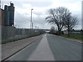
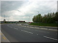
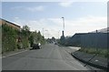
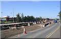
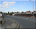
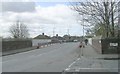
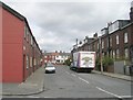
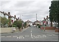
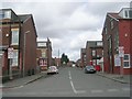
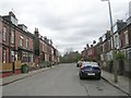
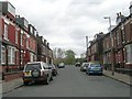
Photos of LS9 0SA

Area Information
LS9 0SA is a small, compact residential area in England, home to 1,567 people spread across a densely populated cluster. With a population density of 492 people per square kilometre, this postcode reflects a tightly knit community. The area is characterised by its mix of older and newer housing stock, predominantly single-family homes. Residents are largely adults aged 30–64, with a median age of 47, suggesting a stable, mature demographic. Daily life here is shaped by proximity to retail hubs, rail networks, and essential services. While the area lacks major natural attractions, its strategic location near Leeds ensures access to urban amenities. The low flood risk and absence of environmental constraints make it practical for living, though crime rates are notably higher than average. For those seeking a quiet residential setting with urban connectivity, LS9 0SA offers a balance of convenience and community.
- Area Type
- Postcode
- Area Size
- Not available
- Population
- 1567
- Population Density
- 492 people/km²
The property market in LS9 0SA is defined by a 42% home ownership rate, with houses making up the majority of accommodation types. This suggests a market skewed towards owner-occupied properties rather than rentals, though the relatively low home ownership figure implies a significant portion of the housing stock is let out. The prevalence of houses over flats indicates a preference for traditional, family-friendly homes. For buyers, this means a focus on semi-detached or terraced properties, which are likely to dominate the local landscape. The small size of the area means properties are closely spaced, and buyers should consider the limited scope for expansion or development. The market may appeal to those seeking a quiet, established residential setting with proximity to urban infrastructure.
House Prices in LS9 0SA
No properties found in this postcode.
Energy Efficiency in LS9 0SA
Daily life in LS9 0SA is shaped by its proximity to retail and transport hubs. Within practical reach are five retail venues, including Spar, Morrisons Hunslet, and Tesco Leeds, offering a range of shopping and dining options. The area’s rail network, with stations such as Leeds and Cottingley, provides seamless access to urban centres and beyond. While there is no mention of parks or leisure facilities in the data, the presence of multiple retail and transport options suggests a focus on convenience over green spaces. Residents can enjoy a mix of essential services and urban connectivity, though those prioritising outdoor recreation may need to travel further for parks or recreational areas.
Amenities
Schools
The nearest school to LS9 0SA is Co-op Academy Brierley, a special school catering to students with specific educational needs. No other schools are listed in the data, so the area’s educational options are limited to this institution. Families with children requiring specialist support may find this school a critical resource, but those seeking mainstream primary or secondary education will need to look further afield. The absence of additional schools highlights a potential gap in local provision, though the existing facility serves a clear purpose. Parents should consider proximity to other schools in nearby areas when planning for long-term educational needs.
| Rank | School | Type | Entry gender | Ages |
|---|
Explore more schools in this area
Go to Schools tabDemographics
The community in LS9 0SA is predominantly composed of adults aged 30–64, with a median age of 47. This suggests a population that is largely settled, with fewer young families or elderly residents. Home ownership stands at 42%, indicating a mix of owner-occupied and rental properties. The area is dominated by houses rather than flats, reflecting a preference for single-family living. The predominant ethnic group is White, though no specific data on diversity or deprivation is provided. The absence of detailed socioeconomic breakdowns means the area’s affordability or deprivation levels remain unquantified. However, the demographic profile points to a community that is stable but not particularly young or transient, which may influence local services and amenities.
Household Size
Accommodation Type
Tenure
Ethnic Group
Religion
Household Composition
Age
Household Deprivation
NS-SEC
Explore more demographic insights in this area
Go to Demographics tabPlanning
Planning Constraints
- Flood RiskPremium
- Ramsar Wetland SitesPremium
- Area of Outstanding Natural BeautyPremium
- Protected Nature ReservePremium
- Protected WoodlandPremium