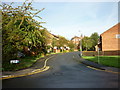
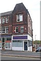
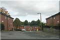
Area Overview for LS8 5EE
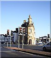
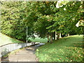
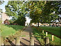
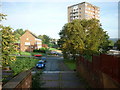
Photos of LS8 5EE


Area Information
LS8 5EE is a small residential postcode in England, home to 2,293 people. It is a compact cluster of properties, typical of areas where housing is concentrated in a single postcode. The area is defined by its proximity to key amenities, including retail hubs like Spar Roseville, Aldi Harehills, and Tesco Sheepscar, which serve daily needs. Nearby rail links, such as Leeds Railway Station and Burley Park Railway Station, provide easy access to the city and beyond. The median age of residents is 22, but the most common age range is 30–64, suggesting a mix of young professionals and older households. This small area is not isolated; its residents benefit from strong digital connectivity, with a broadband score of 97, indicating excellent fixed-line internet. While the area lacks major natural or protected sites, its practicality and accessibility make it a viable option for those seeking a balance between urban convenience and affordability.
- Area Type
- Postcode
- Area Size
- Not available
- Population
- 2293
- Population Density
- 10538 people/km²
LS8 5EE is predominantly a rental market, with only 10% of residents owning their homes. The accommodation type is almost exclusively flats, which aligns with the area’s small footprint and limited space for larger properties. This suggests a housing stock tailored to smaller households or individuals, possibly students or young professionals. The low home ownership rate implies that buyers may struggle to find owner-occupied properties, with most available homes likely targeted at renters. For those considering purchase, the area’s compact nature means competition for properties is concentrated within a small radius. The lack of data on property prices or recent sales trends means buyers should focus on the existing stock, which is likely to be older or purpose-built flats. The rental market’s dominance may also influence long-term value appreciation, though this remains speculative without further data.
House Prices in LS8 5EE
No properties found in this postcode.
Energy Efficiency in LS8 5EE
LS8 5EE’s residents have access to a range of practical amenities within reach. Retail options include Spar Roseville, Aldi Harehills, and Tesco Sheepscar, providing everyday shopping needs. These stores cater to a variety of budgets and preferences, from convenience items to larger grocery purchases. The area’s rail links, such as Leeds Railway Station, connect residents to broader networks, enabling easy access to cultural, employment, and leisure opportunities in the city. While the data does not specify parks or recreational spaces, the proximity to rail stations suggests potential for nearby green spaces or community facilities. The combination of retail and transport options creates a functional lifestyle, though the absence of detailed information on leisure amenities means further research is needed to fully assess the area’s appeal for those prioritising outdoor activities or social spaces.
Amenities
Schools
The nearest school to LS8 5EE is Woodside School, a special educational institution. No other schools are listed in the data, which means families relying on mainstream education may need to look beyond the immediate area. Woodside School’s presence indicates support for students with specific needs, but it does not provide a comprehensive range of educational options. Parents seeking a broader selection of schools, including primary or secondary institutions, would need to consider nearby postcodes or commute to larger towns. The absence of additional schools in the data highlights a potential limitation for families prioritising a variety of educational settings. However, the proximity to rail links may ease access to schools in adjacent areas, though this remains unconfirmed by the provided information.
| Rank | School | Type | Entry gender | Ages |
|---|
Explore more schools in this area
Go to Schools tabDemographics
The population of LS8 5EE is 2,293, with a median age of 22. However, the most common age range is 30–64 years, indicating a community skewed toward middle-aged adults. Only 10% of residents own their homes, with flats being the predominant accommodation type. This suggests a rental-heavy market, likely influenced by the area’s compact size and limited housing diversity. The predominant ethnic group is Black, reflecting the demographic composition of the broader region. While specific data on deprivation is not provided, the low home ownership rate and flat-based housing may indicate a reliance on rental income or shared living arrangements. The age profile suggests a stable population with potential for long-term residency, though the lack of data on family structures or household sizes limits deeper analysis of community dynamics.
Household Size
Accommodation Type
Tenure
Ethnic Group
Religion
Household Composition
Age
Household Deprivation
NS-SEC
Explore more demographic insights in this area
Go to Demographics tabPlanning
Planning Constraints
- Flood RiskPremium
- Ramsar Wetland SitesPremium
- Area of Outstanding Natural BeautyPremium
- Protected Nature ReservePremium
- Protected WoodlandPremium