Area Overview for LS8 4DX
Photos of LS8 4DX
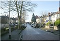
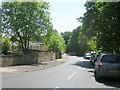
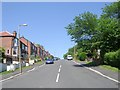
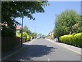
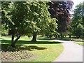
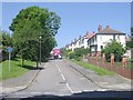
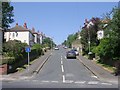
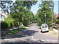
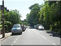
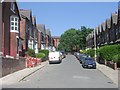
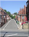
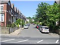
100 photos from this area
Area Information
Key information about the LS8 4DX including its size, population, and administrative classification.
- Area Type
- Postcode
- Area Size
- 5422 m²
- Population
- 1895
- Population Density
- 4731 people/km²
House Prices in LS8 4DX
73
Properties
£186,876
Average Sold Price
£20,000
Lowest Price
£322,000
Highest Price
Showing 73 properties
| Address | Type | Beds | Baths | Last Sale Price | Last Sale Date | |
|---|---|---|---|---|---|---|
| 21 Roundhay View, Chapeltown, Leeds, LS8 4DX | Terraced | 5 | 2 | £315,000 | Jun 2025 | |
| 25 Roundhay View, Chapeltown, Leeds, LS8 4DX | Terraced | 4 | 2 | £322,000 | Jul 2023 | |
| 22 Roundhay View, Chapeltown, Leeds, LS8 4DX | house | 4 | 2 | £312,000 | Apr 2022 | |
| 18 Roundhay View, Chapeltown, Leeds, LS8 4DX | Terraced | 4 | - | £270,000 | Dec 2020 | |
| 17 Roundhay View, Chapeltown, Leeds, LS8 4DX | house | - | - | £199,950 | Apr 2017 | |
| 6 Roundhay View, Chapeltown, Leeds, LS8 4DX | Flat | 1 | - | £120,000 | Oct 2014 | |
| 19 Roundhay View, Chapeltown, Leeds, LS8 4DX | Unknown | - | - | £121,000 | Oct 2011 | |
| 5 Roundhay View, Chapeltown, Leeds, LS8 4DX | house | 4 | - | £183,000 | Aug 2006 | |
| 2 Roundhay View, Chapeltown, Leeds, LS8 4DX | Terraced | 1 | - | £194,250 | Jul 2006 | |
| 1 Roundhay View, Chapeltown, Leeds, LS8 4DX | Terraced | 4 | 2 | £181,500 | Jan 2006 |
Page 1 of 8
Energy Efficiency in LS8 4DX
Amenities
Schools
| Rank | School | Type | Entry gender | Ages |
|---|
Explore more schools in this area
Go to Schools tabDemographics
Household Size
One person
most common
Accommodation Type
Houses
most common
Tenure
48
majority
Ethnic Group
White
most common
Religion
N/A
most common
Household Composition
N/A
most common
Age
47
median
Adults (30-64 years)
most common
Household Deprivation
N/A
with no deprivation
NS-SEC
36
in Lower managerial occupations
Explore more demographic insights in this area
Go to Demographics tabPlanning
Planning Constraints
- Flood RiskPremium
- Ramsar Wetland SitesPremium
- Area of Outstanding Natural BeautyPremium
- Protected Nature ReservePremium
- Protected WoodlandPremium