Area Overview for LS7 4NU
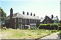
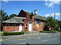
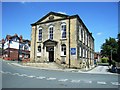
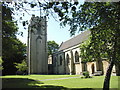
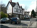
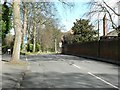
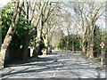
Photos of LS7 4NU

Area Information
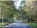
LS7 4NU is a small, tightly knit residential area in England, home to 1,849 residents. Its compact size fosters a quiet, community-focused atmosphere, with homes predominantly set in traditional house layouts. The area’s demographic profile suggests a mature population, with a median age of 47 and the majority of residents falling within the 30–64 age range. This makes LS7 4NU a place where families and established professionals coexist, often in owner-occupied properties. Daily life here is shaped by proximity to local amenities, including retail outlets and rail links, while the absence of major environmental constraints allows for straightforward planning. For those seeking a balance between convenience and tranquillity, LS7 4NU offers a snapshot of suburban living, with its small-scale character and accessible connections to nearby cities and transport hubs.
- Area Type
- Postcode
- Area Size
- Not available
- Population
- 1849
- Population Density
- 6245 people/km²
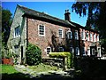
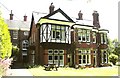
The property market in LS7 4NU is characterised by a 44% home ownership rate, with houses forming the predominant accommodation type. This suggests a mix of owner-occupied and rental properties, though the exact proportion of renters is not specified. The focus on houses rather than flats indicates a housing stock tailored to families or those seeking more space, which may appeal to buyers prioritising long-term stability. Given the area’s small size, property availability is likely limited, and buyers may need to consider nearby suburbs for additional options. The moderate home ownership rate also implies a degree of rental activity, which could affect market dynamics. For those seeking a home in LS7 4NU, the emphasis on traditional housing aligns with a community that values established, family-oriented living.
House Prices in LS7 4NU
No properties found in this postcode.
Energy Efficiency in LS7 4NU
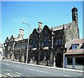
The lifestyle in LS7 4NU is enriched by nearby amenities that cater to daily needs. Retail options include Co-op Chapel, Aldi Harrogate, and Lidl Chapel, offering convenience for grocery shopping. Rail stations such as Burley Park and Leeds provide direct links to cities, while the proximity to Leeds Bradford Airport ensures easy travel for both business and leisure. Though the area lacks detailed information on parks or leisure facilities, the availability of retail and transport hubs suggests a practical, community-oriented lifestyle. The mix of local shops and transport links allows residents to balance routine errands with broader connectivity, supporting both casual and active lifestyles.
Amenities
Schools
Residents of LS7 4NU have access to two primary schools: Chapel Allerton Primary School, which holds an Ofsted rating of ‘good’, and Chapel Allerton First School. Both institutions cater to younger children, providing essential early education within the area. The presence of two primary schools suggests a focus on local schooling, though no secondary schools are listed in the data. For families, this means proximity to foundational education, though further research would be needed to assess options for older students. The ‘good’ rating at Chapel Allerton Primary School indicates a standard of teaching and facilities that meet expectations, offering reassurance for parents prioritising school quality.
| Rank | School | Type | Entry gender | Ages |
|---|
Explore more schools in this area
Go to Schools tabDemographics
The population of LS7 4NU is 1,849, with a median age of 47. Over 80% of residents are adults aged 30–64, reflecting a community rooted in middle-aged stability. Home ownership stands at 44%, with the majority of properties being houses rather than flats. This suggests a preference for family-friendly housing stock, though the lower ownership rate indicates a significant proportion of residents rent. The predominant ethnic group is White, though no specific diversity statistics are provided. The age profile implies a mature demographic, which may influence local services and amenities. With no data on deprivation levels, the quality of life here appears to align with the availability of nearby schools, transport, and retail, though further analysis would be needed to assess broader socioeconomic factors.
Household Size
Accommodation Type
Tenure
Ethnic Group
Religion
Household Composition
Age
Household Deprivation
NS-SEC
Explore more demographic insights in this area
Go to Demographics tabPlanning
Planning Constraints
- Flood RiskPremium
- Ramsar Wetland SitesPremium
- Area of Outstanding Natural BeautyPremium
- Protected Nature ReservePremium
- Protected WoodlandPremium