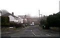
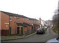
Area Overview for LS7 2XF
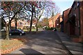
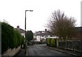
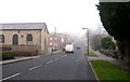
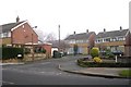
Photos of LS7 2XF


Area Information
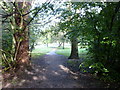
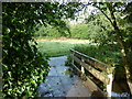
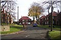
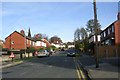
LS7 2XF is a small, tightly knit residential postcode in England with a population of 1518. It is a quiet, low-density area characterised by a predominance of houses, reflecting a community that values private living spaces. The median age of 47 suggests a mature demographic, with the majority of residents falling between 30 and 64 years. This area is not defined by sprawling developments but by a cluster of homes that offer a sense of stability. Daily life here is shaped by proximity to essential services, including retail outlets, rail links, and nearby airports. The low crime risk score of 71 and no flood or environmental hazards make it an attractive option for those prioritising safety and security. While not a bustling urban hub, LS7 2XF provides a balance between accessibility to city amenities and the tranquillity of a smaller community. Its small size means it is ideal for buyers seeking a manageable, well-maintained neighbourhood without the pressures of larger urban areas.
- Area Type
- Postcode
- Area Size
- Not available
- Population
- 1518
- Population Density
- 6462 people/km²
The property market in LS7 2XF is dominated by owner-occupied homes, with 67% of residents owning their properties. This contrasts with areas where rental demand drives the market, indicating a focus on long-term residency rather than short-term investment. The prevalence of houses over flats or apartments suggests a preference for private, spacious living, which may appeal to families or those seeking a traditional suburban layout. Given the small size of the area, property availability is limited, and buyers should consider the immediate surroundings for more options. The high home ownership rate also implies a stable market with less volatility, making it a reliable choice for those seeking a secure investment. However, the lack of rental properties may mean that LS7 2XF is not a hotspot for landlords or those prioritising flexibility in housing.
House Prices in LS7 2XF
No properties found in this postcode.
Energy Efficiency in LS7 2XF
Daily life in LS7 2XF is supported by a range of nearby amenities, including five retail outlets such as Aldi Meanwood, Waitrose Meanwood, and Morrisons Daily Leeds. These shops provide access to groceries, household goods, and other essentials without the need for long journeys. The area’s rail stations connect residents to broader networks, enabling easy access to cultural, professional, and recreational opportunities in Leeds. While parks and leisure facilities are not explicitly listed, the proximity to rail and retail suggests a lifestyle that balances local convenience with urban connectivity. The presence of multiple airports within reach also opens up travel options, making LS7 2XF a practical base for those who need frequent travel.
Amenities
Schools
The nearest school to LS7 2XF is Lawrence Oates School, a primary institution serving the local community. While no Ofsted rating is provided, the presence of a primary school within reach is a key consideration for families. The absence of secondary schools in the immediate vicinity means that students may need to travel to nearby areas for higher education. This could be a practical challenge for parents, though the proximity to rail stations may ease commuting. The school’s role in the area is significant, as it anchors the community’s educational infrastructure. For families prioritising a strong local school network, LS7 2XF may require additional research into secondary education options nearby.
| Rank | School | Type | Entry gender | Ages |
|---|
Explore more schools in this area
Go to Schools tabDemographics
The community in LS7 2XF is predominantly composed of adults aged 30 to 64, with a median age of 47. This suggests a population that is largely in their prime working years, with a strong presence of families and established households. Home ownership rates stand at 67%, indicating a stable housing market where most residents own their homes. The accommodation type is primarily houses, which aligns with the area’s character as a residential cluster rather than a high-density housing zone. The predominant ethnic group is White, reflecting a homogenous demographic profile. With no specific data on deprivation levels, the overall quality of life appears to be supported by low crime rates and the absence of environmental risks. This combination of factors suggests a community that is both stable and relatively insulated from the challenges faced by more diverse or rapidly changing areas.
Household Size
Accommodation Type
Tenure
Ethnic Group
Religion
Household Composition
Age
Household Deprivation
NS-SEC
Explore more demographic insights in this area
Go to Demographics tabPlanning
Planning Constraints
- Flood RiskPremium
- Ramsar Wetland SitesPremium
- Area of Outstanding Natural BeautyPremium
- Protected Nature ReservePremium
- Protected WoodlandPremium