Area Overview for LS7 2UE
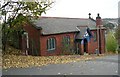
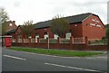
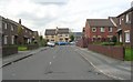
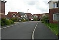
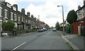
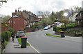
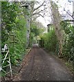
Photos of LS7 2UE

Area Information
LS7 2UE is a small, tightly knit residential postcode in England, home to around 1500 residents. It is a compact area where daily life is shaped by proximity to essential services and a mix of housing types. The community here is predominantly middle-aged, with a median age of 47, and the majority of residents fall within the 30-64 age range. This suggests a stable, established population, many of whom may be long-term residents. The area’s small size means amenities and services are within easy reach, though it remains a quiet, low-density cluster of homes. While it lacks the bustling vibrancy of larger urban centres, its appeal lies in its simplicity and practicality. The presence of nearby primary schools, retail outlets, and transport links makes it a viable choice for families and professionals seeking a balanced lifestyle. However, with only 37% of homes owner-occupied, the area is more rental-focused than owner-occupied, which may influence the dynamics of the local community. For those considering living in LS7 2UE, the key is understanding its modest scale and the practical realities of its location.
- Area Type
- Postcode
- Area Size
- Not available
- Population
- 1500
- Population Density
- 5869 people/km²
The property market in LS7 2UE is characterised by a 37% home ownership rate, indicating that the majority of residents rent their homes. The accommodation type is predominantly houses, which suggests a focus on standalone properties rather than flats or terraced housing. This mix may appeal to families or individuals seeking more space and privacy. However, the small size of the area means the housing stock is limited, and buyers may need to look beyond LS7 2UE itself to find options. The low home ownership rate also points to a rental market that could be competitive, particularly for desirable properties. For those considering purchasing, the area’s proximity to schools, transport, and retail may offset its modest scale. However, the limited number of homes available could mean longer search times and higher prices compared to larger, more developed areas.
House Prices in LS7 2UE
No properties found in this postcode.
Energy Efficiency in LS7 2UE
Living in LS7 2UE offers access to a range of nearby amenities that support daily life. Retail options include Morrisons Daily Leeds, Aldi Meanwood, and Waitrose Meanwood, providing a mix of supermarket choices for groceries and household needs. The area’s proximity to rail stations such as Burley Park, Headingley, and Leeds stations ensures easy access to public transport, while the nearby Leeds Bradford Airport and Leeds Bradford International Airport cater to travel needs. Although the area is small, the combination of shops, transport hubs, and airports creates a convenient environment for residents. The presence of multiple retail outlets and transport links suggests a practical, functional lifestyle, though the area lacks larger leisure or entertainment facilities.
Amenities
Schools
Residents of LS7 2UE have access to two primary schools: Bentley Primary School and Bentley First School. Both institutions serve the local community, offering education for younger children. The presence of two primary schools within the area suggests a focus on early education and may be a key factor for families considering the area. However, no specific Ofsted ratings or performance data are provided, so it is difficult to assess the quality of education directly. The availability of two schools may reduce competition for places and provide parents with options for their children’s schooling. For families prioritising proximity to educational facilities, LS7 2UE’s schools are a practical advantage.
| Rank | School | Type | Entry gender | Ages |
|---|
Explore more schools in this area
Go to Schools tabDemographics
The population of LS7 2UE is 1500, with a median age of 47. This indicates a mature demographic, with the largest age group being adults aged 30-64. The area is predominantly composed of households with a single type of accommodation—houses, which suggests a mix of family homes and single-occupancy properties. Home ownership stands at 37%, meaning the majority of residents rent their homes. The predominant ethnic group is White, though no specific data on diversity or minority representation is provided. The absence of detailed information on deprivation or socioeconomic breakdown means it is difficult to assess broader quality-of-life factors. However, the age profile suggests a community with established careers and families, which may influence local services and amenities. The relatively low population density and focus on houses imply a quieter, more spread-out living environment compared to high-density urban areas.
Household Size
Accommodation Type
Tenure
Ethnic Group
Religion
Household Composition
Age
Household Deprivation
NS-SEC
Explore more demographic insights in this area
Go to Demographics tabPlanning
Planning Constraints
- Flood RiskPremium
- Ramsar Wetland SitesPremium
- Area of Outstanding Natural BeautyPremium
- Protected Nature ReservePremium
- Protected WoodlandPremium