Area Overview for LS7 2QE
Photos of LS7 2QE
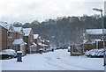
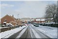
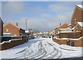
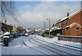

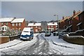
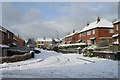
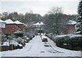
100 photos from this area
Area Information
Key information about the LS7 2QE including its size, population, and administrative classification.
- Area Type
- Postcode
- Area Size
- 4.1 hectares
- Population
- 1301
- Population Density
- 3261 people/km²
House Prices in LS7 2QE
48
Properties
£162,300
Average Sold Price
£33,000
Lowest Price
£311,000
Highest Price
Showing 48 properties
| Address | Type | Beds | Baths | Last Sale Price | Last Sale Date | |
|---|---|---|---|---|---|---|
| 52 Farm Hill North, Meanwood, Leeds, LS7 2QE | Semi-detached | 5 | 2 | £311,000 | Nov 2023 | |
| 72 Farm Hill North, Meanwood, Leeds, LS7 2QE | Retail | 3 | 1 | £265,500 | Jun 2023 | |
| 65 Farm Hill North, Meanwood, Leeds, LS7 2QE | house | - | - | £282,000 | Aug 2021 | |
| 37 Farm Hill North, Meanwood, Leeds, LS7 2QE | Semi-detached | 3 | 2 | £220,151 | Apr 2021 | |
| 59 Farm Hill North, Meanwood, Leeds, LS7 2QE | house | 3 | 1 | £230,000 | Dec 2020 | |
| 57 Farm Hill North, Meanwood, Leeds, LS7 2QE | Terraced | 3 | 1 | £216,000 | Jan 2020 | |
| 55 Farm Hill North, Meanwood, Leeds, LS7 2QE | Terraced | 3 | 1 | £170,000 | Jul 2019 | |
| 78 Farm Hill North, Meanwood, Leeds, LS7 2QE | Semi-detached | 3 | - | £132,000 | Sep 2016 | |
| 63 Farm Hill North, Meanwood, Leeds, LS7 2QE | Semi-detached | - | - | £165,000 | Nov 2015 | |
| 68 Farm Hill North, Meanwood, Leeds, LS7 2QE | Bungalow | 2 | - | £126,000 | Oct 2014 |
Page 1 of 5
Energy Efficiency in LS7 2QE
Amenities
Schools
| Rank | School | Type | Entry gender | Ages |
|---|
Explore more schools in this area
Go to Schools tabDemographics
Household Size
Family (3-5 people)
most common
Accommodation Type
Houses
most common
Tenure
50
majority
Ethnic Group
White
most common
Religion
N/A
most common
Household Composition
N/A
most common
Age
47
median
Adults (30-64 years)
most common
Household Deprivation
N/A
with no deprivation
NS-SEC
37
in Lower managerial occupations
Explore more demographic insights in this area
Go to Demographics tabPlanning
Planning Constraints
- Flood RiskPremium
- Ramsar Wetland SitesPremium
- Area of Outstanding Natural BeautyPremium
- Protected Nature ReservePremium
- Protected WoodlandPremium