Area Overview for LS7 1XT
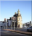
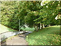
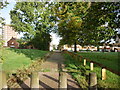
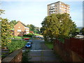
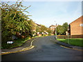
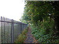
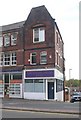
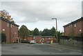
Photos of LS7 1XT


Area Information
LS7 1XT is a small residential postcode in England with a population of 2179, forming a tight-knit cluster of properties. This area is characterised by its compact size and focus on flat living, reflecting a community that prioritises convenience over space. The demographic profile shows a median age of 22, but the majority of residents fall within the 30-64 age range, suggesting a mix of young professionals and established families. Daily life here is shaped by proximity to essential services, with five retail outlets including Morrisons Daily and Co-op Leeds within practical reach. The area’s rail connectivity is robust, with five stations including Leeds Railway Station offering swift access to the city. While the broadband score is excellent at 100, mobile coverage scores slightly lower at 85, which may impact those reliant on cellular data. LS7 1XT’s appeal lies in its balance of accessibility, affordability, and the presence of local schools, making it a practical choice for those seeking a manageable urban lifestyle. However, the high crime risk score of 1/100 demands careful consideration of security measures.
- Area Type
- Postcode
- Area Size
- Not available
- Population
- 2179
- Population Density
- 7791 people/km²
The property market in LS7 1XT is defined by its low home ownership rate of 15%, indicating a rental-heavy market rather than owner-occupied properties. The predominant accommodation type is flats, which aligns with the area’s compact residential nature. This suggests a focus on high-density living, likely catering to commuters or students seeking affordable housing. The limited data on property types means the market’s diversity remains unclear, but the prevalence of flats implies a lack of larger homes or family-oriented properties. Buyers considering this area should note the small scale of the postcode, which may limit availability of properties. The rental market’s dominance could mean competition for available units, particularly in a small area. Prospective buyers should also consider the high crime risk score, which may affect property desirability. The market’s character is shaped by its practical, urban layout, making it suitable for those prioritising proximity to transport and services over expansive living spaces.
House Prices in LS7 1XT
No properties found in this postcode.
Energy Efficiency in LS7 1XT
The lifestyle in LS7 1XT is shaped by its proximity to retail and transport hubs. Residents can access five retail outlets, including Morrisons Daily and Co-op Leeds, ensuring everyday shopping needs are met without long journeys. The rail network, with stations like Leeds Railway Station and Headingley Railway Station, provides seamless connections to the city and beyond, supporting both work and leisure activities. While the area lacks detailed information on parks or leisure facilities, the presence of multiple retail and transport options suggests a focus on convenience over expansive recreational spaces. The community’s character is defined by its practicality, with amenities designed for efficiency rather than luxury. The availability of schools and shops within walking distance fosters a self-contained environment, ideal for those prioritising accessibility. However, the absence of data on parks or cultural venues means the area’s leisure offerings remain unexplored in this analysis. Overall, LS7 1XT caters to a lifestyle centred on ease of access and urban connectivity.
Amenities
Schools
Residents of LS7 1XT have access to a range of educational institutions, including primary schools such as Little London Community Primary School and Little London First School, both catering to younger children. For secondary education, Leeds College of Building offers sixth-form provision, while Little London Academy provides a broader academic or vocational curriculum. The presence of multiple primary schools suggests a focus on early education, though no secondary schools are listed in the data. The mix of school types allows families to choose between primary-only institutions and those offering higher-level education. However, the absence of comprehensive secondary schools may require students to commute to nearby areas for further study. The availability of these schools supports families seeking local education options, though the lack of data on Ofsted ratings means performance metrics are unknown. This diversity in schooling options reflects the area’s role as a residential hub for families with children.
| Rank | School | Type | Entry gender | Ages |
|---|
Explore more schools in this area
Go to Schools tabDemographics
The community in LS7 1XT has a median age of 22, though the most common age group is adults aged 30-64, indicating a mature population base. Home ownership is low, with only 15% of residents owning their homes, suggesting a rental-dominated market. The predominant accommodation type is flats, reflecting the area’s density and focus on multi-unit housing. The predominant ethnic group is White, with no data provided on other demographics. This profile implies a stable, working-age population likely reliant on local employment or commuting. The low home ownership rate may indicate a transient community or a focus on rental properties for students or professionals. The absence of specific data on deprivation levels means the quality of life remains unquantified, though the presence of schools and amenities suggests basic needs are met. The age distribution suggests a mix of young professionals and families, though the lack of data on household composition limits deeper analysis.
Household Size
Accommodation Type
Tenure
Ethnic Group
Religion
Household Composition
Age
Household Deprivation
NS-SEC
Explore more demographic insights in this area
Go to Demographics tabPlanning
Planning Constraints
- Flood RiskPremium
- Ramsar Wetland SitesPremium
- Area of Outstanding Natural BeautyPremium
- Protected Nature ReservePremium
- Protected WoodlandPremium