Area Overview for LS7 1XL
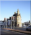
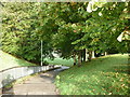
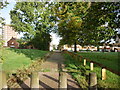
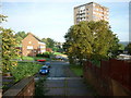
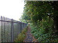
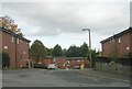
Photos of LS7 1XL


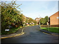
Area Information
LS7 1XL is a small residential postcode in England, home to 2,179 people. This compact area is defined by its cluster of flats, reflecting a community where rental living predominates. The population is predominantly adults aged 30–64, suggesting a mix of established professionals and families. Daily life here is shaped by proximity to retail and transport hubs, with Morrisons Daily, Co-op Leeds, and Tesco Leeds within reach. Rail connectivity is strong, with Leeds Railway Station and Burley Park Railway Station offering easy access to the city. Despite its small size, LS7 1XL balances practicality with accessibility, though the high crime risk score of 1/100 warrants caution. The area’s low flood risk and absence of environmental constraints like AONB or protected woodlands make it a pragmatic choice for those prioritising safety and straightforward planning. However, the lack of natural amenities or green spaces may appeal more to commuters than nature enthusiasts.
- Area Type
- Postcode
- Area Size
- Not available
- Population
- 2179
- Population Density
- 7791 people/km²
The property market in LS7 1XL is dominated by rental flats, with only 15% of homes owned by residents. This suggests a transient population and limited opportunities for long-term investment in owner-occupied properties. The prevalence of flats indicates a lack of larger housing types, which may appeal to individuals or couples rather than growing families. Buyers considering the area should note the small postcode’s constraints, as the immediate surroundings likely offer similar housing stock. The rental market may provide short-term affordability but could limit options for those seeking permanent residency. Proximity to retail and transport hubs may offset the lack of diverse housing, though the high crime risk score of 1/100 could deter some buyers.
House Prices in LS7 1XL
No properties found in this postcode.
Energy Efficiency in LS7 1XL
The lifestyle in LS7 1XL is shaped by its retail and transport links. Nearby shops include Morrisons Daily, Co-op Leeds, and Tesco Leeds, offering everyday essentials within walking distance. The rail network provides easy access to Leeds city centre and surrounding areas, making commuting efficient. However, the data does not mention parks, leisure facilities, or dining options, suggesting the area may lack recreational amenities. The convenience of retail and transport is balanced by the absence of green spaces or cultural venues, which could be a drawback for those prioritising leisure. Daily life here is functional, with practicality over luxury, though the high crime risk score of 1/100 may affect overall quality of life.
Amenities
Schools
Residents of LS7 1XL have access to several educational institutions. Little London Community Primary School and Little London First School cater to younger children, while Little London Academy serves secondary students. Leeds College of Building offers sixth-form education, providing pathways to further study or vocational training. The mix of primary, secondary, and further education options supports families at different life stages. However, the absence of Ofsted ratings means the quality of these schools remains unverified. The concentration of schools in the area suggests a focus on local education, though the lack of independent or specialist institutions may limit choices for parents seeking alternative schooling.
| Rank | School | Type | Entry gender | Ages |
|---|
Explore more schools in this area
Go to Schools tabDemographics
The population of LS7 1XL is 2,179, with a median age of 22. This appears at odds with the most common age range of 30–64 years, suggesting a demographic shift where younger residents may be transient or students. Home ownership is low at 15%, indicating a rental-heavy market. The area is characterised by flats, reflecting a lack of detached or semi-detached housing. The predominant ethnic group is White, though diversity data is not specified. The age profile implies a community of working-age adults, possibly including professionals and families. The low home ownership rate may impact long-term stability, with tenants forming the majority. The absence of specific deprivation data means the quality of life remains unquantified, but the high crime risk score of 1/100 suggests safety could be a concern for residents.
Household Size
Accommodation Type
Tenure
Ethnic Group
Religion
Household Composition
Age
Household Deprivation
NS-SEC
Explore more demographic insights in this area
Go to Demographics tabPlanning
Planning Constraints
- Flood RiskPremium
- Ramsar Wetland SitesPremium
- Area of Outstanding Natural BeautyPremium
- Protected Nature ReservePremium
- Protected WoodlandPremium