Area Overview for LS6 4QD
Photos of LS6 4QD
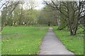
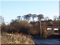
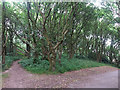
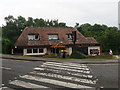
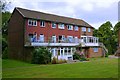
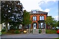
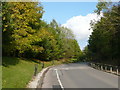
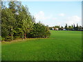
100 photos from this area
Area Information
Key information about the LS6 4QD including its size, population, and administrative classification.
- Area Type
- Postcode
- Area Size
- 14.1 hectares
- Population
- 1702
- Population Density
- 2175 people/km²
House Prices in LS6 4QD
6
Properties
£423,333
Average Sold Price
£250,000
Lowest Price
£560,000
Highest Price
Showing 6 properties
| Address | Type | Beds | Baths | Last Sale Price | Last Sale Date | |
|---|---|---|---|---|---|---|
| Parkside House, Tongue Lane, Meanwood, Leeds, LS6 4QD | Detached | 4 | - | £460,000 | May 2018 | |
| Hillside House, Tongue Lane, Meanwood, Leeds, LS6 4QD | house | - | - | £560,000 | Mar 2018 | |
| Field House, Tongue Lane, Meanwood, Leeds, LS6 4QD | house | - | - | £250,000 | Feb 2009 | |
| The Brow, Tongue Lane, Meanwood, Leeds, LS6 4QD | house | - | - | - | - | |
| Brandon House Nursing Home, Tongue Lane, Meanwood, Leeds, LS6 4QD | hospital_care_home | - | - | - | - | |
| Penny Field School, Tongue Lane, Meanwood, Leeds, LS6 4QD | commercial | - | - | - | - |
Energy Efficiency in LS6 4QD
Amenities
Schools
| Rank | School | Type | Entry gender | Ages |
|---|
Explore more schools in this area
Go to Schools tabDemographics
Household Size
Family (3-5 people)
most common
Accommodation Type
Houses
most common
Tenure
77
majority
Ethnic Group
White
most common
Religion
N/A
most common
Household Composition
N/A
most common
Age
47
median
Adults (30-64 years)
most common
Household Deprivation
N/A
with no deprivation
NS-SEC
40
in Lower managerial occupations
Explore more demographic insights in this area
Go to Demographics tabPlanning
Planning Constraints
- Flood RiskPremium
- Ramsar Wetland SitesPremium
- Area of Outstanding Natural BeautyPremium
- Protected Nature ReservePremium
- Protected WoodlandPremium