Area Overview for LS4 2SE
Photos of LS4 2SE
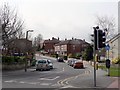
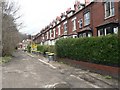
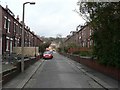
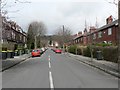
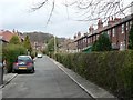
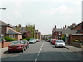
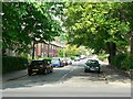
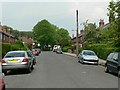
100 photos from this area
Area Information
Key information about the LS4 2SE including its size, population, and administrative classification.
- Area Type
- Postcode
- Area Size
- 1.5 hectares
- Population
- 1639
- Population Density
- 6111 people/km²
House Prices in LS4 2SE
44
Properties
£171,860
Average Sold Price
£45,500
Lowest Price
£449,276
Highest Price
Showing 44 properties
| Address | Type | Beds | Baths | Last Sale Price | Last Sale Date | |
|---|---|---|---|---|---|---|
| 21 St Anns Lane, Burley, Leeds, LS4 2SE | Flat | 2 | 1 | £140,000 | Oct 2024 | |
| 14 St Anns Lane, Burley, Leeds, LS4 2SE | Semi-detached | 5 | 2 | £449,276 | Mar 2023 | |
| 7 St Anns Lane, Burley, Leeds, LS4 2SE | Semi-detached | 2 | 1 | £240,000 | Mar 2021 | |
| 20 St Anns Lane, Burley, Leeds, LS4 2SE | Semi-detached | 4 | 2 | £278,000 | Aug 2019 | |
| 5 St Anns Lane, Burley, Leeds, LS4 2SE | house | - | - | £186,100 | Apr 2018 | |
| 23 St Anns Lane, Burley, Leeds, LS4 2SE | Flat | - | - | £123,000 | Jun 2017 | |
| 18 St Anns Lane, Burley, Leeds, LS4 2SE | Semi-detached | 4 | - | £240,000 | Sep 2013 | |
| 28 St Anns Lane, Burley, Leeds, LS4 2SE | house | 3 | - | £135,000 | Jul 2012 | |
| 32 St Anns Lane, Burley, Leeds, LS4 2SE | Semi-detached | - | - | £140,000 | Jun 2012 | |
| 25 St Anns Lane, Burley, Leeds, LS4 2SE | Flat | - | - | £108,750 | Aug 2006 |
Page 1 of 5
Energy Efficiency in LS4 2SE
Amenities
Schools
| Rank | School | Type | Entry gender | Ages |
|---|
Explore more schools in this area
Go to Schools tabDemographics
Household Size
Two person
most common
Accommodation Type
Houses
most common
Tenure
73
majority
Ethnic Group
White
most common
Religion
N/A
most common
Household Composition
N/A
most common
Age
47
median
Adults (30-64 years)
most common
Household Deprivation
N/A
with no deprivation
NS-SEC
32
in Lower managerial occupations
Explore more demographic insights in this area
Go to Demographics tabPlanning
Planning Constraints
- Flood RiskPremium
- Ramsar Wetland SitesPremium
- Area of Outstanding Natural BeautyPremium
- Protected Nature ReservePremium
- Protected WoodlandPremium