Area Overview for LS4 2RD
Photos of LS4 2RD
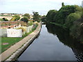
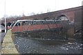
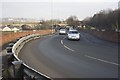
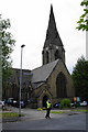
100 photos from this area
Area Information
Key information about the LS4 2RD including its size, population, and administrative classification.
- Area Type
- Postcode
- Area Size
- 5738 m²
- Population
- 1737
- Population Density
- 3581 people/km²
House Prices in LS4 2RD
72
Properties
£129,786
Average Sold Price
£35,000
Lowest Price
£249,995
Highest Price
Showing 72 properties
| Address | Type | Beds | Baths | Last Sale Price | Last Sale Date | |
|---|---|---|---|---|---|---|
| 18 Argie Road, Burley, Leeds, LS4 2RD | house | 2 | 1 | £160,000 | Aug 2025 | |
| 29 Argie Road, Burley, Leeds, LS4 2RD | Terraced | 2 | 1 | £201,000 | Jul 2025 | |
| 53 Argie Road, Burley, Leeds, LS4 2RD | Terraced | 2 | 2 | £197,000 | Apr 2025 | |
| 20 Argie Road, Burley, Leeds, LS4 2RD | Terraced | 1 | 1 | £232,500 | Mar 2025 | |
| 54 Argie Road, Burley, Leeds, LS4 2RD | Terraced | 2 | 1 | £200,000 | Feb 2025 | |
| 16 Argie Road, Burley, Leeds, LS4 2RD | Terraced | 1 | 1 | £206,000 | Jul 2023 | |
| 66 Argie Road, Burley, Leeds, LS4 2RD | Terraced | 3 | 3 | £205,000 | May 2023 | |
| 3 Argie Road, Burley, Leeds, LS4 2RD | Terraced | 3 | 1 | £175,000 | Jun 2022 | |
| 19 Argie Road, Burley, Leeds, LS4 2RD | house | 2 | - | £167,750 | Sep 2021 | |
| 35 Argie Road, Burley, Leeds, LS4 2RD | Terraced | 2 | 1 | £175,000 | Jun 2021 |
Page 1 of 8
Energy Efficiency in LS4 2RD
Amenities
Schools
| Rank | School | Type | Entry gender | Ages |
|---|
Explore more schools in this area
Go to Schools tabDemographics
Household Size
Two person
most common
Accommodation Type
Houses
most common
Tenure
36
majority
Ethnic Group
White
most common
Religion
N/A
most common
Household Composition
N/A
most common
Age
22
median
Young Adults (15-29 years)
most common
Household Deprivation
N/A
with no deprivation
NS-SEC
40
in Lower managerial occupations
Explore more demographic insights in this area
Go to Demographics tabPlanning
Planning Constraints
- Flood RiskPremium
- Ramsar Wetland SitesPremium
- Area of Outstanding Natural BeautyPremium
- Protected Nature ReservePremium
- Protected WoodlandPremium