Area Overview for LS4 2PD
Photos of LS4 2PD
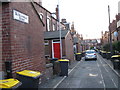
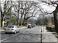
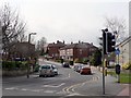
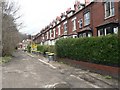
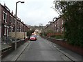
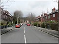
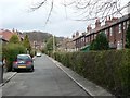
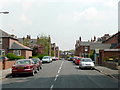
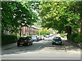
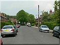
100 photos from this area
Area Information
Key information about the LS4 2PD including its size, population, and administrative classification.
- Area Type
- Postcode
- Area Size
- 4622 m²
- Population
- 1769
- Population Density
- 10406 people/km²
House Prices in LS4 2PD
19
Properties
£126,043
Average Sold Price
£24,500
Lowest Price
£230,000
Highest Price
Showing 19 properties
| Address | Type | Beds | Baths | Last Sale Price | Last Sale Date | |
|---|---|---|---|---|---|---|
| 167 St Michaels Lane, Headingley, Leeds, LS4 2PD | Terraced | 2 | 1 | £215,000 | Jun 2023 | |
| 153 St Michaels Lane, Headingley, Leeds, LS4 2PD | house | - | - | £207,500 | Feb 2022 | |
| 54 St Michaels Lane, Headingley, Leeds, LS4 2PD | Terraced | 5 | 2 | £230,000 | May 2019 | |
| 169 St Michaels Lane, Headingley, Leeds, LS4 2PD | Flat | - | - | £205,000 | Feb 2016 | |
| 165 St Michaels Lane, Headingley, Leeds, LS4 2PD | Terraced | 2 | - | £123,000 | Jun 2014 | |
| 163 St Michaels Lane, Headingley, Leeds, LS4 2PD | house | 2 | 1 | £129,000 | Feb 2011 | |
| 151 St Michaels Lane, Headingley, Leeds, LS4 2PD | Terraced | 3 | 1 | £125,000 | Nov 2010 | |
| 157 St Michaels Lane, Headingley, Leeds, LS4 2PD | house | - | - | £122,000 | Dec 2007 | |
| 159 St Michaels Lane, Headingley, Leeds, LS4 2PD | Terraced | - | - | £131,000 | Oct 2004 | |
| 147 St Michaels Lane, Headingley, Leeds, LS4 2PD | Terraced | 4 | 2 | £112,000 | Jul 2003 |
Page 1 of 2
Energy Efficiency in LS4 2PD
Amenities
Schools
| Rank | School | Type | Entry gender | Ages |
|---|
Explore more schools in this area
Go to Schools tabDemographics
Household Size
One person
most common
Accommodation Type
Houses
most common
Tenure
30
majority
Ethnic Group
White
most common
Religion
N/A
most common
Household Composition
N/A
most common
Age
22
median
Young Adults (15-29 years)
most common
Household Deprivation
N/A
with no deprivation
NS-SEC
32
in Lower managerial occupations
Explore more demographic insights in this area
Go to Demographics tabPlanning
Planning Constraints
- Flood RiskPremium
- Ramsar Wetland SitesPremium
- Area of Outstanding Natural BeautyPremium
- Protected Nature ReservePremium
- Protected WoodlandPremium