Area Overview for LS4 2NU
Photos of LS4 2NU
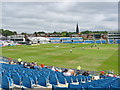
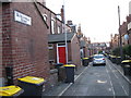
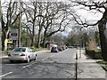
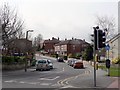
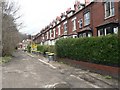
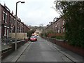
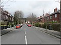
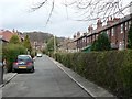
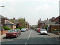
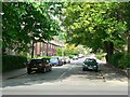
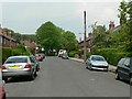
100 photos from this area
Area Information
Key information about the LS4 2NU including its size, population, and administrative classification.
- Area Type
- Postcode
- Area Size
- 1076 m²
- Population
- 1521
- Population Density
- 13261 people/km²
House Prices in LS4 2NU
21
Properties
£157,649
Average Sold Price
£92,500
Lowest Price
£239,950
Highest Price
Showing 21 properties
| Address | Type | Beds | Baths | Last Sale Price | Last Sale Date | |
|---|---|---|---|---|---|---|
| 17 Village Terrace, Burley, Leeds, LS4 2NU | Terraced | 2 | 1 | £239,950 | Aug 2023 | |
| 19 Village Terrace, Burley, Leeds, LS4 2NU | house | 4 | 2 | £195,000 | Jan 2021 | |
| 11 Village Terrace, Burley, Leeds, LS4 2NU | Detached | 1 | 1 | £193,444 | Feb 2020 | |
| 9 Village Terrace, Burley, Leeds, LS4 2NU | house | 2 | 3 | £115,000 | Aug 2016 | |
| 5 Village Terrace, Burley, Leeds, LS4 2NU | Terraced | 5 | - | £92,500 | Jun 2013 | |
| 15 Village Terrace, Burley, Leeds, LS4 2NU | Terraced | 3 | - | £110,000 | Aug 2009 | |
| Room 1, 11 Village Terrace, Burley, Leeds, LS4 2NU | Unknown | - | - | - | - | |
| Room 6, 19 Village Terrace, Burley, Leeds, LS4 2NU | Unknown | - | - | - | - | |
| Room 1, 19 Village Terrace, Burley, Leeds, LS4 2NU | Unknown | - | - | - | - | |
| Room 2, 11 Village Terrace, Burley, Leeds, LS4 2NU | Unknown | - | - | - | - |
Page 1 of 3
Energy Efficiency in LS4 2NU
Amenities
Schools
| Rank | School | Type | Entry gender | Ages |
|---|
Explore more schools in this area
Go to Schools tabDemographics
Household Size
Family (3-5 people)
most common
Accommodation Type
Houses
most common
Tenure
22
majority
Ethnic Group
White
most common
Religion
N/A
most common
Household Composition
N/A
most common
Age
22
median
Young Adults (15-29 years)
most common
Household Deprivation
N/A
with no deprivation
NS-SEC
27
in Lower managerial occupations
Explore more demographic insights in this area
Go to Demographics tabPlanning
Planning Constraints
- Flood RiskPremium
- Ramsar Wetland SitesPremium
- Area of Outstanding Natural BeautyPremium
- Protected Nature ReservePremium
- Protected WoodlandPremium