Area Overview for LS4 2HZ
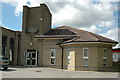
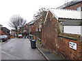
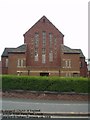
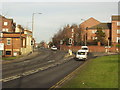
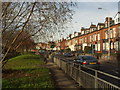
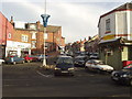
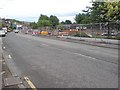
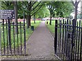
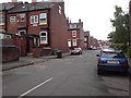
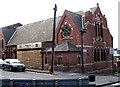
Photos of LS4 2HZ
Area Information
LS4 2HZ is a small residential postcode area in England, home to 1,812 people. It is a compact cluster of properties, likely spread across a limited geographical footprint, serving as a microcosm of suburban living. The area’s character is shaped by its demographic profile: a population skewed heavily towards young adults aged 15–29, with a median age of just 22. This suggests a community of students, early-career professionals, or those in transitional life stages. Daily life here is likely influenced by proximity to transport hubs and retail centres, with nearby rail stations and supermarkets within practical reach. While the area lacks large-scale amenities, its connectivity to Leeds city centre and surrounding infrastructure makes it a viable option for those prioritising accessibility over sprawling green spaces. The low flood risk and absence of protected natural areas indicate a pragmatic, low-constraint environment for development. However, the high crime risk score of 32/100 raises practical concerns for residents. For buyers, LS4 2HZ offers a snapshot of a youthful, mobile population with limited local amenities but strong ties to regional transport and retail networks.
- Area Type
- Postcode
- Area Size
- Not available
- Population
- 1812
- Population Density
- 6964 people/km²
The property market in LS4 2HZ is characterised by low home ownership, with only 18% of residents owning their homes. This suggests a rental market dominated by tenants, likely students or young professionals seeking short-term accommodation. The accommodation type is primarily houses, though the small population and limited data make it unclear whether these are single-family homes or smaller units. Given the area’s proximity to Leeds and its transport links, it may cater to commuters or those prioritising access to urban amenities over spacious living. The low home ownership rate and focus on houses indicate a market where property purchases are less common, possibly due to the area’s transient nature or affordability challenges. Buyers considering LS4 2HZ should note that this is not a traditional owner-occupied community, and property values may reflect the demand for rental properties rather than long-term investment. The immediate surroundings may offer similar dynamics, reinforcing the area’s role as a satellite to larger urban centres.
House Prices in LS4 2HZ
No properties found in this postcode.
Energy Efficiency in LS4 2HZ
Daily life in LS4 2HZ is shaped by its proximity to retail and transport hubs. The area has five retail outlets within reach, including major supermarkets like Tesco Leeds, Morrisons Daily Leeds, and Asda Armley, ensuring easy access to groceries and everyday essentials. While there are no specific parks or leisure facilities listed, the rail network connects residents to larger urban centres, offering access to cultural and recreational opportunities in Leeds. The presence of two airports nearby further enhances connectivity for travel. However, the absence of named parks, restaurants, or community spaces suggests a lifestyle centred on convenience and mobility rather than local amenities. For residents, this means a practical, no-frills approach to daily living, with reliance on nearby towns for more extensive leisure options. The retail and transport infrastructure makes LS4 2HZ a functional choice for those prioritising accessibility over a self-contained community.
Amenities
Schools
The only named school near LS4 2HZ is The KS3 Pupil Referral Unit at Burley Park Centre, which is categorised as an “other” type. This suggests it may serve students with specific educational needs or those requiring alternative schooling arrangements. There are no primary or secondary schools listed in the data, which could be a concern for families seeking traditional schooling options. The absence of mainstream schools in the immediate vicinity implies that residents may need to look beyond LS4 2HZ for comprehensive education, potentially increasing commuting times. For parents prioritising local schools, this area may not meet expectations, though proximity to larger towns like Leeds could offer broader choices. The single listed school highlights a limited educational infrastructure, which is a practical consideration for families planning long-term residency.
| Rank | School | Type | Entry gender | Ages |
|---|
Explore more schools in this area
Go to Schools tabDemographics
The community in LS4 2HZ is overwhelmingly young, with a median age of 22 and 82% of residents falling within the 15–29 age bracket. This demographic skew suggests a population of students, recent graduates, or individuals in early employment, likely drawn to the area’s proximity to Leeds and its transport links. Home ownership is low, with just 18% of households owning their properties, indicating a rental-dominated market. The accommodation type is predominantly houses, though the small population and limited data suggest a mix of housing stock. The predominant ethnic group is White, with no specific data on diversity or deprivation levels provided. This profile aligns with a transient community, possibly influenced by student populations or temporary housing needs. The age range and low home ownership imply a dynamic, possibly student-driven area where long-term stability may be less common. For prospective buyers, this demographic context highlights a market suited to those seeking short-term or flexible housing solutions rather than long-term family homes.
Household Size
Accommodation Type
Tenure
Ethnic Group
Religion
Household Composition
Age
Household Deprivation
NS-SEC
Explore more demographic insights in this area
Go to Demographics tabPlanning
Planning Constraints
- Flood RiskPremium
- Ramsar Wetland SitesPremium
- Area of Outstanding Natural BeautyPremium
- Protected Nature ReservePremium
- Protected WoodlandPremium