Area Overview for LS4 2AQ
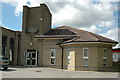
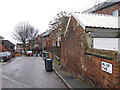
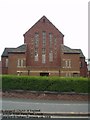
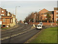
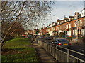
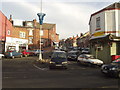
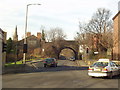
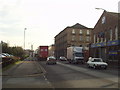
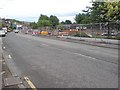
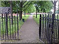
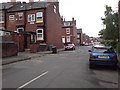
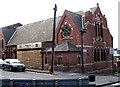
Photos of LS4 2AQ
Area Information
LS4 2AQ is a small residential postcode area in England with a population of 1625, characterised by its compact size and focused community. The area is home to a predominantly young population, with a median age of 22 and the majority of residents aged between 15 and 29. This demographic suggests a community shaped by students, early-career professionals, and young families. Daily life here is influenced by proximity to retail hubs, rail networks, and nearby airports, offering practical connectivity for commuters and shoppers. The area’s small scale means it is likely to feel close-knit, though the 21% home ownership rate indicates a significant proportion of residents rent rather than own property. While the area lacks major natural or historical landmarks, its accessibility to Leeds city centre and surrounding amenities makes it a pragmatic choice for those prioritising convenience over rural or coastal settings. Living in LS4 2AQ involves navigating a balance between urban proximity and the relative quiet of a smaller postcode, with local shops and transport links serving as the backbone of daily life.
- Area Type
- Postcode
- Area Size
- Not available
- Population
- 1625
- Population Density
- 5232 people/km²
The property market in LS4 2AQ is shaped by its low home ownership rate of 21%, indicating that the majority of residents are renters rather than homeowners. This suggests a market that may be more responsive to rental demand than to long-term investment. The predominant accommodation type is houses, though the specific distribution between detached, semi-detached, or terraced properties is not detailed. Given the area’s small size, the housing stock is likely limited, with limited scope for expansion or new developments. For buyers, this means competition for available properties could be fierce, particularly for those seeking owner-occupied homes. The low ownership rate also implies that landlords may hold a significant share of the market, potentially influencing pricing and availability. Prospective buyers should consider the area’s proximity to transport links and amenities as key selling points, though the small postcode size may limit the range of options.
House Prices in LS4 2AQ
No properties found in this postcode.
Energy Efficiency in LS4 2AQ
The lifestyle in LS4 2AQ is defined by its proximity to retail, transport, and travel hubs. Residents have access to five notable retail venues, including Tesco Leeds, Asda Armley, and Aldi Kirkstall, offering a range of shopping options within easy reach. The area’s rail network connects to multiple stations, enabling swift travel to Leeds city centre, Headingley, and beyond. Nearby airports provide additional mobility, though the absence of major leisure or cultural amenities means entertainment options are limited to what is available locally. The compact nature of LS4 2AQ means that daily life revolves around these practical resources, with convenience outweighing variety. While the area may not offer the vibrancy of larger urban centres, its accessibility and functional infrastructure cater to those prioritising efficiency over expansive leisure opportunities.
Amenities
Schools
Residents of LS4 2AQ have access to two primary schools within practical reach: Burley St Matthias Church of England Voluntary Controlled Primary School, which holds an Ofsted rating of ‘good’, and St Mathia’s CofE First School. Both institutions cater to younger children, providing essential early education for families in the area. The presence of a ‘good’-rated school offers reassurance for parents prioritising quality education, though the absence of secondary schools or further education facilities means families may need to look beyond LS4 2AQ for comprehensive schooling. The mix of schools reflects a focus on primary education, which is typical for smaller postcode areas. For those considering the area for its schools, the proximity of these institutions is a practical advantage, though the limited range of educational options should be factored into long-term planning.
| Rank | School | Type | Entry gender | Ages |
|---|
Explore more schools in this area
Go to Schools tabDemographics
The community in LS4 2AQ is overwhelmingly young, with a median age of 22 and the most common age range being 15–29 years. This reflects a population dominated by students, young professionals, and early-stage families. Home ownership is low, with only 21% of residents owning their homes, suggesting a rental market that caters to transient or budget-conscious occupants. The predominant accommodation type is houses, though the exact mix of household types is not specified. The area’s demographic is predominantly White, with no data provided on other ethnic groups. The high proportion of young adults may indicate a transient population, potentially affecting social cohesion and long-term stability. For prospective buyers, this profile suggests a community that is dynamic but perhaps less rooted than older, more established areas. The absence of detailed diversity metrics means the full picture of cultural or socioeconomic variety remains unclear, though the data highlights a clearly defined age demographic.
Household Size
Accommodation Type
Tenure
Ethnic Group
Religion
Household Composition
Age
Household Deprivation
NS-SEC
Explore more demographic insights in this area
Go to Demographics tabPlanning
Planning Constraints
- Flood RiskPremium
- Ramsar Wetland SitesPremium
- Area of Outstanding Natural BeautyPremium
- Protected Nature ReservePremium
- Protected WoodlandPremium