Area Overview for LS29 8YH
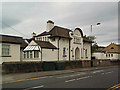
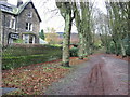
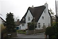
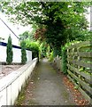
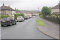
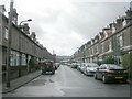
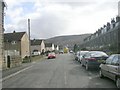
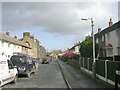
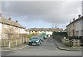
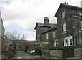
Photos of LS29 8YH


Area Information
LS29 8YH is a small residential cluster in England, home to 1,611 people. This postcode area is characterised by a quiet, established community with a focus on family living. The area’s compact size means residents enjoy a close-knit environment, with easy access to nearby towns and amenities. The population is predominantly adults aged 30-64, reflecting a mature demographic with strong ties to local institutions. Daily life here is shaped by proximity to retail, transport, and educational facilities. The low crime risk and absence of environmental constraints such as protected woodlands or AONB designations make it a practical choice for those prioritising safety and stability. With 89% of homes owned outright, the area leans towards owner-occupation, suggesting long-term residency and community continuity. For buyers, LS29 8YH offers a blend of practicality and accessibility, with nearby rail links and high-quality broadband connectivity supporting both work and leisure. The presence of a well-rated primary school further cements its appeal for families seeking a balanced lifestyle.
- Area Type
- Postcode
- Area Size
- Not available
- Population
- 1611
- Population Density
- 1837 people/km²
The property market in LS29 8YH is dominated by owner-occupied homes, with 89% of properties owned outright. This high home ownership rate indicates a stable, long-term resident base with little reliance on rental markets. The area is primarily composed of houses, rather than flats or apartments, which is typical of smaller, suburban clusters. This housing stock suggests a focus on family homes, with larger properties that cater to established households. The limited scale of the area means the market is niche, with fewer properties available compared to larger towns. Buyers should consider that the demand for homes here is likely driven by local residents seeking to remain in the area rather than external investment. The absence of rental properties also means competition for available homes may be limited, but this could change if the population profile shifts. For those prioritising stability and space, LS29 8YH offers a clear advantage in its housing composition.
House Prices in LS29 8YH
No properties found in this postcode.
Energy Efficiency in LS29 8YH
Living in LS29 8YH offers access to a range of amenities within practical reach. The area is served by five retail outlets, including major names like Tesco Ilkley, Booths Ilkley, and M&S Ilkley SF, ensuring convenient shopping options. Residents can also utilise nearby rail stations such as Ilkley and Ben Rhydding, which connect to broader transport networks. The Bolton Abbey metro station adds further mobility, though it is slightly farther away. The presence of these retail and transport hubs supports a lifestyle that balances convenience with the tranquillity of a smaller community. While the data does not mention parks or leisure facilities directly, the absence of environmental constraints like AONB or protected woodlands suggests open spaces may be accessible nearby. The combination of retail, transport, and the well-rated primary school contributes to a functional, family-friendly environment.
Amenities
Schools
The nearest school to LS29 8YH is Ben Rhydding Primary School, which has an Ofsted rating of ‘good’. This primary school serves the immediate community, providing education for younger children. While no secondary schools are listed in the data, the presence of a well-rated primary school is a significant draw for families. The school’s ‘good’ rating suggests a reliable standard of education, though parents may need to consider additional options for secondary schooling. The proximity of the school to homes in LS29 8YH enhances the area’s appeal, particularly for those prioritising ease of access to educational institutions. The absence of other schools in the immediate vicinity means families may need to travel to nearby towns for secondary education, but the quality of the primary school mitigates this concern. For buyers, the school’s rating is a key factor in assessing the area’s suitability for raising children.
| Rank | School | Type | Entry gender | Ages |
|---|
Explore more schools in this area
Go to Schools tabDemographics
The community in LS29 8YH is predominantly composed of adults aged 30-64, with a median age of 47. This suggests a mature, settled population with established careers and family structures. Home ownership is exceptionally high at 89%, indicating a strong preference for long-term residency over rental living. The area is primarily composed of houses, reflecting a preference for single-family homes over flats or apartments. The predominant ethnic group is White, though no specific data on diversity or deprivation is provided. The absence of younger demographics or higher rental rates implies a community focused on stability rather than transient populations. For buyers, this profile suggests a neighbourhood with low turnover and a consistent demand for family-oriented housing. The demographic makeup also aligns with areas where local amenities and schools are central to daily life, reinforcing the importance of nearby services like Ben Rhydding Primary School.
Household Size
Accommodation Type
Tenure
Ethnic Group
Religion
Household Composition
Age
Household Deprivation
NS-SEC
Explore more demographic insights in this area
Go to Demographics tabPlanning
Planning Constraints
- Flood RiskPremium
- Ramsar Wetland SitesPremium
- Area of Outstanding Natural BeautyPremium
- Protected Nature ReservePremium
- Protected WoodlandPremium