Area Overview for LS29 8TE
Photos of LS29 8TE
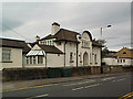

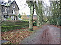
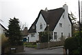
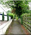
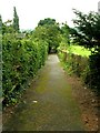
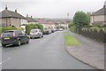
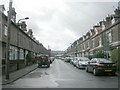
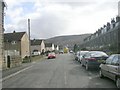
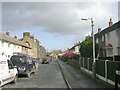
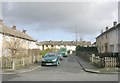
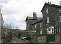
100 photos from this area
Area Information
Key information about the LS29 8TE including its size, population, and administrative classification.
- Area Type
- Postcode
- Area Size
- 5925 m²
- Population
- 1576
- Population Density
- 2191 people/km²
House Prices in LS29 8TE
14
Properties
£306,396
Average Sold Price
£83,500
Lowest Price
£875,000
Highest Price
Showing 14 properties
| Address | Type | Beds | Baths | Last Sale Price | Last Sale Date | |
|---|---|---|---|---|---|---|
| 49 Springs Lane, Ilkley, LS29 8TE | Detached | 4 | 2 | £875,000 | Mar 2025 | |
| 43 Springs Lane, Ilkley, LS29 8TE | Detached | 2 | 1 | £338,500 | Dec 2023 | |
| 33 Springs Lane, Ilkley, LS29 8TE | house | - | - | £455,000 | May 2021 | |
| 35 Springs Lane, Ilkley, LS29 8TE | Semi-detached | 3 | - | £469,000 | Feb 2021 | |
| 23 Springs Lane, Ilkley, LS29 8TE | Semi-detached | 3 | - | £275,300 | Oct 2014 | |
| 29 Springs Lane, Ilkley, LS29 8TE | house | - | - | £223,000 | Feb 2011 | |
| 47 Springs Lane, Ilkley, LS29 8TE | Bungalow | - | - | £230,000 | Nov 2009 | |
| 37 Springs Lane, Ilkley, LS29 8TE | Semi-detached | - | - | £249,950 | Feb 2008 | |
| 45 Springs Lane, Ilkley, LS29 8TE | Detached | - | - | £225,000 | Jan 2006 | |
| 31 Springs Lane, Ilkley, LS29 8TE | house | - | - | £160,000 | Nov 2003 |
Page 1 of 2
Energy Efficiency in LS29 8TE
Amenities
Schools
| Rank | School | Type | Entry gender | Ages |
|---|
Explore more schools in this area
Go to Schools tabDemographics
Household Size
Two person
most common
Accommodation Type
Houses
most common
Tenure
91
majority
Ethnic Group
White
most common
Religion
N/A
most common
Household Composition
N/A
most common
Age
47
median
Adults (30-64 years)
most common
Household Deprivation
N/A
with no deprivation
NS-SEC
61
in Lower managerial occupations
Explore more demographic insights in this area
Go to Demographics tabPlanning
Planning Constraints
- Flood RiskPremium
- Ramsar Wetland SitesPremium
- Area of Outstanding Natural BeautyPremium
- Protected Nature ReservePremium
- Protected WoodlandPremium