Area Overview for LS29 8QP
Photos of LS29 8QP
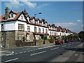
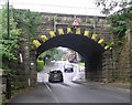
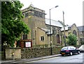
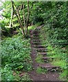
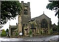
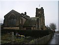

100 photos from this area
Area Information
Key information about the LS29 8QP including its size, population, and administrative classification.
- Area Type
- Postcode
- Area Size
- 2.0 hectares
- Population
- 1576
- Population Density
- 2191 people/km²
House Prices in LS29 8QP
32
Properties
£508,039
Average Sold Price
£168,000
Lowest Price
£925,000
Highest Price
Showing 32 properties
| Address | Type | Beds | Baths | Last Sale Price | Last Sale Date | |
|---|---|---|---|---|---|---|
| 27 Manley Road, Ilkley, LS29 8QP | Detached | 4 | 1 | £699,950 | Aug 2024 | |
| Ingleside, 29 Manley Road, Ilkley, LS29 8QP | Semi-detached | 5 | 2 | £845,000 | Mar 2024 | |
| 22 Manley Road, Ilkley, LS29 8QP | Detached | - | - | £850,000 | Jul 2023 | |
| 23 Manley Road, Ilkley, LS29 8QP | Retail | 4 | 3 | £925,000 | Nov 2022 | |
| 45 Manley Road, Ilkley, LS29 8QP | Detached | 4 | - | £679,950 | Sep 2021 | |
| 28 Manley Road, Ilkley, LS29 8QP | Bungalow | 3 | - | £549,950 | Dec 2019 | |
| 39 Manley Road, Ilkley, LS29 8QP | house | - | - | £595,050 | Jul 2019 | |
| 25 Manley Road, Ilkley, LS29 8QP | house | - | - | £532,800 | Aug 2018 | |
| 33 Manley Road, Ilkley, LS29 8QP | Semi-detached | 5 | - | £450,000 | Feb 2015 | |
| 17 Manley Road, Ilkley, LS29 8QP | Detached | 4 | - | £419,500 | Aug 2014 |
Page 1 of 4
Energy Efficiency in LS29 8QP
Amenities
Schools
| Rank | School | Type | Entry gender | Ages |
|---|
Explore more schools in this area
Go to Schools tabDemographics
Household Size
Two person
most common
Accommodation Type
Houses
most common
Tenure
91
majority
Ethnic Group
White
most common
Religion
N/A
most common
Household Composition
N/A
most common
Age
47
median
Adults (30-64 years)
most common
Household Deprivation
N/A
with no deprivation
NS-SEC
61
in Lower managerial occupations
Explore more demographic insights in this area
Go to Demographics tabPlanning
Planning Constraints
- Flood RiskPremium
- Ramsar Wetland SitesPremium
- Area of Outstanding Natural BeautyPremium
- Protected Nature ReservePremium
- Protected WoodlandPremium