Area Overview for LS29 8DF
Photos of LS29 8DF


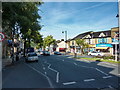


100 photos from this area
Area Information
Key information about the LS29 8DF including its size, population, and administrative classification.
- Area Type
- Postcode
- Area Size
- 2846 m²
- Population
- 1554
- Population Density
- 4183 people/km²
House Prices in LS29 8DF
18
Properties
£209,531
Average Sold Price
£97,000
Lowest Price
£293,000
Highest Price
Showing 18 properties
| Address | Type | Beds | Baths | Last Sale Price | Last Sale Date | |
|---|---|---|---|---|---|---|
| 6 Castle Gate, Ilkley, LS29 8DF | Flat | 2 | 1 | £280,000 | Mar 2025 | |
| 1 Castle Gate, Ilkley, LS29 8DF | Flat | 2 | 1 | £270,000 | Mar 2025 | |
| 5 Castle Gate, Ilkley, LS29 8DF | Flat | - | - | £265,000 | Oct 2024 | |
| 8 Castle Gate, Ilkley, LS29 8DF | Flat | - | - | £270,000 | Jul 2024 | |
| 11 Castle Gate, Ilkley, LS29 8DF | Flat | - | - | £293,000 | Feb 2022 | |
| 10 Castle Gate, Ilkley, LS29 8DF | Flat | - | - | £217,000 | Nov 2018 | |
| 17 Castle Gate, Ilkley, LS29 8DF | Flat | - | - | £212,000 | May 2017 | |
| 15 Castle Gate, Ilkley, LS29 8DF | Flat | - | - | £205,000 | Aug 2016 | |
| 12 Castle Gate, Ilkley, LS29 8DF | Flat | 2 | 1 | £220,000 | Mar 2016 | |
| 2 Castle Gate, Ilkley, LS29 8DF | Flat | - | - | £171,000 | May 2015 |
Page 1 of 2
Energy Efficiency in LS29 8DF
Amenities
Schools
| Rank | School | Type | Entry gender | Ages |
|---|
Explore more schools in this area
Go to Schools tabDemographics
Household Size
One person
most common
Accommodation Type
Houses
most common
Tenure
61
majority
Ethnic Group
White
most common
Religion
N/A
most common
Household Composition
N/A
most common
Age
47
median
Adults (30-64 years)
most common
Household Deprivation
N/A
with no deprivation
NS-SEC
47
in Lower managerial occupations
Explore more demographic insights in this area
Go to Demographics tabPlanning
Planning Constraints
- Flood RiskPremium
- Ramsar Wetland SitesPremium
- Area of Outstanding Natural BeautyPremium
- Protected Nature ReservePremium
- Protected WoodlandPremium