Area Overview for LS29 7XD
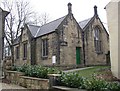
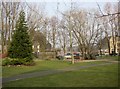
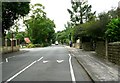
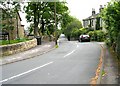
Photos of LS29 7XD


Area Information
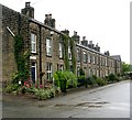
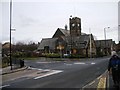
Living in LS29 7XD means being part of a small, tightly knit residential cluster in England, home to 1,444 residents. The area’s compact size fosters a quiet, community-oriented lifestyle, with homes primarily in single-family structures. The population skews towards adults aged 30–64, reflecting a stable demographic with a median age of 47. Daily life here balances domestic comfort with practical access to nearby amenities. Residents benefit from proximity to rail networks, including Burley, Menston, and Ben Rhydding stations, which connect to broader regional routes. Retail options like Co-op Burley in and Sainsburys Menston are within reach, while Leeds Bradford International Airport is a short journey away. The area’s low flood risk and absence of protected natural sites suggest minimal environmental constraints, allowing for straightforward planning and living. For those seeking a calm, family-friendly environment with essential services nearby, LS29 7XD offers a blend of convenience and tranquillity.
- Area Type
- Postcode
- Area Size
- Not available
- Population
- 1444
- Population Density
- 4276 people/km²
The property market in LS29 7XD is characterised by a strong emphasis on owner-occupied homes, with 71% of properties owned by residents rather than rented. The accommodation type is predominantly houses, which suggests a focus on single-family dwellings rather than flats or apartments. This makes the area more appealing to families or individuals seeking larger living spaces. Given the small size of the postcode and its residential nature, the housing stock is likely limited, which could mean fewer options for buyers. However, the high home ownership rate indicates a stable market with long-term residents. For those considering the area, the availability of houses may be more significant than rental properties, though the compact size of LS29 7XD means buyers may need to look beyond immediate surroundings for more diverse options.
House Prices in LS29 7XD
No properties found in this postcode.
Energy Efficiency in LS29 7XD
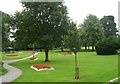
The lifestyle in LS29 7XD is shaped by its proximity to essential amenities. Residents can access five rail stations, including Burley and Menston, which connect to regional transport networks. For shopping, Co-op Burley in and Sainsburys Menston provide nearby retail options, while Tesco Ilkley is a short journey away. The area’s small size means these amenities are within practical reach, supporting daily convenience. Although there is no mention of parks or leisure facilities in the data, the absence of protected natural sites suggests minimal restrictions on local development or recreational spaces. The presence of two airports also offers travel flexibility for those requiring regular flights. Overall, the area balances practicality with accessibility, ensuring residents can meet their needs without long commutes or significant effort.
Amenities
Schools
Residents of LS29 7XD have access to two primary schools: Burley Middle School and Burley Oaks Primary School. Both institutions cater to younger children, providing essential early education within the local area. The presence of two primary schools suggests a focus on supporting families with young children, though the data does not include Ofsted ratings or specific academic performance metrics. The lack of secondary schools nearby may require students to travel to adjacent areas for further education. For families prioritising proximity to schools, the availability of primary education within walking distance is a practical advantage, though parents should consider additional travel for secondary schooling. The mix of primary schools reflects the area’s residential orientation, designed to meet the needs of local households with young children.
| Rank | School | Type | Entry gender | Ages |
|---|
Explore more schools in this area
Go to Schools tabDemographics
The community in LS29 7XD is predominantly composed of adults aged 30–64, with a median age of 47. This age group shapes the area’s character, reflecting a mature, stable population. Home ownership is high, with 71% of residents living in owner-occupied properties, compared to 29% in rental homes. The accommodation type is primarily houses, indicating a focus on single-family homes rather than apartments or flats. The predominant ethnic group is White, which aligns with broader regional patterns. The absence of specific data on deprivation or diversity metrics means the area’s social dynamics are not explicitly detailed, but the high home ownership rate and age profile suggest a settled, low-turnover community. This demographic structure likely influences local services and amenities, tailored to the needs of families and long-term residents.
Household Size
Accommodation Type
Tenure
Ethnic Group
Religion
Household Composition
Age
Household Deprivation
NS-SEC
Explore more demographic insights in this area
Go to Demographics tabPlanning
Planning Constraints
- Flood RiskPremium
- Ramsar Wetland SitesPremium
- Area of Outstanding Natural BeautyPremium
- Protected Nature ReservePremium
- Protected WoodlandPremium