Area Overview for LS29 7HW
Photos of LS29 7HW
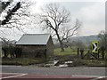
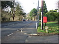
![Lay-by on the north side of the Ilkley Road [A65] in LS29 7HW](https://images.propbar.co.uk/images/geograph/43/88/4388629_120.jpg)
17 photos from this area
Area Information
Key information about the LS29 7HW including its size, population, and administrative classification.
- Area Type
- Postcode
- Area Size
- 9.6 hectares
- Population
- 1626
- Population Density
- 616 people/km²
House Prices in LS29 7HW
2
Properties
-
Average Sold Price
-
Lowest Price
-
Highest Price
Showing 2 properties
| Address | Type | Beds | Baths | Last Sale Price | Last Sale Date | |
|---|---|---|---|---|---|---|
| Assistant Managers Flat, Generous Pioneer, 2 Ilkley Road, Burley In Wharfedale, Ilkley, LS29 7HW | Flat | - | - | - | - | |
| Greystone Manor Farm, Ilkley Road, Burley In Wharfedale, Ilkley, LS29 7HW | Detached | - | - | - | - |
Energy Efficiency in LS29 7HW
Amenities
Schools
| Rank | School | Type | Entry gender | Ages |
|---|
Explore more schools in this area
Go to Schools tabDemographics
Household Size
Family (3-5 people)
most common
Accommodation Type
Houses
most common
Tenure
92
majority
Ethnic Group
White
most common
Religion
N/A
most common
Household Composition
N/A
most common
Age
47
median
Adults (30-64 years)
most common
Household Deprivation
N/A
with no deprivation
NS-SEC
56
in Lower managerial occupations
Explore more demographic insights in this area
Go to Demographics tabPlanning
Planning Constraints
- Flood RiskPremium
- Ramsar Wetland SitesPremium
- Area of Outstanding Natural BeautyPremium
- Protected Nature ReservePremium
- Protected WoodlandPremium