Area Overview for LS29 6PJ
Photos of LS29 6PJ

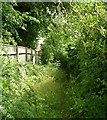
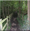
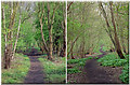
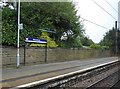

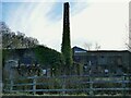
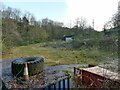
100 photos from this area
Area Information
Key information about the LS29 6PJ including its size, population, and administrative classification.
- Area Type
- Postcode
- Area Size
- 2.5 hectares
- Population
- 1272
- Population Density
- 1859 people/km²
House Prices in LS29 6PJ
44
Properties
£295,724
Average Sold Price
£72,000
Lowest Price
£501,999
Highest Price
Showing 44 properties
| Address | Type | Beds | Baths | Last Sale Price | Last Sale Date | |
|---|---|---|---|---|---|---|
| 18 Brooklands Lane, Menston, Ilkley, LS29 6PJ | Detached | 3 | 1 | £432,500 | Oct 2025 | |
| 114 Brooklands Lane, Menston, Ilkley, LS29 6PJ | house | - | - | £501,999 | Jan 2022 | |
| 30 Brooklands Lane, Menston, Ilkley, LS29 6PJ | house | - | - | £295,500 | Aug 2021 | |
| 148 Brooklands Lane, Menston, Ilkley, LS29 6PJ | house | - | - | £410,000 | Feb 2021 | |
| 4 Brooklands Lane, Menston, Ilkley, LS29 6PJ | house | - | - | £390,000 | Dec 2020 | |
| 92 Brooklands Lane, Menston, Ilkley, LS29 6PJ | house | - | - | £327,000 | Jun 2020 | |
| 12 Brooklands Lane, Menston, Ilkley, LS29 6PJ | house | - | - | £395,000 | Sep 2018 | |
| 138 Brooklands Lane, Menston, Ilkley, LS29 6PJ | house | - | - | £423,000 | Jun 2018 | |
| 72 Brooklands Lane, Menston, Ilkley, LS29 6PJ | Bungalow | 3 | 2 | £360,000 | Dec 2016 | |
| 144 Brooklands Lane, Menston, Ilkley, LS29 6PJ | house | - | - | £317,500 | Mar 2016 |
Page 1 of 5
Energy Efficiency in LS29 6PJ
Amenities
Schools
| Rank | School | Type | Entry gender | Ages |
|---|
Explore more schools in this area
Go to Schools tabDemographics
Household Size
Two person
most common
Accommodation Type
Houses
most common
Tenure
91
majority
Ethnic Group
White
most common
Religion
N/A
most common
Household Composition
N/A
most common
Age
47
median
Adults (30-64 years)
most common
Household Deprivation
N/A
with no deprivation
NS-SEC
56
in Lower managerial occupations
Explore more demographic insights in this area
Go to Demographics tabPlanning
Planning Constraints
- Flood RiskPremium
- Ramsar Wetland SitesPremium
- Area of Outstanding Natural BeautyPremium
- Protected Nature ReservePremium
- Protected WoodlandPremium