Area Overview for LS29 6AA
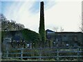
Photos of LS29 6AA


Area Information
LS29 6AA is a small residential cluster in England, covering just 1.3 hectares with a population of 1311 people. The area’s compact size means it is densely populated, with 787 people per square kilometre. This postcode is characterised by a mature demographic, with a median age of 47 and most residents aged between 30 and 64. The area is predominantly home-owning, with 86% of properties in private hands, and houses are the primary accommodation type. Living here offers proximity to key transport links, including five nearby railway stations such as Menston and Burley, and access to Leeds Bradford International Airport within a short distance. Daily life is shaped by a balance of suburban tranquility and practical connectivity, though the high population density means space is limited. The area’s appeal lies in its blend of established housing, reliable infrastructure, and proximity to larger towns, making it a viable choice for those seeking a settled, low-crime environment with accessible amenities.
- Area Type
- Postcode
- Area Size
- 1.3 hectares
- Population
- 1311
- Population Density
- 787 people/km²
The property market in LS29 6AA is dominated by owner-occupied homes, with 86% of properties in private hands. This high rate of home ownership suggests a community of long-term residents rather than a transient rental market. The area’s housing stock is primarily composed of houses, which are more common than flats or apartments. Given the postcode’s small size—just 1.3 hectares—the housing stock is likely limited in scale, with properties concentrated in a tight cluster. This makes the area ideal for buyers seeking a settled, low-density environment, though it may also mean limited availability for new developments. The focus on houses rather than apartments suggests a preference for family-friendly or more spacious living arrangements. For buyers, this means a market where properties are likely to be well-established, with potential for long-term value retention, though the small area size may restrict options for those seeking larger properties or additional space.
House Prices in LS29 6AA
Showing 1 properties
| Address | Type | Beds | Baths | Last Sale Price | Last Sale Date | |
|---|---|---|---|---|---|---|
| Mill House, Imperial Works, Otley Road, Menston, Ilkley, LS29 6AA | Detached | - | - | - | - |
Energy Efficiency in LS29 6AA
Residents of LS29 6AA have access to a range of nearby amenities, including five railway stations such as Menston and Burley, which provide direct links to surrounding towns and cities. Retail options are well-served, with Sainsburys Menston, Spar, and Aldi Guiseley within practical reach, offering everyday shopping needs. While the area’s compact size means it lacks large supermarkets or extensive leisure facilities, the nearby stations connect residents to broader networks of services, from healthcare to entertainment. The absence of major parks or recreational spaces within the postcode suggests that outdoor activities may require travel to nearby areas. However, the proximity to rail links and retail hubs compensates by enabling quick access to larger amenities. The lifestyle here is defined by convenience and connectivity, with residents able to enjoy a mix of local services and regional opportunities, though the area’s small footprint means it is best suited for those who prioritise ease of access over expansive amenities.
Amenities
Schools
| Rank | School | Type | Entry gender | Ages |
|---|
Explore more schools in this area
Go to Schools tabDemographics
The community in LS29 6AA is predominantly composed of adults aged 30 to 64, reflecting a mature, stable population. The median age of 47 suggests a community with a strong presence of middle-aged residents, many of whom may be in their peak earning years or nearing retirement. Home ownership is high, with 86% of residents living in their own homes, indicating a long-term commitment to the area. The majority of properties are houses, rather than flats or apartments, which aligns with the area’s character as a residential cluster. The predominant ethnic group is White, with no data provided on other groups. The population density of 787 people per square kilometre means the area is compact, with limited space for expansion. This density, combined with the age profile, suggests a community focused on family stability and long-term residency, though it may also mean fewer amenities per capita compared to larger urban areas.
Household Size
Accommodation Type
Tenure
Ethnic Group
Religion
Household Composition
Age
Household Deprivation
NS-SEC
Explore more demographic insights in this area
Go to Demographics tabPlanning
Planning Constraints
- Flood RiskPremium
- Ramsar Wetland SitesPremium
- Area of Outstanding Natural BeautyPremium
- Protected Nature ReservePremium
- Protected WoodlandPremium