Area Overview for LS29 0XF
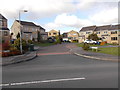
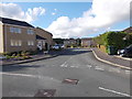
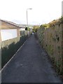
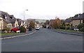
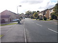
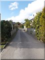
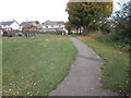
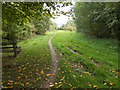
Photos of LS29 0XF
Area Information
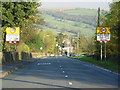
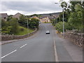
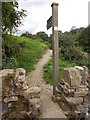
Living in LS29 0XF means being part of a small, tightly knit residential cluster in England, home to 1,379 residents. This area is defined by its compact size and the presence of traditional housing stock, which reflects a community that values stability and continuity. The population is predominantly adults aged 30–64, suggesting a mature demographic with established careers and family ties. Daily life here is shaped by proximity to key transport links, including railway stations at Ilkley, Steeton & Silsden, and Ben Rhydding, which provide easy access to nearby towns and cities. Locals can walk or cycle to nearby amenities such as Co-op stores in Addingham and Silsden, as well as Aldi in Silsden. The area’s low crime risk and absence of environmental constraints make it an attractive choice for those seeking a quiet, secure place to live without sacrificing connectivity to urban centres.
- Area Type
- Postcode
- Area Size
- Not available
- Population
- 1379
- Population Density
- 1714 people/km²
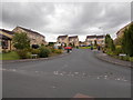
The property market in LS29 0XF is dominated by owner-occupied homes, with 87% of properties owned outright. This high rate of home ownership suggests a community that prioritises long-term investment over rental living, which can create a sense of permanence and neighbourly cohesion. The accommodation type is primarily houses, which is unusual for areas with limited space but aligns with the area’s small, residential character. For buyers, this means a market where properties are likely to be family homes rather than speculative investments. The limited size of LS29 0XF means the housing stock is finite, so buyers should consider proximity to nearby towns like Ilkley or Skipton for additional options. The focus on owner-occupation also implies that the market may be less influenced by short-term rental trends.
House Prices in LS29 0XF
No properties found in this postcode.
Energy Efficiency in LS29 0XF
Residents of LS29 0XF have access to a range of local amenities that support daily life. Nearby shops include Co-op stores in Addingham and Silsden, as well as Aldi in Silsden, offering essential groceries and household items. The area’s proximity to metro stops like Bolton Abbey and Embsay provides opportunities for leisure, shopping, and dining in nearby towns. Railway stations such as Ilkley and Steeton & Silsden connect residents to broader networks, enabling travel to cultural hubs or business centres. While the area itself is small, its strategic location ensures that residents can enjoy both rural tranquillity and urban convenience. The availability of these amenities contributes to a lifestyle that balances practicality with accessibility, making LS29 0XF a viable choice for those who value both local community and regional connectivity.
Amenities
Schools
| Rank | School | Type | Entry gender | Ages |
|---|
Explore more schools in this area
Go to Schools tabDemographics
The community in LS29 0XF is predominantly composed of adults aged 30–64, with a median age of 47. This suggests a population that is largely in their prime working years, likely with established careers and family commitments. Home ownership is exceptionally high at 87%, indicating a strong preference for long-term residency over rental properties. The accommodation type is primarily houses, which aligns with the area’s traditional character and may appeal to those seeking more space than typical flats. The predominant ethnic group is White, reflecting a homogenous demographic profile. While no specific data on deprivation is provided, the high home ownership rate and low crime risk imply a stable, low-pressure environment where residents can expect a consistent quality of life.
Household Size
Accommodation Type
Tenure
Ethnic Group
Religion
Household Composition
Age
Household Deprivation
NS-SEC
Explore more demographic insights in this area
Go to Demographics tabPlanning
Planning Constraints
- Flood RiskPremium
- Ramsar Wetland SitesPremium
- Area of Outstanding Natural BeautyPremium
- Protected Nature ReservePremium
- Protected WoodlandPremium