Area Overview for LS28 9NS
Photos of LS28 9NS
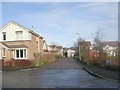
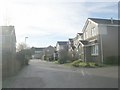
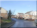
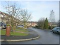
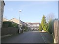
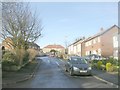
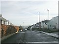
100 photos from this area
Area Information
Key information about the LS28 9NS including its size, population, and administrative classification.
- Area Type
- Postcode
- Area Size
- 6182 m²
- Population
- 1658
- Population Density
- 5146 people/km²
House Prices in LS28 9NS
24
Properties
£91,376
Average Sold Price
£22,500
Lowest Price
£157,000
Highest Price
Showing 24 properties
| Address | Type | Beds | Baths | Last Sale Price | Last Sale Date | |
|---|---|---|---|---|---|---|
| 2 Coleridge Lane, Pudsey, LS28 9NS | Semi-detached | 2 | 1 | £81,000 | Oct 2022 | |
| 6 Coleridge Lane, Pudsey, LS28 9NS | house | - | - | £157,000 | May 2022 | |
| 8 Coleridge Lane, Pudsey, LS28 9NS | Semi-detached | 3 | - | £155,000 | Nov 2021 | |
| 17 Coleridge Lane, Pudsey, LS28 9NS | Semi-detached | 3 | - | £148,000 | Jan 2021 | |
| 20 Coleridge Lane, Pudsey, LS28 9NS | Terraced | 2 | 1 | £143,000 | Jan 2020 | |
| 1 Coleridge Lane, Pudsey, LS28 9NS | Semi-detached | 2 | 1 | £110,000 | Jun 2018 | |
| 9 Coleridge Lane, Pudsey, LS28 9NS | Semi-detached | 2 | - | £124,950 | Feb 2016 | |
| 7 Coleridge Lane, Pudsey, LS28 9NS | Semi-detached | 3 | 2 | £129,000 | Jun 2015 | |
| 3 Coleridge Lane, Pudsey, LS28 9NS | Semi-detached | 2 | 1 | £62,000 | May 2015 | |
| 10 Coleridge Lane, Pudsey, LS28 9NS | house | 3 | 2 | £85,000 | Dec 2012 |
Page 1 of 3
Energy Efficiency in LS28 9NS
Amenities
Schools
| Rank | School | Type | Entry gender | Ages |
|---|
Explore more schools in this area
Go to Schools tabDemographics
Household Size
Family (3-5 people)
most common
Accommodation Type
Houses
most common
Tenure
70
majority
Ethnic Group
White
most common
Religion
N/A
most common
Household Composition
N/A
most common
Age
47
median
Adults (30-64 years)
most common
Household Deprivation
N/A
with no deprivation
NS-SEC
32
in Lower managerial occupations
Explore more demographic insights in this area
Go to Demographics tabPlanning
Planning Constraints
- Flood RiskPremium
- Ramsar Wetland SitesPremium
- Area of Outstanding Natural BeautyPremium
- Protected Nature ReservePremium
- Protected WoodlandPremium