Area Overview for LS28 8HW
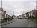
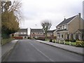
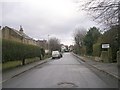
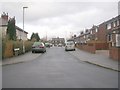
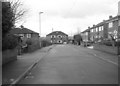
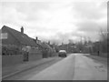
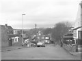
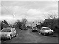
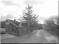
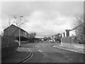
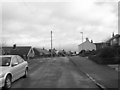
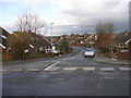
Photos of LS28 8HW
Area Information
LS28 8HW is a compact residential postcode nestled in the Pudsey Ward of Leeds, West Yorkshire. Covering just 1,897 square metres, it is densely populated, housing 1,758 residents within a small cluster of homes. The area’s history is deeply rooted in industrial heritage, with Pudsey once a hub for woollen manufacturing and iron foundries. Today, it blends this past with modern living, offering a quiet residential character amid the broader Leeds urban landscape. The postcode area is part of the former Pudsey Urban District, which merged into Leeds in 1974. Its proximity to Swinnow and Tyersal adds a layer of local distinctiveness, while its coordinates (approximately 53.792048, -1.70396) sit within the historic Morley and Calverley Parish. Living here means being close to both historical landmarks, like Pudsey Park and listed buildings, and practical amenities such as rail links and retail hubs. The area’s compact size ensures a tight-knit community feel, though its density may limit green spaces. For buyers, it offers a mix of older homes and proximity to essential services, though the small footprint means limited expansion.
- Area Type
- Postcode
- Area Size
- 1897 m²
- Population
- 1758
- Population Density
- 2708 people/km²
The property market in LS28 8HW is characterised by high home ownership (87%) and a predominance of houses over flats, suggesting a market geared toward family homes and long-term residency. With only 1,758 residents spread across 1,897 square metres, the area is small and likely to have limited new developments. This compact size means buyers must consider proximity to amenities, as expansion is constrained. The high ownership rate indicates a stable market with fewer rental properties, which may appeal to those seeking a settled, low-turnover environment. However, the lack of newer housing stock could limit options for buyers seeking modern properties or larger homes. The area’s historical roots in industrial manufacturing may influence property styles, with older homes dominating. For buyers, this means prioritising location over size, as the immediate surroundings offer limited alternatives. The small footprint also means that properties are likely to be in close proximity to each other, which could be a consideration for those valuing privacy.
House Prices in LS28 8HW
No properties found in this postcode.
Energy Efficiency in LS28 8HW
Living in LS28 8HW offers access to a range of amenities within practical reach. Retail options include Sainsburys Pudsey and M&S Pudsey, providing essential shopping and dining choices. The area’s rail stations—New Pudsey Station and Bramley Railway Station—connect residents to Leeds and surrounding areas, while nearby airports offer regional and international travel. Pudsey Park, a designated conservation area, adds green space for recreation, and the town’s historical sites, such as Pudsey Cemetery and listed buildings, offer cultural interest. The presence of cricket clubs like Pudsey St Lawrence and Pudsey Congs suggests a community with sporting traditions. However, the area’s compact size means amenities are concentrated, requiring car use for wider access. The mix of retail, transport, and green spaces supports a balanced lifestyle, though the lack of larger commercial hubs may limit leisure options beyond the immediate vicinity.
Amenities
Schools
The schools near LS28 8HW include two primary schools: Waterloo Junior School and Pudsey Waterloo Primary, the latter of which holds a ‘good’ Ofsted rating. Both institutions cater to younger children, providing a foundation for families with school-age dependents. The presence of two primary schools within the area offers redundancy and convenience, reducing the need for long commutes. However, the absence of secondary schools or higher education institutions means families may need to look beyond LS28 8HW for secondary education. The ‘good’ rating at Pudsey Waterloo Primary suggests a reliable standard of teaching, though parents should verify current performance against the latest Ofsted reports. The mix of schools is limited to primary levels, which may be a consideration for those planning for long-term family needs. Overall, the area provides immediate access to early education but requires additional planning for older children.
| Rank | School | Type | Entry gender | Ages |
|---|
Explore more schools in this area
Go to Schools tabDemographics
The population of LS28 8HW is 1,758, with a median age of 47, reflecting a mature demographic skewed towards adults aged 30–64. Home ownership is high at 87%, indicating a stable, long-term resident base. The area is predominantly composed of houses rather than flats, which aligns with the age profile of older, family-oriented households. The predominant ethnic group is White, with no specific data provided on other demographics. The high home ownership rate suggests a community with strong financial stability and fewer rental properties, which may influence local dynamics such as lower turnover and a sense of permanence. The age range implies a population likely focused on retirement, family life, or established careers, with fewer young families or students. This profile shapes a quiet, settled neighbourhood where residents are likely to have lived for many years, contributing to a cohesive but not overly social community.
Household Size
Accommodation Type
Tenure
Ethnic Group
Religion
Household Composition
Age
Household Deprivation
NS-SEC
Explore more demographic insights in this area
Go to Demographics tabPlanning
Planning Constraints
- Flood RiskPremium
- Ramsar Wetland SitesPremium
- Area of Outstanding Natural BeautyPremium
- Protected Nature ReservePremium
- Protected WoodlandPremium