Area Overview for LS28 7HY
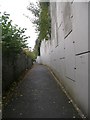
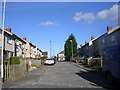
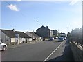
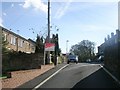
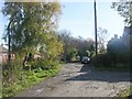
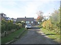
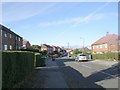
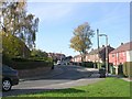
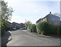
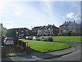
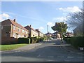
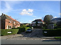
Photos of LS28 7HY
Area Information
LS28 7HY is a small, densely populated residential postcode in the Pudsey area of Leeds, West Yorkshire. Covering 2,824 square metres, it is home to 1,401 people, resulting in a population density of nearly 500,000 people per square kilometre—a stark reflection of its compact, clustered layout. This area sits within Pudsey Ward, an electoral district with historical roots dating back to the 11th century, when it was granted to Cistercian monks. Today, it is part of the modern Leeds urban fabric, blending historic features with contemporary living. The area’s proximity to Leeds city centre, combined with nearby rail links and retail hubs, makes it a practical choice for those seeking a balance between suburban tranquillity and urban accessibility. Daily life here is shaped by its small-scale nature, with residents relying on local amenities and community networks. The presence of Pudsey Park and historic cricket clubs like Pudsey St Lawrence adds a layer of cultural continuity, while the area’s high broadband scores ensure modern connectivity. For buyers, LS28 7HY offers a snapshot of a tightly knit, historically rich neighbourhood with practical advantages for commuters and families alike.
- Area Type
- Postcode
- Area Size
- 2824 m²
- Population
- 1401
- Population Density
- 4749 people/km²
The property market in LS28 7HY is characterised by a high rate of home ownership—63% of residents own their homes—suggesting a stable, long-term demographic. The accommodation type is predominantly houses, which is typical of suburban and semi-rural areas, though the area’s compact size means housing stock is limited. This combination of high ownership and house-centric development implies a market that caters to families and professionals seeking semi-detached or detached properties. The small area size means buyers must consider proximity to nearby towns like Pudsey or Leeds for additional housing options. The lack of flats or apartments indicates that rental opportunities may be limited, with the market likely skewed towards owner-occupation. For buyers, this presents both challenges and advantages: while the inventory is constrained, the demand for homes in this area may support property values. However, the high population density and small footprint mean competition for available properties could be intense, particularly for those seeking larger homes.
House Prices in LS28 7HY
Showing 14 properties
| Address | Type | Beds | Baths | Last Sale Price | Last Sale Date | |
|---|---|---|---|---|---|---|
| 60 Thorpe Road, Pudsey, LS28 7HY | Flat | - | - | £70,000 | Mar 2019 | |
| 57 Thorpe Road, Pudsey, LS28 7HY | house | - | - | £68,950 | Jun 2002 | |
| 70 Thorpe Road, Pudsey, LS28 7HY | Flat | - | - | - | - | |
| 60A Thorpe Road, Pudsey, LS28 7HY | Flat | - | - | - | - | |
| 70A Thorpe Road, Pudsey, LS28 7HY | Flat | - | - | - | - | |
| 68 Thorpe Road, Pudsey, LS28 7HY | Flat | - | - | - | - | |
| 66 Thorpe Road, Pudsey, LS28 7HY | Flat | - | - | - | - | |
| 62 Thorpe Road, Pudsey, LS28 7HY | Flat | - | - | - | - | |
| 64 Thorpe Road, Pudsey, LS28 7HY | Flat | - | - | - | - | |
| 68A Thorpe Road, Pudsey, LS28 7HY | Flat | - | - | - | - |
Energy Efficiency in LS28 7HY
Living in LS28 7HY offers access to a mix of practical amenities and historical charm. Within walking distance are major retailers such as M&S Pudsey, Asda Pudsey, and Sainsburys Pudsey, providing everyday shopping needs. The area’s rail stations—New Pudsey, Bramley, and New Pudsey Station—offer straightforward connections to Leeds city centre and surrounding towns, facilitating both work and leisure travel. Nearby, Leeds Bradford Airport provides regional and international flight options. Historically, Pudsey has been a hub for sports, with cricket clubs like Pudsey St Lawrence (founded in 1845) and Pudsey Congs offering recreational opportunities. Pudsey Park, a designated green space, adds to the area’s appeal, offering leisure and outdoor activities. The presence of Pudsey Cemetery, listed for its historic significance, and conservation areas with 47 listed buildings highlights the blend of heritage and modern living. These amenities contribute to a lifestyle that balances practicality with cultural continuity.
Amenities
Schools
| Rank | School | Type | Entry gender | Ages |
|---|
Explore more schools in this area
Go to Schools tabDemographics
The population of LS28 7HY is predominantly middle-aged, with a median age of 47 and the majority of residents falling within the 30–64 age range. This suggests a community of established professionals and families, rather than students or retirees. Home ownership is high at 63%, indicating a stable residential base, with the majority of properties being houses rather than flats. The predominant ethnic group is White, reflecting the area’s historical and demographic patterns. The population density of nearly 500,000 people per square kilometre implies a tightly packed residential cluster, which may influence the character of local interactions and community cohesion. While the data does not specify deprivation levels, the high home ownership rate and age profile suggest a relatively stable socioeconomic environment. However, the medium crime risk score of 60, which aligns with average regional rates, indicates that residents should remain mindful of standard security measures. This demographic profile paints a picture of a mature, settled community with a strong emphasis on residential permanence.
Household Size
Accommodation Type
Tenure
Ethnic Group
Religion
Household Composition
Age
Household Deprivation
NS-SEC
Explore more demographic insights in this area
Go to Demographics tabPlanning
Planning Constraints
- Flood RiskPremium
- Ramsar Wetland SitesPremium
- Area of Outstanding Natural BeautyPremium
- Protected Nature ReservePremium
- Protected WoodlandPremium