Area Overview for LS28 7HR
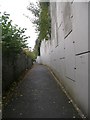
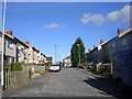
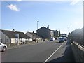
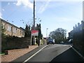
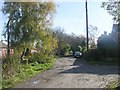
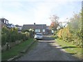
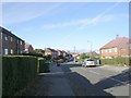
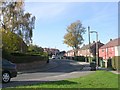
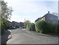
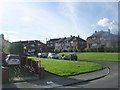
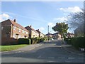
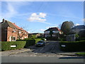
Photos of LS28 7HR
Area Information
LS28 7HR is a compact postcode area in west Leeds, England, covering 5966 m² and home to 1401 residents. Despite its small size, it sits within the Calverley and Farsley electoral ward, a historically significant region with roots in medieval times. The area’s population density is 234,848 people per km², reflecting its residential concentration. Centrally located, it lies near Pudsey and Bradford, with the A657 road providing direct access to nearby towns. The ward includes Calverley village, known for its 14th-century Calverley Old Hall, a listed manor house with ties to the Calverley family. While the area lacks detailed modern character descriptions, its proximity to retail hubs like M&S Pudsey and rail stations such as New Pudsey Station suggests a blend of traditional and contemporary living. With a median age of 47 and a population skewed toward adults aged 30–64, LS28 7HR appears to be a stable, mature community. Its high broadband score of 100 ensures seamless digital connectivity, though mobile coverage is slightly lower at 85. For buyers, this area offers a quiet residential cluster with historical depth and practical access to nearby amenities.
- Area Type
- Postcode
- Area Size
- 5966 m²
- Population
- 1401
- Population Density
- 4749 people/km²
The property market in LS28 7HR is dominated by owner-occupied homes, with 63% of residents living in properties they own. The predominant accommodation type is houses, which is typical for smaller, residential postcode areas. This suggests a market skewed toward family homes rather than flats or rental properties. The high home ownership rate indicates a stable community with long-term residency, reducing the likelihood of frequent property turnover. Given the area’s small size and proximity to Pudsey and Bradford, the housing stock is likely limited to a few hundred properties. Buyers should consider that the area’s compact nature means limited scope for expansion or new developments. The presence of nearby retail amenities like Asda Pudsey and Sainsburys Pudsey may enhance property desirability, though the ward’s overall deprivation ranking could influence affordability. For those seeking a quiet, residential setting with historical context, LS28 7HR offers a niche market with distinct local character.
House Prices in LS28 7HR
Showing 16 properties
| Address | Type | Beds | Baths | Last Sale Price | Last Sale Date | |
|---|---|---|---|---|---|---|
| 23 Highfield Green, Pudsey, LS28 7HR | Flat | - | - | - | - | |
| 27 Highfield Green, Pudsey, LS28 7HR | Flat | - | - | - | - | |
| 1A Highfield Green, Pudsey, LS28 7HR | Flat | - | - | - | - | |
| 19 Highfield Green, Pudsey, LS28 7HR | Flat | - | - | - | - | |
| 7 Highfield Green, Pudsey, LS28 7HR | Flat | - | - | - | - | |
| 11 Highfield Green, Pudsey, LS28 7HR | Flat | - | - | - | - | |
| 21 Highfield Green, Pudsey, LS28 7HR | Flat | - | - | - | - | |
| 17 Highfield Green, Pudsey, LS28 7HR | Flat | - | - | - | - | |
| 1 Highfield Green, Pudsey, LS28 7HR | Flat | - | - | - | - | |
| 3A Highfield Green, Pudsey, LS28 7HR | Flat | - | - | - | - |
Energy Efficiency in LS28 7HR
Living in LS28 7HR offers access to a range of nearby amenities within practical reach. Retail options include major chains such as M&S Pudsey, Asda Pudsey, and Sainsburys Pudsey, ensuring convenience for everyday shopping. The area is served by multiple rail stations, including New Pudsey Station and Bramley Railway Station, which connect residents to Leeds, Bradford, and beyond. For air travel, Leeds Bradford Airport is within easy reach, providing regional and international flight options. While specific details on dining, parks, or leisure facilities are not provided, the presence of retail and transport hubs suggests a functional lifestyle. The A657 road provides access to broader networks, though the area’s small size means local amenities are limited to immediate surroundings. Residents may find the community’s proximity to historical sites like Calverley Old Hall adds cultural value, though the lack of detailed information on parks or recreational spaces means further exploration would be needed to assess lifestyle options fully.
Amenities
Schools
| Rank | School | Type | Entry gender | Ages |
|---|
Explore more schools in this area
Go to Schools tabDemographics
The population of LS28 7HR has a median age of 47, with the majority of residents falling within the 30–64 age range. This suggests a community of established adults, likely focused on long-term residency rather than transient populations. Home ownership rates are strong at 63%, indicating a preference for property ownership over renting. The predominant accommodation type is houses, which aligns with the area’s residential character. Ethnically, the population is predominantly White (80.8%), with Asian residents making up 13.8% and smaller groups from other backgrounds. While the ward as a whole has a deprivation score placing it near the bottom of Leeds for deprivation, LS28 7HR’s specific deprivation data is not provided. However, the high population density and presence of retail amenities suggest a mix of socioeconomic profiles. The age distribution and ownership figures imply a community with a stable, family-oriented structure, though the lack of detailed diversity metrics beyond ethnicity means further analysis would be needed to fully assess inclusivity.
Household Size
Accommodation Type
Tenure
Ethnic Group
Religion
Household Composition
Age
Household Deprivation
NS-SEC
Explore more demographic insights in this area
Go to Demographics tabPlanning
Planning Constraints
- Flood RiskPremium
- Ramsar Wetland SitesPremium
- Area of Outstanding Natural BeautyPremium
- Protected Nature ReservePremium
- Protected WoodlandPremium