Area Overview for LS28 7FQ
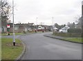
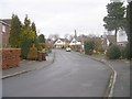
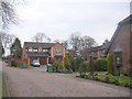
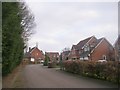
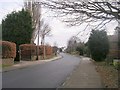
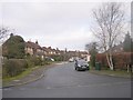
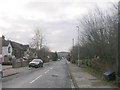
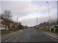
Photos of LS28 7FQ
Area Information
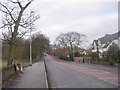
Living in LS28 7FQ means being part of a tightly knit residential cluster in west Leeds, just 10 miles from the city centre and four miles from Bradford. The postcode area covers 2,469 square metres and is home to 2,169 residents, creating a densely populated but compact community. Historically, the area is part of Calverley and Farsley, a ward with roots in medieval times, including Calverley Old Hall, a 14th-century manor house. Daily life here is shaped by proximity to the A657 road, which links the area to nearby towns, and the presence of local schools and amenities. The median age of 47 suggests a mature population, with many residents in the 30–64 age range. While the ward has a high deprivation score, the area’s low crime rate and access to services like primary schools and rail stations make it a practical choice for those prioritising safety and connectivity over luxury. The mix of homes and the predominantly Asian population add cultural diversity, though the community remains rooted in traditional infrastructure and historical landmarks.
- Area Type
- Postcode
- Area Size
- 2469 m²
- Population
- 2169
- Population Density
- 1927 people/km²
The property market in LS28 7FQ is predominantly owner-occupied, with 67% of homes owned by residents rather than rented. The area is characterised by houses, which dominate the accommodation type, suggesting a focus on family homes and long-term residency. This contrasts with rental-heavy areas, where flats or apartments are more common. The small size of the postcode area means the housing stock is limited, potentially making the market competitive for buyers. The high home ownership rate indicates a stable community with little turnover, which can be appealing to those seeking a settled environment. However, the lack of data on property prices or recent developments means buyers should consider the broader context of the Calverley and Farsley ward, where historical infrastructure and proximity to transport links may influence property values.
House Prices in LS28 7FQ
Showing 3 properties
| Address | Type | Beds | Baths | Last Sale Price | Last Sale Date | |
|---|---|---|---|---|---|---|
| 3 Galloway Gardens, Pudsey, LS28 7FQ | Retail | 4 | 2 | £370,000 | Oct 2022 | |
| 1 Galloway Gardens, Pudsey, LS28 7FQ | house | - | - | £399,995 | Jun 2022 | |
| 2 Galloway Gardens, Pudsey, LS28 7FQ | house | - | - | £334,995 | Oct 2020 |
Energy Efficiency in LS28 7FQ
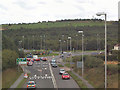
The lifestyle in LS28 7FQ is shaped by its proximity to retail, transport, and regional travel hubs. Within walking distance are five retail venues, including Morrisons, Asda, and M&S, offering everyday shopping needs. The area’s rail network includes five stations, such as New Pudsey and Bramley, connecting residents to Leeds, Bradford, and beyond. Leeds Bradford Airport is just two miles away, making international travel accessible. The A657 road provides direct links to nearby towns, though the lack of detailed bus data means car ownership is practical for longer journeys. The area’s compact size means amenities are clustered, reducing the need for long commutes. While historical sites like Calverley Old Hall add cultural value, the focus on practicality in transport and retail ensures daily life is convenient. The mix of services supports a self-contained lifestyle, though the absence of detailed data on parks or leisure facilities limits a full picture of recreational options.
Amenities
Schools
Residents of LS28 7FQ have access to a range of primary schools, including Farsley Farfield Primary School and Farsley Farfield Junior School, both of which are rated ‘good’ by Ofsted. Priesthorpe School and Co-op Academy Priesthorpe, also in the area, provide additional options for families. The mix of traditional primary schools and academies ensures a variety of educational approaches, from state-run institutions to academies with potentially more specialised curricula. These schools are within practical reach of most homes, reducing the need for long commutes. The presence of multiple schools in the area supports families with children, offering choices that align with different educational preferences. With two schools rated ‘good’, the area provides a foundation for quality education, though further data on secondary schools would be needed to fully assess long-term educational opportunities.
| Rank | School | Type | Entry gender | Ages |
|---|
Explore more schools in this area
Go to Schools tabDemographics
The population of LS28 7FQ has a median age of 47, with the majority of residents aged between 30 and 64. Home ownership is high at 67%, with houses being the predominant type of accommodation. The area’s ethnic composition is 13.8% Asian, with White residents making up 80.8% of the broader Calverley and Farsley ward. While the ward as a whole has a deprivation score placing it near the bottom of Leeds for deprivation, LS28 7FQ’s 81.9% mid-range deprivation suggests a community that balances affordability with access to essential services. This demographic profile indicates a stable, family-oriented population with a strong presence of older adults and middle-aged residents. The high home ownership rate implies long-term residency, while the ethnic diversity adds to the area’s character. However, the deprivation data highlights the need for targeted investment in local services to improve quality of life further.
Household Size
Accommodation Type
Tenure
Ethnic Group
Religion
Household Composition
Age
Household Deprivation
NS-SEC
Explore more demographic insights in this area
Go to Demographics tabPlanning
Planning Constraints
- Flood RiskPremium
- Ramsar Wetland SitesPremium
- Area of Outstanding Natural BeautyPremium
- Protected Nature ReservePremium
- Protected WoodlandPremium