Area Overview for LS28 7FL
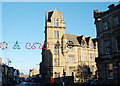
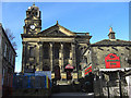
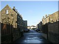
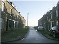
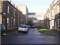
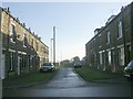
Photos of LS28 7FL
Area Information
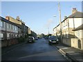
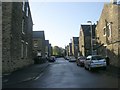
LS28 7FL is a small, tightly packed residential postcode area in the heart of Pudsey, West Yorkshire. With a population of 1,391 spread across 459 square metres, it reflects a dense, compact community. The area’s history is rooted in Pudsey’s legacy as a former municipal borough, with ties to 18th-century woollen manufacturing and early cricketing traditions. Today, it blends historic architecture with modern living, including listed buildings and conservation areas. The median age of 47 suggests a mature population, with most residents aged 30–64, creating a stable, established community. Daily life here is characterised by proximity to amenities like Sainsburys, rail stations, and schools, while the area’s small size fosters a close-knit environment. Despite its compactness, LS28 7FL is strategically located near Leeds Bradford Airport and major transport routes, offering both convenience and access to wider regional networks. The area’s low flood risk and absence of protected natural sites make it a practical choice for those prioritising safety and planning certainty.
- Area Type
- Postcode
- Area Size
- 459 m²
- Population
- 1391
- Population Density
- 4384 people/km²
LS28 7FL is a small area with a housing stock dominated by individual houses, reflecting a preference for detached or semi-detached properties. With 42% of homes owned by residents, the market is split between owner-occupation and rental properties, though the exact proportion of rentals is unspecified. The area’s size means housing options are limited, with buyers likely to find a mix of older and newer homes, many of which may have historical features. The compact nature of the postcode suggests that property values could be influenced by proximity to schools, transport links, and local amenities. For buyers, this means competition may be fierce, particularly for properties near key facilities like Pudsey Grammar School or rail stations. The absence of large-scale commercial development or new housing projects indicates a static market, where demand is driven by existing residents seeking to upgrade or relocate within the area.
House Prices in LS28 7FL
Showing 10 properties
| Address | Type | Beds | Baths | Last Sale Price | Last Sale Date | |
|---|---|---|---|---|---|---|
| Flat 9, Shamrock House, Clifton Hill, Pudsey, LS28 7FL | Flat | - | - | - | - | |
| Flat 3, Shamrock House, Clifton Hill, Pudsey, LS28 7FL | Flat | - | - | - | - | |
| Shamrock Cottage, Clifton Hill, Pudsey, LS28 7FL | Semi-detached | - | - | - | - | |
| Flat 8, Shamrock House, Clifton Hill, Pudsey, LS28 7FL | Flat | - | - | - | - | |
| Flat 6, Shamrock House, Clifton Hill, Pudsey, LS28 7FL | Flat | - | - | - | - | |
| Flat 5, Shamrock House, Clifton Hill, Pudsey, LS28 7FL | Flat | - | - | - | - | |
| Flat 2, Shamrock House, Clifton Hill, Pudsey, LS28 7FL | Flat | - | - | - | - | |
| Flat 4, Shamrock House, Clifton Hill, Pudsey, LS28 7FL | Flat | - | - | - | - | |
| Flat 7, Shamrock House, Clifton Hill, Pudsey, LS28 7FL | Flat | - | - | - | - | |
| Flat 1, Shamrock House, Clifton Hill, Pudsey, LS28 7FL | Flat | 1 | 1 | - | - |
Energy Efficiency in LS28 7FL
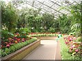
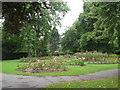
Living in LS28 7FL offers access to a range of practical amenities within walking or short driving distance. Retail options include Sainsburys Pudsey and M&S Pudsey, providing essential shopping and dining choices. The area’s rail stations connect residents to broader networks, while Leeds Bradford Airport ensures easy travel. Pudsey’s historical character, including listed buildings and conservation areas, adds cultural value to daily life. Parks and open spaces, though not named in the data, are likely part of the area’s appeal, given Pudsey’s history of public green spaces like Pudsey Park. The compact nature of the postcode means amenities are closely clustered, reducing the need for long commutes. However, the lack of specific details on leisure facilities or recreational options means buyers should explore the wider Pudsey area for additional activities.
Amenities
Schools
Residents of LS28 7FL have access to several primary schools, including St Joseph’s Catholic Primary School in Pudsey and Pudsey Grammar School, both rated ‘good’ by Ofsted. A third primary school, St Joseph’s Catholic Primary School (A Voluntary Academy), also falls into the ‘good’ category. These institutions provide a range of educational options, though no secondary schools are listed in the data, meaning families may need to look beyond the immediate area for secondary education. The presence of two ‘good’-rated schools suggests a focus on primary education, which could be advantageous for families with younger children. However, the lack of detailed information on school catchment areas or student performance means prospective buyers should investigate further to ensure alignment with their children’s needs.
| Rank | School | Type | Entry gender | Ages |
|---|
Explore more schools in this area
Go to Schools tabDemographics
The population of LS28 7FL is predominantly adults aged 30–64, with a median age of 47. This suggests a community of middle-aged residents, likely settled in long-term homes or careers. Home ownership stands at 42%, with houses being the primary accommodation type, indicating a mix of owner-occupied properties and rentals. The predominant ethnic group is White, reflecting broader demographic trends in the area. The high population density—3.03 million people per square kilometre—underscores the area’s compact nature, where limited space means residents share proximity to neighbours and amenities. While no specific deprivation data is provided, the high home ownership rate and established age profile imply a stable, low-volatility community. However, the lack of diversity in ethnic composition may affect the range of cultural or social services available.
Household Size
Accommodation Type
Tenure
Ethnic Group
Religion
Household Composition
Age
Household Deprivation
NS-SEC
Explore more demographic insights in this area
Go to Demographics tabPlanning
Planning Constraints
- Flood RiskPremium
- Ramsar Wetland SitesPremium
- Area of Outstanding Natural BeautyPremium
- Protected Nature ReservePremium
- Protected WoodlandPremium