Area Overview for LS28 6PT
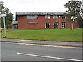
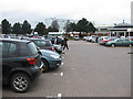
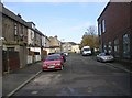
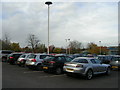
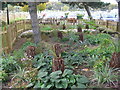
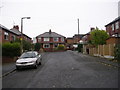
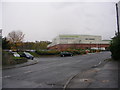
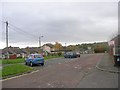
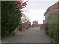
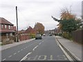
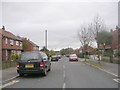
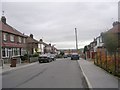
Photos of LS28 6PT
Area Information
LS28 6PT is a compact residential postcode in England, covering just 1.0 hectares and home to 1,748 people. Its high population density of 167,449 people per square kilometre reflects a tightly knit community. Nestled in the Calverley and Farsley ward of Leeds, this area is part of a broader rural-urban mix, with the village of Calverley lying on the A657 road, four miles from Bradford and ten miles from Leeds. The area’s history is steeped in medieval heritage, including Calverley Old Hall, a 14th-century manor house. Daily life here is shaped by proximity to Pudsey and the surrounding towns, with residents benefiting from nearby rail links and retail hubs. While the ward as a whole faces mid-range deprivation, LS28 6PT itself is a small, focused cluster of homes, predominantly owner-occupied. Its character is defined by a balance of historical landmarks and modern amenities, making it a niche choice for buyers seeking a quiet yet connected location.
- Area Type
- Postcode
- Area Size
- 1.0 hectares
- Population
- 1748
- Population Density
- 2339 people/km²
The property market in LS28 6PT is characterised by a high rate of home ownership (74%) and a predominance of houses over other accommodation types. This suggests a largely owner-occupied area, with limited rental activity. Given the small size of the postcode (1.0 hectares), the housing stock is likely limited, making the area a niche market for buyers seeking specific properties. The focus on houses rather than flats or apartments implies a suburban or semi-rural setting, possibly with larger plots or garden spaces. For buyers, this means competition may be fierce due to the area’s scarcity of available homes. The high home ownership rate also indicates a stable community, which can be a positive factor for long-term investment. However, the small size of LS28 6PT means that buyers should consider nearby areas for broader options.
House Prices in LS28 6PT
No properties found in this postcode.
Energy Efficiency in LS28 6PT
Living in LS28 6PT offers access to essential amenities within practical reach. The area is close to five retail venues, including Asda Pudsey, M&S Pudsey, and Co-op Farsley, providing everyday shopping and services. Rail stations like New Pudsey and Bramley offer connections to wider networks, while nearby airports cater to travel needs. Although specific parks or leisure facilities are not detailed in the data, the proximity to the A657 road and historical sites like Calverley Old Hall suggest a blend of rural charm and urban convenience. The retail options and transport links contribute to a lifestyle that balances local accessibility with regional connectivity, supporting both daily errands and broader mobility.
Amenities
Schools
The nearest school to LS28 6PT is Pudsey Primrose Hill Primary School, which serves the local community with primary education. This school holds an Ofsted rating of “outstanding,” reflecting high standards in teaching and student outcomes. As a primary school, it caters to younger children, making it a key consideration for families with school-age dependents. The absence of secondary schools in the immediate area means families may need to look further afield for secondary education, though the proximity to Pudsey and surrounding towns likely provides multiple options. The presence of a top-rated primary school enhances the area’s appeal, particularly for parents prioritising quality education for their children.
| Rank | School | Type | Entry gender | Ages |
|---|
Explore more schools in this area
Go to Schools tabDemographics
The population of LS28 6PT has a median age of 47, with the majority of residents aged between 30 and 64. This suggests a community skewed towards middle-aged adults, likely with established careers and families. Home ownership is high at 74%, indicating a stable, long-term resident base. The accommodation type is primarily houses, reflecting a suburban or semi-rural layout rather than flats or apartments. The predominant ethnic group is White, comprising the vast majority of the population. While the ward as a whole has a significant Asian population, LS28 6PT’s data does not specify diversity beyond this. The high home ownership rate and age profile suggest a community focused on stability, with fewer young families or transient residents. This demographic profile may influence local services and amenities, aligning with the needs of older, established households.
Household Size
Accommodation Type
Tenure
Ethnic Group
Religion
Household Composition
Age
Household Deprivation
NS-SEC
Explore more demographic insights in this area
Go to Demographics tabPlanning
Planning Constraints
- Flood RiskPremium
- Ramsar Wetland SitesPremium
- Area of Outstanding Natural BeautyPremium
- Protected Nature ReservePremium
- Protected WoodlandPremium