Area Overview for LS28 6BW
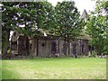
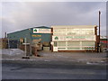
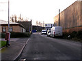
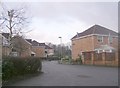
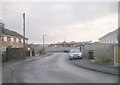
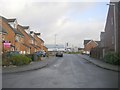
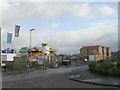
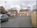
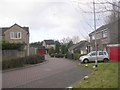
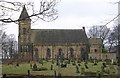
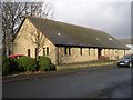
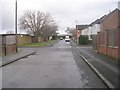
Photos of LS28 6BW
Area Information
LS28 6BW is a compact residential postcode in the heart of Pudsey, a historically significant town in West Yorkshire. Covering 6,106 square metres, this area is densely populated, with 1,748 residents living in a tightly knit cluster. Pudsey itself is part of the City of Leeds, with roots tracing back to the 11th century and a legacy of woollen manufacturing. The area’s proximity to Swinnow and Tyersal adds to its character, blending residential comfort with historical depth. Daily life here is shaped by its small-scale nature, where local amenities and community ties are prominent. The postcode’s integration into Leeds’ urban fabric means residents benefit from city access while retaining a distinct local identity. With a median age of 47, the population skews towards adults, suggesting a stable, established community. The area’s compact size means most needs are met within walking distance, though its limited size also means housing options are focused on owner-occupied properties, predominantly houses. This makes LS28 6BW a niche market for those seeking a settled, family-oriented environment with a strong sense of place.
- Area Type
- Postcode
- Area Size
- 6106 m²
- Population
- 1748
- Population Density
- 2339 people/km²
LS28 6BW is predominantly an owner-occupied area, with 74% of properties owned by residents rather than rented. The accommodation type is largely houses, which is unusual for urban areas and suggests a focus on family homes with more space. This makes the property market here distinct from larger cities where flats or apartments dominate. The small size of the postcode means the housing stock is limited, but the emphasis on houses indicates a market suited to buyers prioritising privacy and space. For those seeking a home in LS28 6BW, the availability of owner-occupied properties may mean fewer turnover opportunities but a more stable market. The concentration of houses also implies that the area is not a hotspot for rental investors, which could be a consideration for buyers looking for long-term value. Given the high home ownership rate, the community likely has a strong sense of local identity, with properties reflecting the needs of established families.
House Prices in LS28 6BW
Showing 15 properties
| Address | Type | Beds | Baths | Last Sale Price | Last Sale Date | |
|---|---|---|---|---|---|---|
| 8 Chapel Street, Stanningley, Pudsey, LS28 6BW | Terraced | 4 | 1 | £215,000 | Jan 2024 | |
| 22 Chapel Street, Stanningley, Pudsey, LS28 6BW | Terraced | 2 | 1 | £168,000 | Mar 2022 | |
| 7 Chapel Street, Stanningley, Pudsey, LS28 6BW | Terraced | 3 | 1 | £222,500 | Sep 2021 | |
| 12 Chapel Street, Stanningley, Pudsey, LS28 6BW | Terraced | 4 | 1 | £148,000 | Mar 2019 | |
| 26 Chapel Street, Stanningley, Pudsey, LS28 6BW | Terraced | 3 | - | £129,995 | Feb 2016 | |
| 16 Chapel Street, Stanningley, Pudsey, LS28 6BW | house | 3 | - | £68,000 | Mar 2002 | |
| 6 Chapel Street, Stanningley, Pudsey, LS28 6BW | house | 3 | - | £56,499 | Jun 2000 | |
| 24 Chapel Street, Stanningley, Pudsey, LS28 6BW | Terraced | - | - | £48,000 | Dec 1997 | |
| 9 Chapel Street, Stanningley, Pudsey, LS28 6BW | Terraced | 3 | - | - | - | |
| 10 Chapel Street, Stanningley, Pudsey, LS28 6BW | Terraced | - | - | - | - |
Energy Efficiency in LS28 6BW
LS28 6BW offers a mix of retail, transport, and travel options within practical reach. Local shops include M&S Pudsey, Lidl Bramley, and Asda Pudsey, providing everyday essentials and grocery needs. The area’s rail network, with stations like New Pudsey and Bramley, connects residents to broader regional networks, while proximity to Leeds Bradford Airport facilitates travel beyond the immediate region. Though the data does not list parks or leisure facilities directly, historical research indicates nearby amenities such as Pudsey Park and Pudsey Cemetery, which may contribute to a sense of community and green space. The presence of listed buildings and conservation areas suggests a blend of historical charm with modern convenience. For residents, this means a lifestyle that balances local retail and transport access with the heritage of Pudsey’s past, though the area’s small size means some amenities require travel to nearby districts.
Amenities
Schools
The nearest school to LS28 6BW is Pudsey Primrose Hill Primary School, which serves the local community with a primary education offering. This school has an outstanding Ofsted rating, indicating high standards in teaching and student outcomes. The presence of a primary school with such a rating is a significant draw for families, as it ensures access to quality education for younger children. The absence of secondary schools in the immediate area means students may need to travel to nearby districts for further education, but the primary school’s excellence mitigates this concern. The school’s rating also suggests that the area is likely to attract families prioritising educational quality, reinforcing the community’s focus on family-oriented living. With no other schools listed, the primary school is the cornerstone of local education infrastructure.
| Rank | School | Type | Entry gender | Ages |
|---|
Explore more schools in this area
Go to Schools tabDemographics
The population of LS28 6BW is 1,748, with a median age of 47, indicating a mature demographic skewed towards adults aged 30–64. This age group constitutes the majority, suggesting a community of long-term residents rather than a transient population. Home ownership is high at 74%, with houses being the primary accommodation type, reflecting a preference for private, stable living arrangements. The predominant ethnic group is White, though no specific data on diversity or deprivation is provided. The high home ownership rate implies a low reliance on rental housing, which may contribute to a sense of permanence. However, the absence of detailed diversity statistics means the full range of community experiences cannot be quantified. The area’s demographic profile suggests a focus on family life, with older adults and middle-aged residents forming the core of daily interactions. This stability may influence local services and amenities, which are tailored to the needs of an established population.
Household Size
Accommodation Type
Tenure
Ethnic Group
Religion
Household Composition
Age
Household Deprivation
NS-SEC
Explore more demographic insights in this area
Go to Demographics tabPlanning
Planning Constraints
- Flood RiskPremium
- Ramsar Wetland SitesPremium
- Area of Outstanding Natural BeautyPremium
- Protected Nature ReservePremium
- Protected WoodlandPremium