Area Overview for LS28 6BF
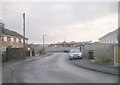
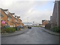
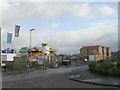
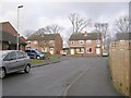
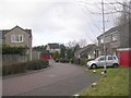
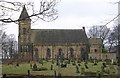
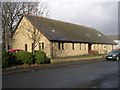
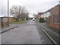
Photos of LS28 6BF
Area Information
LS28 6BF is a small residential postcode area in west Leeds, nestled within the Calverley and Farsley ward. With a population of 1,648 spread across 5,856 square metres, it is a densely populated cluster of homes. The area lies approximately ten miles from Leeds city centre and four miles from Bradford, placing it at the edge of urban and rural landscapes. Historically, the village of Calverley, which includes this postcode, is home to Calverley Old Hall, a 14th-century manor house, and Calverley Cutting, a 19th-century road carved through sandstone. The ward’s demographics reflect a mature community, with a median age of 47 and a majority of residents aged 30–64. Over 77% of homes are owner-occupied, and the area is predominantly White, with Asian communities making up 13.8% of the population. Daily life here is shaped by proximity to retail hubs like Asda Pudsey and M&S Pudsey, as well as rail links to New Pudsey and Bramley stations. The compact size of LS28 6BF means amenities are within walking distance, though the area ranks near the bottom of Leeds for deprivation, suggesting a mix of economic conditions.
- Area Type
- Postcode
- Area Size
- 5856 m²
- Population
- 1648
- Population Density
- 2698 people/km²
The property market in LS28 6BF is characterised by a high rate of home ownership (77%) and a predominance of houses over flats or apartments. This suggests a community of long-term residents who have invested in their homes, likely reflecting the area’s appeal as a semi-rural extension of Leeds. The compact size of the postcode means the housing stock is limited, with properties concentrated in a small geographical footprint. For buyers, this implies a competitive market where availability is restricted, particularly for owner-occupied homes. The absence of large-scale developments or rental-focused housing indicates that the area is not a hotspot for short-term lets or speculative investment. Prospective buyers should consider the proximity to transport links, such as rail stations and the A657 road, which may influence property value and desirability. The mix of historical and modern infrastructure, including Calverley Old Hall, adds a unique character that could appeal to buyers seeking heritage or distinctiveness.
House Prices in LS28 6BF
Showing 10 properties
| Address | Type | Beds | Baths | Last Sale Price | Last Sale Date | |
|---|---|---|---|---|---|---|
| 1 Printworks Row, Stanningley, Pudsey, LS28 6BF | Terraced | 3 | 2 | £260,000 | May 2022 | |
| 4 Printworks Row, Stanningley, Pudsey, LS28 6BF | Terraced | 3 | 2 | £225,000 | Jul 2019 | |
| 6 Printworks Row, Stanningley, Pudsey, LS28 6BF | house | - | - | £228,000 | Jul 2019 | |
| 2 Printworks Row, Stanningley, Pudsey, LS28 6BF | Terraced | 3 | 2 | £400,000 | Jan 2017 | |
| 9 Printworks Row, Stanningley, Pudsey, LS28 6BF | Flat | - | - | - | - | |
| 10 Printworks Row, Stanningley, Pudsey, LS28 6BF | Flat | - | - | - | - | |
| 3 Printworks Row, Stanningley, Pudsey, LS28 6BF | house | - | - | - | - | |
| 5 Printworks Row, Stanningley, Pudsey, LS28 6BF | house | - | - | - | - | |
| 8 Printworks Row, Stanningley, Pudsey, LS28 6BF | house | - | - | - | - | |
| 7 Printworks Row, Stanningley, Pudsey, LS28 6BF | house | - | - | - | - |
Energy Efficiency in LS28 6BF
Living in LS28 6BF offers access to a range of amenities within close proximity. Retail options include Lidl Bramley, Asda Pudsey, and M&S Pudsey, providing everyday shopping needs. The area’s rail network, with stations at New Pudsey, Bramley, and others, ensures easy access to public transport, while the A657 road connects to nearby towns and cities. For those seeking leisure, the historical significance of Calverley Old Hall and Calverley Cutting adds cultural depth, though recreational spaces like parks are not explicitly mentioned in the data. The presence of two airports nearby enhances travel flexibility, particularly for those requiring frequent flights. The compact nature of the area means amenities are walkable, fostering a sense of convenience. However, the lack of detailed information on dining or leisure venues suggests that residents may need to venture slightly further for more specialised services. Overall, LS28 6BF balances practicality with historical charm, supporting a lifestyle that prioritises accessibility and local character.
Amenities
Schools
| Rank | School | Type | Entry gender | Ages |
|---|
Explore more schools in this area
Go to Schools tabDemographics
The population of LS28 6BF is 1,648, with a median age of 47 and the majority of residents falling within the 30–64 age range. Over 77% of homes are owner-occupied, reflecting a community rooted in long-term residency. The accommodation type is predominantly houses, which is notable in a region where flats are more common. The ethnic composition is largely White (80.8%), with Asian residents comprising 13.8% of the population. The ward’s deprivation score places it in the mid-range, meaning residents face moderate challenges in accessing services or employment opportunities compared to other parts of Leeds. This context suggests a community that is stable but not without socioeconomic pressures. The high proportion of owner-occupied homes indicates a degree of financial security, though the ward’s lower ranking for deprivation highlights areas where investment in local infrastructure or support services might improve quality of life.
Household Size
Accommodation Type
Tenure
Ethnic Group
Religion
Household Composition
Age
Household Deprivation
NS-SEC
Explore more demographic insights in this area
Go to Demographics tabPlanning
Planning Constraints
- Flood RiskPremium
- Ramsar Wetland SitesPremium
- Area of Outstanding Natural BeautyPremium
- Protected Nature ReservePremium
- Protected WoodlandPremium