Area Overview for LS28 5TG
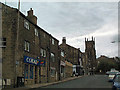
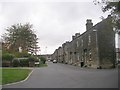
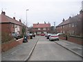
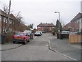
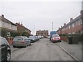
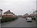
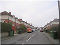
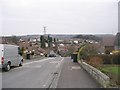
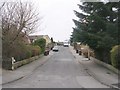
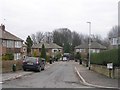
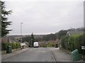
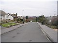
Photos of LS28 5TG
Area Information
LS28 5TG is a small residential postcode area nestled in west Leeds, within the Calverley and Farsley ward. Covering 4,477 square metres, it is densely populated, with 1,966 residents living at a density of 439,175 people per square kilometre. This compact cluster lies approximately ten miles from Leeds city centre and four miles from Bradford, placing it at the crossroads of urban and rural Yorkshire. The area’s character is shaped by its historical roots, including Calverley Old Hall, a 14th-century manor house, and Calverley Cutting, a 19th-century road carved through sandstone. Daily life here is defined by proximity to local amenities, with shops, rail stations, and airports within practical reach. The community is predominantly middle-aged, with a strong focus on homeownership, and the area’s low crime risk and minimal environmental constraints make it an attractive option for those seeking a settled, low-maintenance lifestyle.
- Area Type
- Postcode
- Area Size
- 4477 m²
- Population
- 1966
- Population Density
- 2786 people/km²
The property market in LS28 5TG is dominated by owner-occupied homes, with 84% of properties owned outright by their residents. The accommodation type is predominantly houses, reflecting a community that values private, standalone living spaces. This contrasts with areas where flats or apartments predominate, suggesting a preference for larger, more traditional housing stock. The high rate of homeownership indicates a stable market with limited rental activity, which may appeal to buyers seeking long-term investment or family homes. However, the small size of the area means that the housing stock is limited, and buyers should consider the immediate surroundings for additional options. The presence of houses also implies that properties may be larger than average, offering more space for growing families or those prioritising privacy.
House Prices in LS28 5TG
Showing 13 properties
| Address | Type | Beds | Baths | Last Sale Price | Last Sale Date | |
|---|---|---|---|---|---|---|
| 7 Kirklees Croft, Farsley, Pudsey, LS28 5TG | Detached | 3 | 1 | £320,000 | Jun 2023 | |
| 3 Kirklees Croft, Farsley, Pudsey, LS28 5TG | Detached | 3 | - | £270,000 | Dec 2020 | |
| 1 Kirklees Croft, Farsley, Pudsey, LS28 5TG | Detached | 3 | 1 | £208,000 | Feb 2017 | |
| 5 Kirklees Croft, Farsley, Pudsey, LS28 5TG | house | - | - | £175,500 | Nov 2011 | |
| Sunnyside, 2 Kirklees Croft, Farsley, Pudsey, LS28 5TG | house | 4 | 1 | £219,000 | Sep 2010 | |
| 10 Kirklees Croft, Farsley, Pudsey, LS28 5TG | Detached | - | - | £186,500 | Jan 2007 | |
| 11 Kirklees Croft, Farsley, Pudsey, LS28 5TG | Detached | - | - | £62,000 | Apr 1996 | |
| 12 Kirklees Croft, Farsley, Pudsey, LS28 5TG | Detached | - | - | - | - | |
| 8 Kirklees Croft, Farsley, Pudsey, LS28 5TG | Detached | - | - | - | - | |
| 4 Kirklees Croft, Farsley, Pudsey, LS28 5TG | Detached | - | - | - | - |
Energy Efficiency in LS28 5TG
The lifestyle in LS28 5TG is supported by a range of nearby amenities, including five retail outlets such as Co-op Farsley, Tesco Stanningley Half, and Lidl Bramley. These shops provide everyday essentials, reducing the need for long trips to larger centres. The area’s rail network, with stations like New Pudsey and Bramley, connects residents to broader transport options, while proximity to Leeds Bradford Airport enhances travel flexibility. Though the data does not mention parks or leisure facilities, the presence of multiple retail and transport hubs suggests a practical, convenience-focused lifestyle. Residents can enjoy a mix of local shopping, efficient commuting, and regional travel, making daily life in LS28 5TG both functional and accessible.
Amenities
Schools
The nearest school to LS28 5TG is Farsley Springbank Primary School, which serves the local community with a good Ofsted rating. This primary school is a key resource for families in the area, providing early education and fostering a sense of community among parents and children. While no secondary schools are listed in the data, the proximity to Farsley Springbank suggests that families may need to look further afield for secondary education. The presence of a well-rated primary school is a significant advantage, as it ensures that younger children receive a quality education close to home. For families prioritising school quality, this is a strong point in LS28 5TG’s favour, though further research would be needed to confirm secondary school options.
| Rank | School | Type | Entry gender | Ages |
|---|
Explore more schools in this area
Go to Schools tabDemographics
The population of LS28 5TG has a median age of 47, with the majority of residents falling within the 30-64 age range. Homeownership is high, at 84%, and the area is composed largely of houses rather than flats or apartments. The predominant ethnic group is White, accounting for the majority of the population, though smaller communities of Asian and other backgrounds exist. The ward, which includes LS28 5TG, has 81.9% of its population in the mid-range of deprivation, which suggests that while basic needs are generally met, there may be limited access to high-end services or amenities. This context is important for understanding the area’s quality of life: residents benefit from a stable, mature community but may face challenges in accessing premium resources or opportunities for economic advancement.
Household Size
Accommodation Type
Tenure
Ethnic Group
Religion
Household Composition
Age
Household Deprivation
NS-SEC
Explore more demographic insights in this area
Go to Demographics tabPlanning
Planning Constraints
- Flood RiskPremium
- Ramsar Wetland SitesPremium
- Area of Outstanding Natural BeautyPremium
- Protected Nature ReservePremium
- Protected WoodlandPremium