Area Overview for LS28 5QB
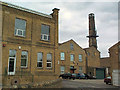
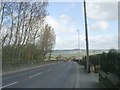
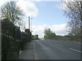
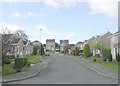
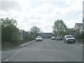
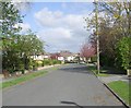
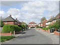
Photos of LS28 5QB
Area Information
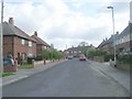
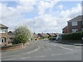
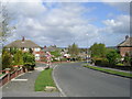
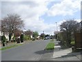
LS28 5QB is a small residential postcode in west Leeds, England, covering just 1.6 hectares and home to 1,699 people. This compact area sits within the Calverley and Farsley ward, a historically significant part of Leeds City Council. The village of Calverley, nearby, is steeped in medieval heritage, including Calverley Old Hall, a 14th-century manor house. The area lies 10 miles from Leeds city centre and four miles from Bradford, positioned along the A657 road. With a population density of 538 people per square kilometre, it’s a tight-knit community. Daily life here is shaped by its proximity to major transport routes and retail hubs. Residents benefit from nearby supermarkets like Asda Greengates and Sainsburys Bradford, while rail access to Apperley Bridge and New Pudsey stations connects them to broader networks. The area’s low flood risk and moderate crime score of 68/100 suggest a stable, secure environment. Though small, LS28 5QB blends historical character with modern convenience, offering a snapshot of suburban life in the West Yorkshire region.
- Area Type
- Postcode
- Area Size
- 1.6 hectares
- Population
- 1699
- Population Density
- 538 people/km²
The property market in LS28 5QB is dominated by owner-occupied homes, with 88% of residents living in houses rather than flats or other forms of accommodation. This reflects a suburban or semi-rural housing stock, typical of areas near major cities like Leeds and Bradford. The high home ownership rate suggests limited rental activity, making the area less attractive to investors seeking short-term returns. The prevalence of houses indicates larger properties, which may appeal to families or those prioritising space. However, the small area size of 1.6 hectares implies a constrained housing supply, potentially limiting availability for buyers. Proximity to retail hubs like Asda Greengates and rail links to New Pudsey station adds to the area’s appeal for commuters. For buyers, this means a focus on established properties rather than new developments, with property values likely influenced by the area’s historical character and transport connectivity. The market is not heavily speculative, with stability stemming from long-term residency and low turnover.
House Prices in LS28 5QB
Showing 41 properties
| Address | Type | Beds | Baths | Last Sale Price | Last Sale Date | |
|---|---|---|---|---|---|---|
| 11 Carr Hill Grove, Calverley, Pudsey, LS28 5QB | Bungalow | 2 | 1 | £300,000 | Dec 2023 | |
| 43 Carr Hill Grove, Calverley, Pudsey, LS28 5QB | Bungalow | - | - | £230,000 | Mar 2022 | |
| 16 Carr Hill Grove, Calverley, Pudsey, LS28 5QB | Semi-detached | 3 | 1 | £350,000 | Jun 2021 | |
| 19 Carr Hill Grove, Calverley, Pudsey, LS28 5QB | Bungalow | - | - | £222,500 | Dec 2020 | |
| 15 Carr Hill Grove, Calverley, Pudsey, LS28 5QB | Bungalow | - | - | £215,000 | Sep 2020 | |
| 34 Carr Hill Grove, Calverley, Pudsey, LS28 5QB | Bungalow | 2 | 1 | £190,000 | May 2020 | |
| 27 Carr Hill Grove, Calverley, Pudsey, LS28 5QB | Semi-detached | 3 | 1 | £220,000 | Oct 2019 | |
| 29 Carr Hill Grove, Calverley, Pudsey, LS28 5QB | Semi-detached | 3 | 2 | £189,005 | Nov 2018 | |
| 24 Carr Hill Grove, Calverley, Pudsey, LS28 5QB | Semi-detached | - | - | £235,000 | Mar 2018 | |
| 6 Carr Hill Grove, Calverley, Pudsey, LS28 5QB | Semi-detached | 5 | - | £220,000 | Mar 2017 |
Energy Efficiency in LS28 5QB
Living in LS28 5QB offers access to essential amenities within easy reach. Retail options include major supermarkets like Asda Greengates, Sainsburys Bradford, and Farmfoods Eccleshill, ensuring daily shopping needs are met. The area’s rail stations—Apperley Bridge and New Pudsey—provide swift connections to Leeds and Bradford, while proximity to Leeds Bradford Airport caters to frequent flyers. Though the data does not specify parks or leisure facilities, the nearby A657 road suggests links to broader recreational networks. The presence of multiple retail and transport hubs indicates a practical, service-oriented lifestyle. Residents benefit from a balance of convenience and connectivity, with shops, transport, and airports all within a short distance. This makes LS28 5QB suitable for those prioritising accessibility without sacrificing the quieter aspects of suburban living.
Amenities
Schools
| Rank | School | Type | Entry gender | Ages |
|---|
Explore more schools in this area
Go to Schools tabDemographics
The population of LS28 5QB has a median age of 47, with the majority of residents aged 30–64 years. This suggests a mature, established community, likely with a strong presence of families and professionals. Home ownership is high at 88%, indicating a predominantly owner-occupied area rather than a rental market. The accommodation type is primarily houses, reflecting a suburban or semi-rural character. The predominant ethnic group is White, accounting for the majority of the population. While specific data on deprivation is not provided for LS28 5QB itself, the wider Calverley and Farsley ward is noted for mid-range deprivation levels, which may influence local services and amenities. The age profile and ownership rates suggest a stable demographic, with fewer transient populations. This aligns with the area’s historical roots and its role as a residential hub near major cities. The absence of detailed diversity statistics means the community’s full composition remains partially unexplored, but the data confirms a homogeneous, mature population profile.
Household Size
Accommodation Type
Tenure
Ethnic Group
Religion
Household Composition
Age
Household Deprivation
NS-SEC
Explore more demographic insights in this area
Go to Demographics tabPlanning
Planning Constraints
- Flood RiskPremium
- Ramsar Wetland SitesPremium
- Area of Outstanding Natural BeautyPremium
- Protected Nature ReservePremium
- Protected WoodlandPremium