Area Overview for LS28 5NB
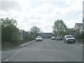
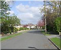
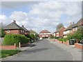
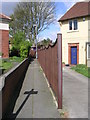
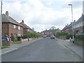
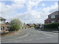
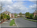
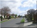
Photos of LS28 5NB
Area Information
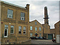
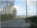
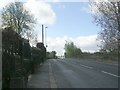
LS28 5NB lies in the heart of Calverley and Farsley, a small residential cluster in west Leeds, West Yorkshire. The area covers 7,978 square metres and is home to 1,777 residents, making it a densely populated yet compact community. With a median age of 47, the area is predominantly occupied by adults aged 30–64, reflecting a mature demographic profile. The ward’s history is steeped in rural heritage, including the 14th-century Calverley Old Hall, a medieval manor house that stands as a testament to the region’s past. Situated near the A657 road, the area is within easy reach of Bradford and Leeds, offering a blend of historical charm and modern connectivity. While the population is largely White (80.8%), the community also includes Asian residents, creating a diverse yet cohesive social fabric. Daily life here is shaped by proximity to retail hubs like Sainsburys Bradford and Asda Greengates, as well as rail links to Apperley Bridge and New Pudsey stations. The area’s compact size and strategic location make it a practical choice for those seeking a balance between suburban tranquillity and urban accessibility.
- Area Type
- Postcode
- Area Size
- 7978 m²
- Population
- 1777
- Population Density
- 1514 people/km²
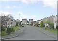
LS28 5NB is predominantly a home-owning area, with 81% of residents living in properties they own. The accommodation type is primarily houses, indicating a mix of semi-detached and detached homes typical of suburban settings. This contrasts with areas dominated by flats or rental properties, suggesting a focus on family-friendly, long-term housing. The compact size of the postcode area—just 7,978 square metres—means the housing stock is limited, with little scope for new developments. For buyers, this creates a niche market where properties are likely to be in high demand, particularly given the area’s proximity to retail and transport hubs. The high home ownership rate also implies a stable market with fewer rental properties, which may appeal to those seeking a secure investment. However, the small size of the area means buyers should consider nearby suburbs for additional options, as the immediate vicinity offers limited expansion.
House Prices in LS28 5NB
No properties found in this postcode.
Energy Efficiency in LS28 5NB
Residents of LS28 5NB have access to a range of essential amenities within practical reach. Retail options include major supermarkets such as Sainsburys Bradford, Asda Greengates, and Farmfoods Eccleshill, ensuring daily shopping needs are met. The area’s rail links to Apperley Bridge and New Pudsey stations provide easy access to public transport, facilitating travel to nearby cities and employment hubs. Leeds Bradford Airport is also within reach, offering regional and international travel options. While specific details on leisure facilities or parks are not provided, the proximity to the A657 road and surrounding towns suggests a network of local services and recreational spaces. The combination of retail, transport, and airport access creates a convenient lifestyle, particularly for those prioritising accessibility and practicality. The area’s small size means amenities are concentrated, reducing the need for long commutes to larger centres.
Amenities
Schools
| Rank | School | Type | Entry gender | Ages |
|---|
Explore more schools in this area
Go to Schools tabDemographics
The population of LS28 5NB has a median age of 47, with the majority of residents falling within the 30–64 age range. This suggests a community of established professionals and families, rather than a younger or elderly demographic. Home ownership is high at 81%, indicating a strong presence of long-term residents and a stable housing market. The area is predominantly composed of houses, reflecting a traditional residential character rather than high-density housing. The predominant ethnic group is White (80.8%), with Asian communities making up 13.8% of the population. The ward ranks near the bottom of Leeds for deprivation, meaning residents generally have access to essential services and infrastructure. However, this also implies that the area’s economic profile is mid-range, with limited data on specific employment drivers. The high home ownership rate and mature age profile suggest a community focused on stability and long-term residency, with a moderate level of social diversity.
Household Size
Accommodation Type
Tenure
Ethnic Group
Religion
Household Composition
Age
Household Deprivation
NS-SEC
Explore more demographic insights in this area
Go to Demographics tabPlanning
Planning Constraints
- Flood RiskPremium
- Ramsar Wetland SitesPremium
- Area of Outstanding Natural BeautyPremium
- Protected Nature ReservePremium
- Protected WoodlandPremium