Area Overview for LS28 5LD
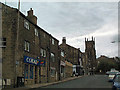
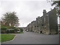
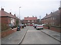
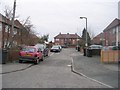
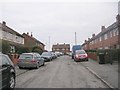
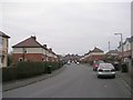
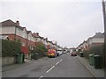
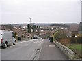
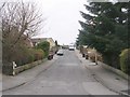
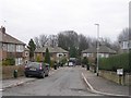
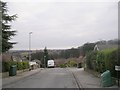
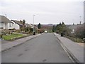
Photos of LS28 5LD
Area Information
LS28 5LD is a small, densely populated postcode area in west Leeds, England, covering just 3,806 square metres. It lies within the Calverley and Farsley electoral ward, a historically significant region with medieval roots. The area is a compact residential cluster, home to 1,966 people, with a population density of 516,494 per square kilometre. This makes it one of the more densely inhabited parts of the region. The area is served by the A657 road, placing it approximately ten miles from Leeds city centre and four miles from Bradford. Its proximity to major cities and transport links, combined with a mix of modern and historical features, creates a distinct character. Notable landmarks include Calverley Old Hall, a 14th-century manor house, and Calverley Cutting, a 19th-century road carved through sandstone. While the area has a strong historical legacy, it also offers practical connectivity, with nearby rail stations and two major airports within reach. For those seeking a balance between heritage and modernity, LS28 5LD presents a unique blend of compact living and accessible infrastructure.
- Area Type
- Postcode
- Area Size
- 3806 m²
- Population
- 1966
- Population Density
- 2786 people/km²
The property market in LS28 5LD is characterised by high home ownership, with 84% of residents owning their homes. This indicates a predominantly owner-occupied area rather than a rental market. The accommodation type is primarily houses, which is typical for smaller, established residential clusters. Given the area’s compact size and limited expansion potential, the housing stock is likely to be mature, with properties that have been in the same families for generations. Buyers considering LS28 5LD should expect a focus on single-family homes rather than apartments or new-build developments. The high home ownership rate also suggests a stable market with fewer speculative investments. However, the area’s small size means that property choices are limited, and buyers may need to look beyond immediate surroundings for more options. The combination of historical charm and practical connectivity makes it an attractive, though niche, market for those seeking a traditional, low-density living environment.
House Prices in LS28 5LD
Showing 8 properties
| Address | Type | Beds | Baths | Last Sale Price | Last Sale Date | |
|---|---|---|---|---|---|---|
| 36A Town Street, Farsley, Pudsey, LS28 5LD | Retail | 2 | - | - | - | |
| Flat, 34 Town Street, Farsley, Pudsey, LS28 5LD | Flat | - | - | - | - | |
| Maisonette, 12-14 Town Street, Farsley, Pudsey, LS28 5LD | Flat | - | - | - | - | |
| 38B Town Street, Farsley, Pudsey, LS28 5LD | Maisonette | - | - | - | - | |
| 38A Town Street, Farsley, Pudsey, LS28 5LD | Flat | - | - | - | - | |
| Esis Grill & Bar, 56 Town Street, Farsley, Pudsey, LS28 5LD | restaurant_cafe | - | - | - | - | |
| 38 Town Street, Farsley, Pudsey, LS28 5LD | Flat | - | - | - | - | |
| 14A Town Street, Farsley, Pudsey, LS28 5LD | Flat | - | - | - | - |
Energy Efficiency in LS28 5LD
The lifestyle in LS28 5LD is shaped by its proximity to essential amenities. Retail options include Co-op Farsley, Lidl Bramley, and Asda Pudsey, offering everyday shopping needs within a short distance. The area’s rail stations, such as New Pudsey and Bramley, provide access to public transport, while nearby airports cater to travel demands. Though the data does not specify parks or leisure facilities, the historical significance of sites like Calverley Old Hall suggests cultural and heritage interests may be present. The compact nature of the area means amenities are within practical reach, supporting a convenient daily life. However, the lack of detailed information on recreational spaces or dining options leaves some aspects of the local lifestyle unexplored. For those prioritising accessibility and practicality, LS28 5LD offers a functional, though modest, range of services.
Amenities
Schools
The nearest school to LS28 5LD is Farsley Springbank Primary School, which serves the local community with a good Ofsted rating. This school is a key consideration for families with young children, as it provides primary education within walking distance of many homes. However, the data does not include secondary schools or further education institutions in the immediate area, meaning families may need to travel to nearby towns for secondary schooling. The presence of a well-rated primary school is a positive factor for the area, offering parents confidence in the quality of early education. For those prioritising schools, LS28 5LD’s proximity to Farsley Springbank Primary School is a significant advantage, though additional research would be required to identify secondary school options in the broader region.
| Rank | School | Type | Entry gender | Ages |
|---|
Explore more schools in this area
Go to Schools tabDemographics
The population of LS28 5LD has a median age of 47, with the majority of residents aged between 30 and 64. This suggests a community skewed towards middle-aged adults, likely with established careers and families. Home ownership is high at 84%, indicating a stable, long-term resident base. The area is predominantly composed of houses, reflecting a traditional housing stock rather than apartments or flats. The predominant ethnic group is White, making up the majority of the population, with Asian residents comprising 13.8% of the wider Calverley and Farsley ward. Deprivation levels in the ward are notably high, with 81.9% of residents living in the mid-range of deprivation. This places the area near the bottom of Leeds in terms of socioeconomic conditions, which may affect access to certain services or amenities. However, the high home ownership rate and mature age profile suggest a community with a strong sense of local identity and resilience.
Household Size
Accommodation Type
Tenure
Ethnic Group
Religion
Household Composition
Age
Household Deprivation
NS-SEC
Explore more demographic insights in this area
Go to Demographics tabPlanning
Planning Constraints
- Flood RiskPremium
- Ramsar Wetland SitesPremium
- Area of Outstanding Natural BeautyPremium
- Protected Nature ReservePremium
- Protected WoodlandPremium