Area Overview for LS28 5JZ
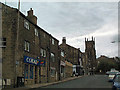
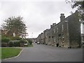
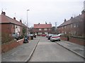
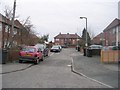
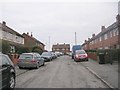
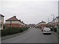
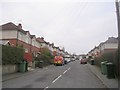
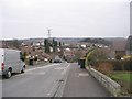
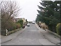
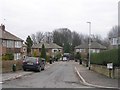
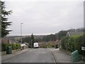
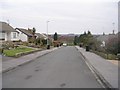
Photos of LS28 5JZ
Area Information
LS28 5JZ is a small, densely populated residential postcode in west Leeds, covering just 3.2 hectares and home to 1,612 residents. Its compact size means it is a tight-knit community, with a population density of 50,384 people per square kilometre—among the highest in the UK. Nestled within the Calverley and Farsley ward, this area sits on the A657 road, approximately ten miles from Leeds city centre and four miles from Bradford. Historically, the region includes Calverley village, known for its 14th-century Calverley Old Hall, a medieval manor house linked to a dramatic 1605 tragedy. While the area lacks modern commercial hubs, its proximity to rail networks and two airports—Leeds Bradford Airport and Leeds Bradford International Airport—offers connectivity to regional and international travel. Daily life here is shaped by its rural roots, with a mix of older housing stock and a community profile skewed toward middle-aged adults. The area’s high population density and historical significance create a unique blend of compact living and heritage, though its small size means amenities are concentrated within a short radius.
- Area Type
- Postcode
- Area Size
- 3.2 hectares
- Population
- 1612
- Population Density
- 4291 people/km²
LS28 5JZ is predominantly an owner-occupied area, with 66% of homes owned by residents rather than rented. The accommodation type is exclusively houses, which is unusual for a small postcode and suggests a mix of older, possibly larger properties. Given the area’s high population density—50,384 people per square kilometre—and its compact size of 3.2 hectares, the housing stock is likely limited, with little scope for new development. This makes the property market relatively stable but also constrained, particularly for buyers seeking a wide range of options. The prevalence of owner-occupied homes indicates a community of long-term residents, which may influence local dynamics and property values. Buyers should consider the small area’s proximity to amenities like rail stations and retail hubs, which could offset the lack of extensive housing choices.
House Prices in LS28 5JZ
Showing 39 properties
| Address | Type | Beds | Baths | Last Sale Price | Last Sale Date | |
|---|---|---|---|---|---|---|
| 26 Beech Lees, Farsley, Pudsey, LS28 5JZ | Detached | 3 | 2 | £365,000 | Nov 2025 | |
| 32 Beech Lees, Farsley, Pudsey, LS28 5JZ | Retail | 4 | 2 | £475,000 | Mar 2022 | |
| 42 Beech Lees, Farsley, Pudsey, LS28 5JZ | Detached | 3 | 1 | £362,500 | May 2019 | |
| 2 Beech Lees, Farsley, Pudsey, LS28 5JZ | Detached | 5 | - | £350,000 | Mar 2019 | |
| 36 Beech Lees, Farsley, Pudsey, LS28 5JZ | house | - | - | £385,000 | Sep 2017 | |
| 34 Beech Lees, Farsley, Pudsey, LS28 5JZ | Detached | 4 | - | £315,000 | May 2016 | |
| 50 Beech Lees, Farsley, Pudsey, LS28 5JZ | Detached | 5 | 2 | £338,000 | Aug 2015 | |
| 10 Beech Lees, Farsley, Pudsey, LS28 5JZ | Detached | 4 | 2 | £305,000 | Oct 2014 | |
| 22 Beech Lees, Farsley, Pudsey, LS28 5JZ | Detached | 4 | 3 | £318,500 | Sep 2014 | |
| 38 Beech Lees, Farsley, Pudsey, LS28 5JZ | house | 3 | - | £278,000 | Nov 2010 |
Energy Efficiency in LS28 5JZ
Residents of LS28 5JZ have access to a range of local amenities within a short distance. The retail sector includes notable stores such as Co-op Farsley, Tesco Stanningley Half, and Lidl Bramley, providing convenience for daily shopping needs. The area’s rail network is well-served, with stations like New Pudsey and Bramley offering regular services to Leeds and surrounding areas. Proximity to two major airports—Leeds Bradford Airport and Leeds Bradford International Airport—enhances travel flexibility for both leisure and business. While the data does not specify parks or leisure facilities, the area’s compact size suggests that amenities are concentrated, reducing the need for long commutes. The presence of multiple retail options and transport links contributes to a practical, accessible lifestyle, ideal for those valuing convenience and connectivity over expansive recreational spaces.
Amenities
Schools
| Rank | School | Type | Entry gender | Ages |
|---|
Explore more schools in this area
Go to Schools tabDemographics
The population of LS28 5JZ has a median age of 47, with the majority of residents aged 30–64. This suggests a mature, stable community with a strong presence of middle-aged adults. Home ownership is high, at 66%, with houses being the predominant type of accommodation. The ethnic composition is overwhelmingly White (80.8%), with Asian residents making up 13.8% of the population. However, the ward as a whole—of which LS28 5JZ is part—has a deprivation score where 81.9% of residents live in the mid-range of deprivation. This indicates that while basic needs are met, there may be limitations in access to higher-quality services or opportunities. The age profile and home ownership rates suggest a community focused on long-term residency rather than transient living, with a demographic that prioritises stability over mobility.
Household Size
Accommodation Type
Tenure
Ethnic Group
Religion
Household Composition
Age
Household Deprivation
NS-SEC
Explore more demographic insights in this area
Go to Demographics tabPlanning
Planning Constraints
- Flood RiskPremium
- Ramsar Wetland SitesPremium
- Area of Outstanding Natural BeautyPremium
- Protected Nature ReservePremium
- Protected WoodlandPremium